NYC Weather Update: Gearing Up for a Mixed Bag of Sun and Storms!
By
Amy Freeze
This week's NYC weather forecast offers a dynamic blend of clear skies and looming storms. Stay ahead with our full coverage.
This week in NYC, enjoy the sunshine on clear days and prepare for potential storms with our detailed weather guidance.
Welcome to our comprehensive weather forecast for New York City. This week, we’ll witness a variant of weather patterns from sunny to stormy. Expect partly cloudy skies with peaks of 85 degrees and watch the evening transitions to cooler temperatures under clear skies. A cold front will bring showers and possible thunderstorms by midweek, ensuring a mix of weather that keeps everyone on their toes. Explore our full spectrum of forecasts and stay prepared with daily weather insights.
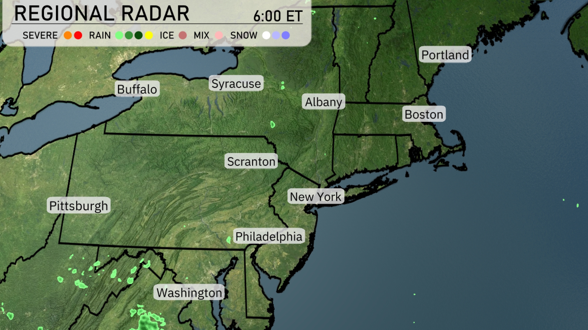
Across the Northeast, the radar is mostly clear, with only isolated patches of light rain near the Scranton area. A slight hint of precipitation is seen moving towards the Pittsburgh area. The rest of the region, including New York, Boston, and Philadelphia, enjoys clearer skies. Heavier showers are located to the southwest, just near the West Virginia border.
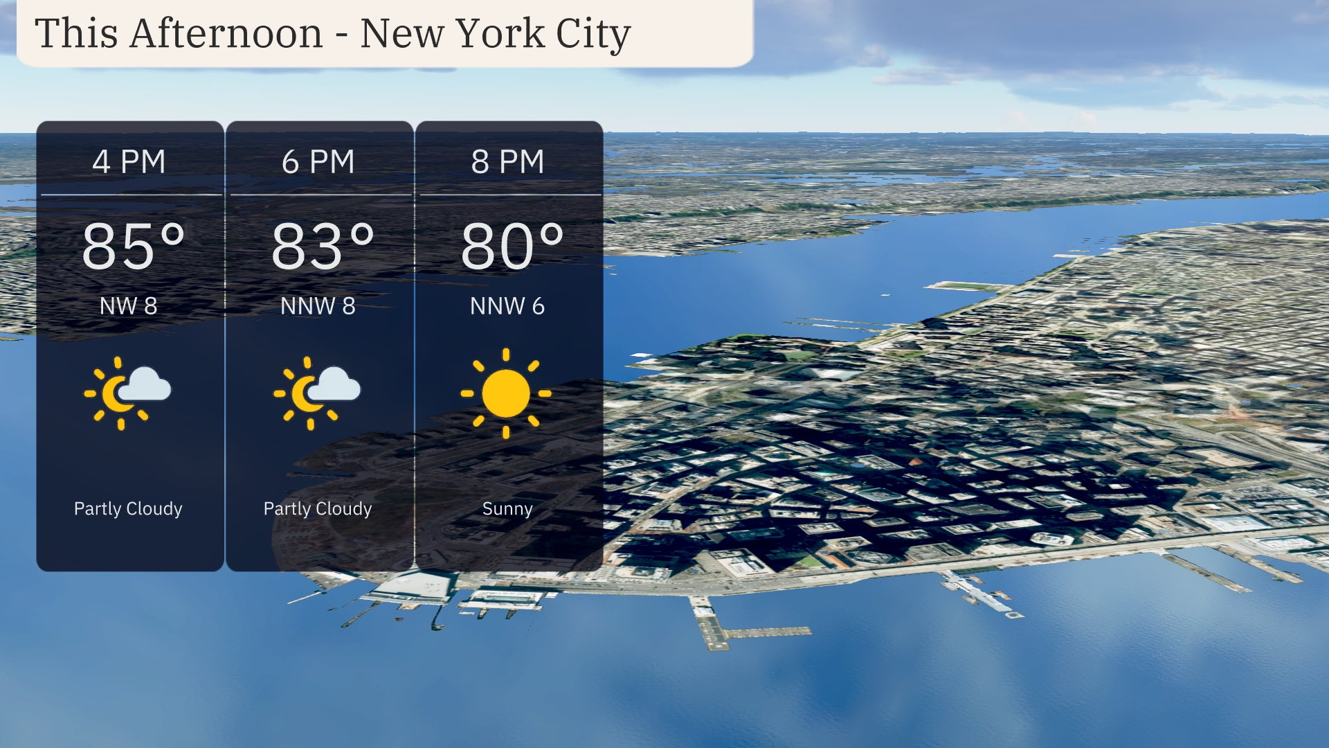
This afternoon in New York City, temperatures will peak at 85 degrees around 4 PM with partly cloudy skies. Expect a north-northwest wind at 8 mph, reducing slightly to 6 mph by 8 PM. As the evening progresses, the temperature will gradually drop to 80 degrees under clear skies.
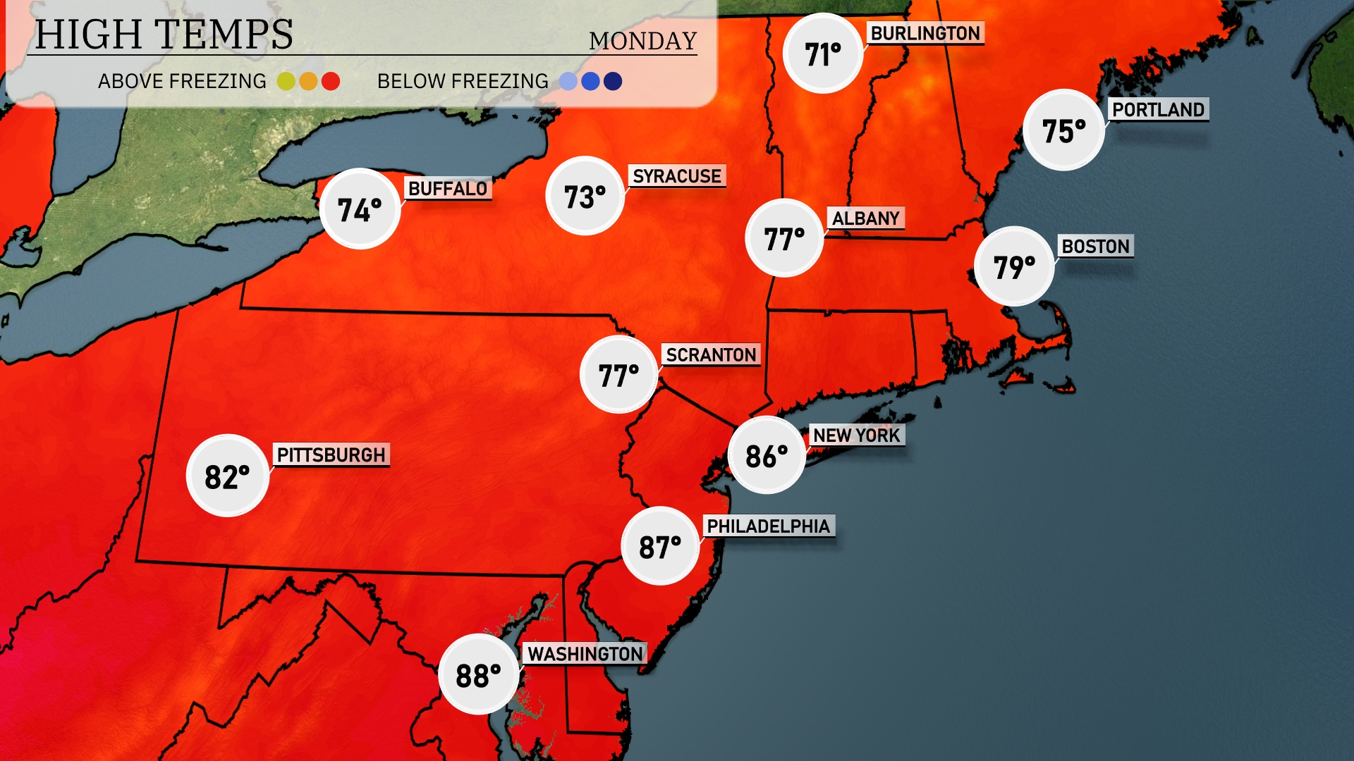
Today’s high temperatures across the Northeast are looking quite warm. New York City will reach a high of 86 degrees, while Philadelphia is slightly warmer at 87 degrees. Scranton enjoys a mild high of 77, and Buffalo will see a comfortable 74 degrees. Boston is on the cooler side, hitting 79 degrees, and Portland will stay refreshed at 75 degrees.
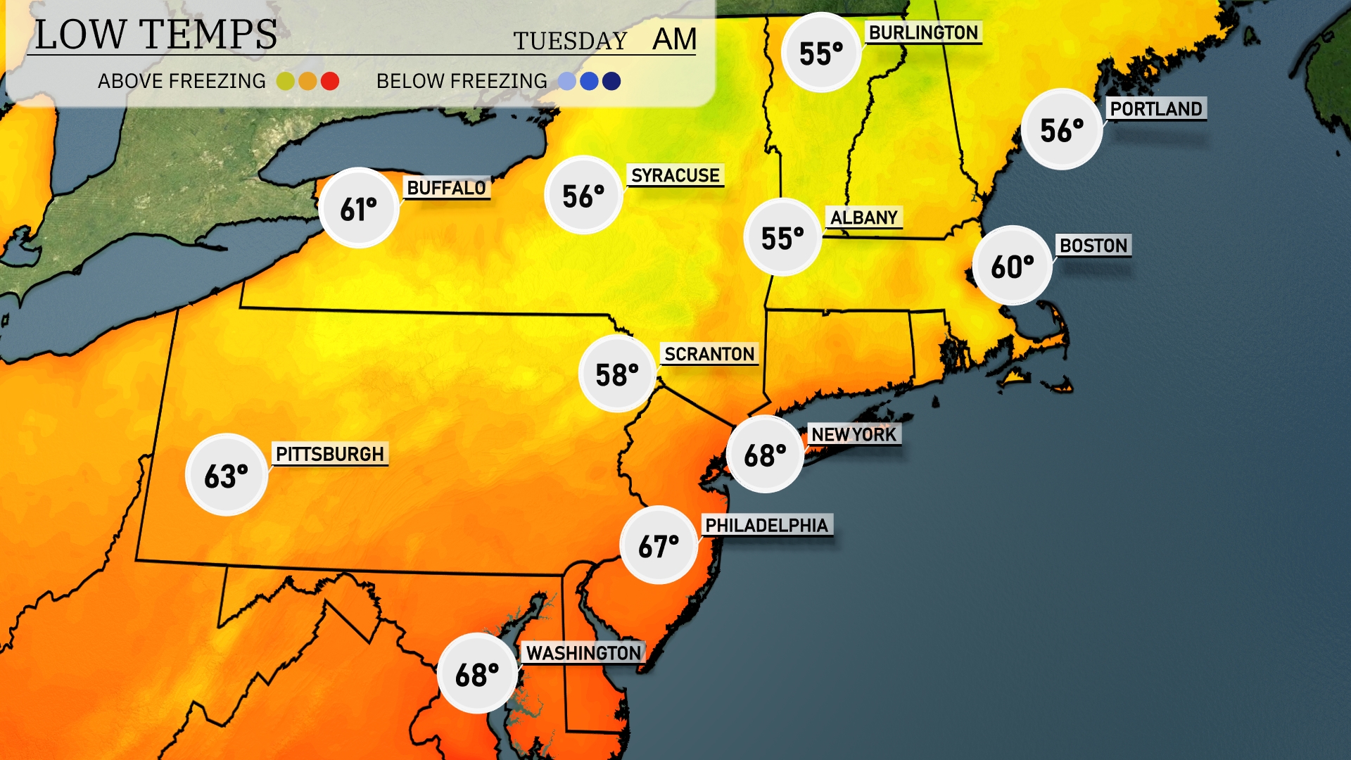
Tonight, Boston will see a low of 60 degrees, while Portland drops to 56. In New York, the temperature will settle at 68 degrees, making for a mild evening. Scranton expects a cooler night at 58 degrees, and Buffalo will experience a low of 61.
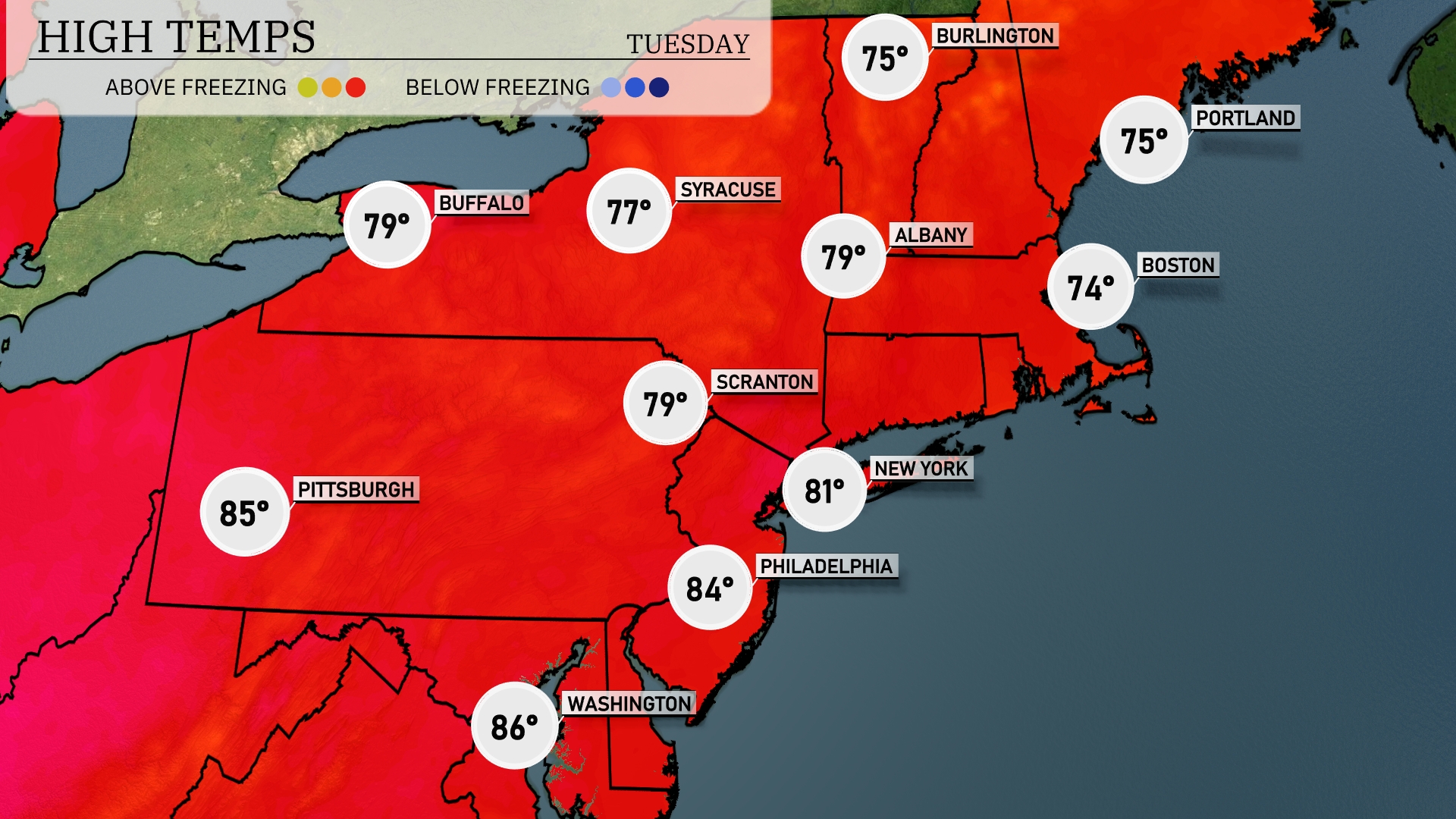
Tomorrow, the Northeast will experience warm temperatures, with Pittsburgh leading the way at 85 degrees. Philadelphia is expected to see a high of 84, while New York City will warm up to 81 degrees. Scranton and Syracuse are both forecasted for 79 degrees, and Boston will have a cooler afternoon high of 74.
A cold front swings through the Northeast tomorrow, bringing with it scattered showers and thunderstorms from Boston down to Philadelphia by midday. Expect potential for heavy rain and gusty winds, with localized flooding possible along the Interstate 95 corridor. Temperatures will see a noticeable drop post-front, with highs struggling to reach the mid-70s. As the front exits to the east late Wednesday, clearing conditions will follow, setting the stage for a cooler, sunny Thursday. Stay alert for any updates on severe storm threats.
The UV index in New York City is very high today, with a level of 9, indicating a burn time of just 15 minutes in direct sunlight. For your Tuesday plans, the UV index remains at 9, so be sure to apply a high-SPF sunscreen, wear protective clothing, and take frequent breaks in the shade! Stay safe out there in the sun!