NYC Weather Watch: Mild Mornings and Stormy Evenings Ahead
By
Amy Freeze
Partly cloudy skies and gentle breezes set the tone for NYC's morning, with storms brewing by evening. Stay updated with our comprehensive weather forecast.
Discover what New York City’s weather will look like tomorrow with Amy Freeze’s expert forecast. From cloudy mornings to potential evening storms, learn all you need to plan your day.
As we delve into tomorrow’s weather prospects for New York City and the broader Northeast, expect a range of conditions from mild, partly cloudy mornings in NYC with temperatures gently increasing from 77 to 82 degrees by midday. The Northeast sees varying temperatures, with potential storms threatening evening commutes. Don’t miss out on Amy Freeze’s tips for handling very high UV levels and best practices to stay safe during weather shifts.
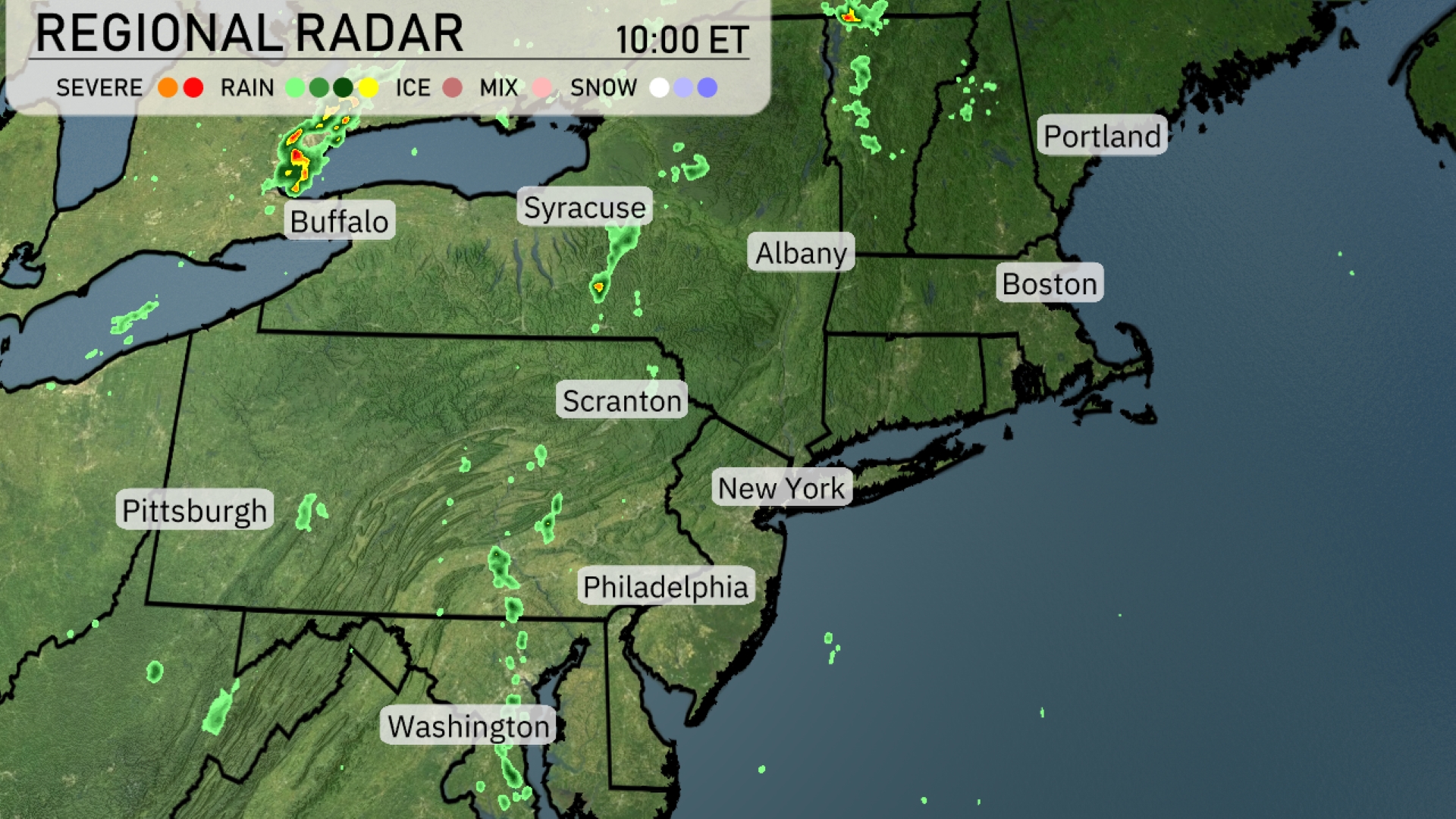
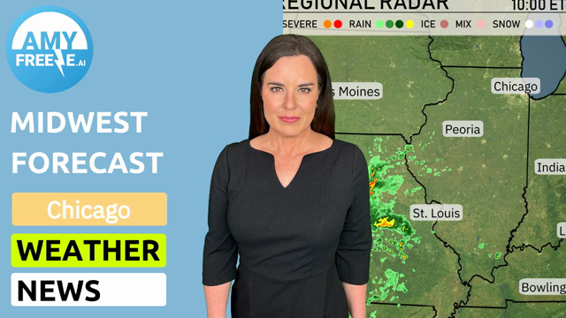
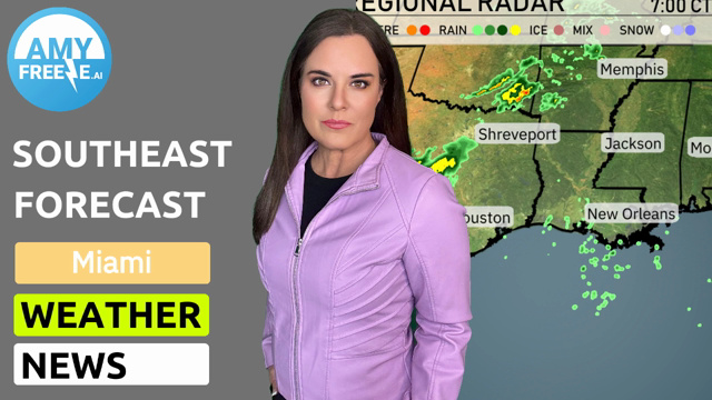
Across the Northeast, the radar reveals scattered showers primarily around Buffalo and Syracuse, moving southeast. A distinct line of storms is developing near the Pittsburgh area, extending towards Scranton. Meanwhile, lighter showers and isolated rain pockets are spotted around Albany, tracing down toward Philadelphia. The majority of the East Coast, including New York City and Boston, remains under clear to partly cloudy skies with no immediate precipitation threats.
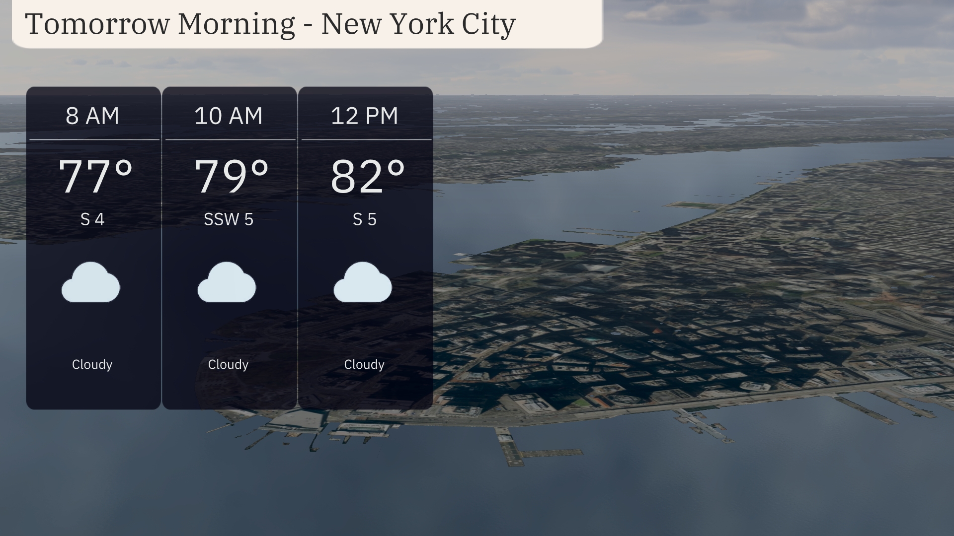
For tomorrow morning in New York City, expect cloudy skies with temperatures starting at 77 degrees at 8 AM, gradually rising to 79 degrees by 10 AM. A light breeze from the south at 4 to 5 miles per hour will keep conditions comfortable. By midday, temperatures reach 82 degrees, with a slight southern breeze at 5 miles per hour. Overall, a mild and overcast morning awaits, ideal for outdoor plans once temperatures warm up.
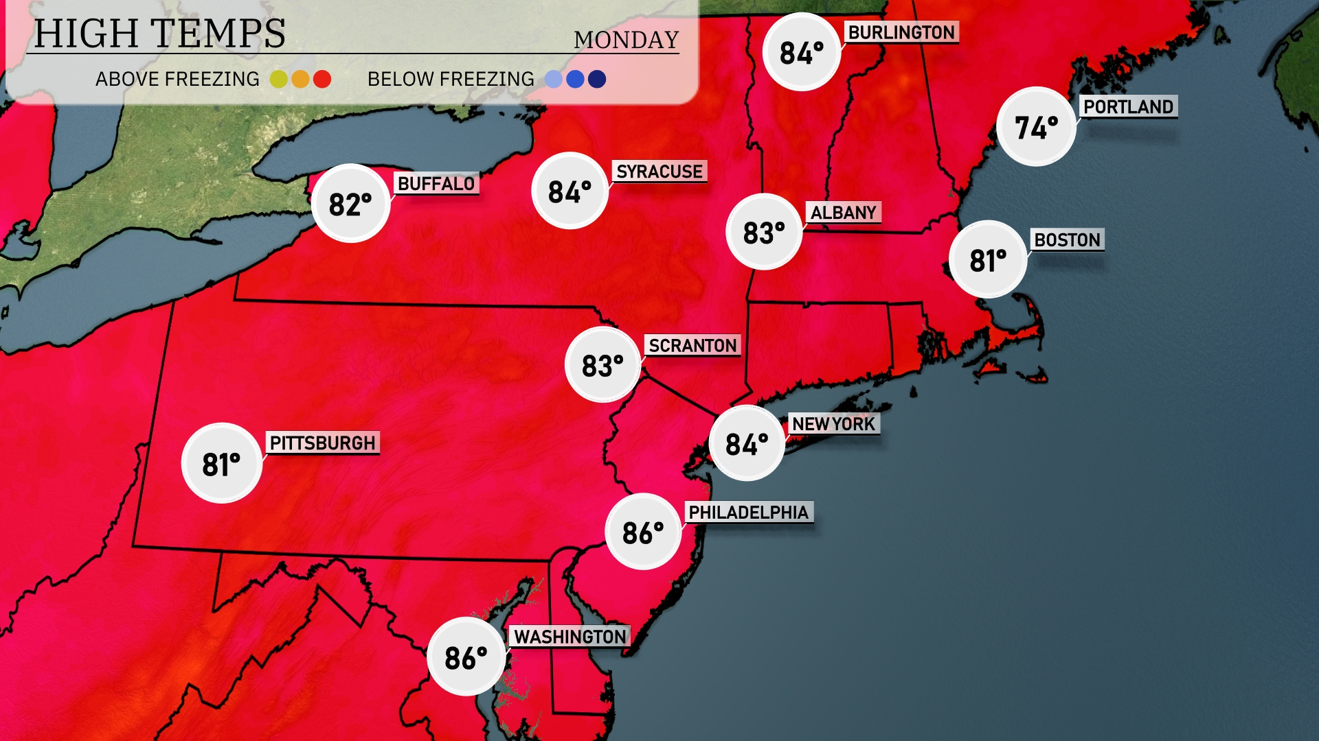
Tomorrow, expect a warm day across the Northeast with highs reaching 86 degrees in Philadelphia and Washington, D.C. New York City is not far behind with a high of 84 degrees, while Boston warms up to 81 degrees. Scranton and Syracuse will also enjoy balmy temperatures at 83 and 84 degrees, respectively. Most areas are trending above average for this time of year, influenced by a warm front moving through the region.
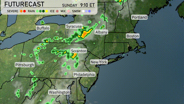
A quick-moving front is set to bring showers and thunderstorms across the Northeast tomorrow. Expect scattered storms from Philadelphia up through Syracuse, with the heaviest impacts likely along the I-95 corridor. Severe weather risks, including heavy rain and gusty winds, may disrupt the evening commute, particularly around New York and Albany. Temperatures will remain in the comfortable 70s, but cooler air is on the way following the storm, leading to clearer skies into Friday. Keep an eye out for potential localized flooding as storm systems linger.
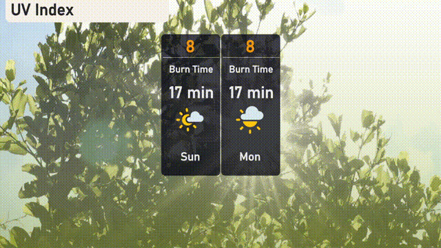
The UV index in New York City is 8, which is very high, resulting in a burn time of approximately 17 minutes in direct sunlight. With this level of UV exposure, it’s crucial to apply broad-spectrum sunscreen, wear protective clothing, and seek shade when possible. For Monday, expect similar conditions with the UV index remaining at 8 and a comparable burn time.
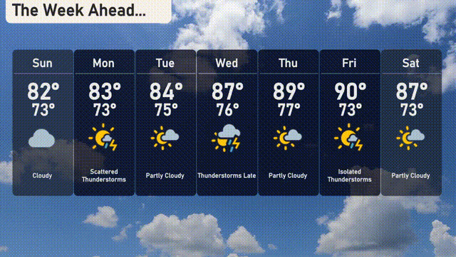
For the 7 Day Forecast in New York City:
Sunday: The day starts off cloudy with a high of 82 degrees and a low of 73 degrees.
Monday: Watch for scattered thunderstorms, with temperatures reaching up to 83 degrees during the day and dropping to 73 degrees at night.
Tuesday: Partly cloudy skies with a high of 84 degrees and a low of 75 degrees.
Wednesday: Thunderstorms are expected late in the day, with the temperature peaking at 87 degrees and a low of 76 degrees.
Thursday: Partly cloudy conditions will prevail, with a high of 89 degrees and lows around 77 degrees.
Friday: Isolated thunderstorms might develop. The daytime high will reach 90 degrees while nights will cool to 73 degrees.
Saturday: The weather will be partly cloudy with a high of 87 degrees and a low of 73 degrees.
Stay safe and enjoy your week ahead!