NYC’s Weather Whirlwind: From Scorching Heat to Stormy Skies
By
Amy Freeze
Explore our in-depth analysis of NYC's dramatic weather shifts this week, from sunny highs to stormy lows.
This week in NYC promises a real mix in the weather department—high temperatures during the day with thunderstorms rolling in by morning. Check out our full report!
Welcome to our comprehensive New York City weather blog post. This week, New Yorkers can expect a gamut of weather conditions from high temperatures reaching up to 90 degrees to thunderstorms and potential localized flooding. Understand the implications of a high UV index and how to plan your week around this weather rollercoaster. Dive deep into each day’s forecast with us on our blog!
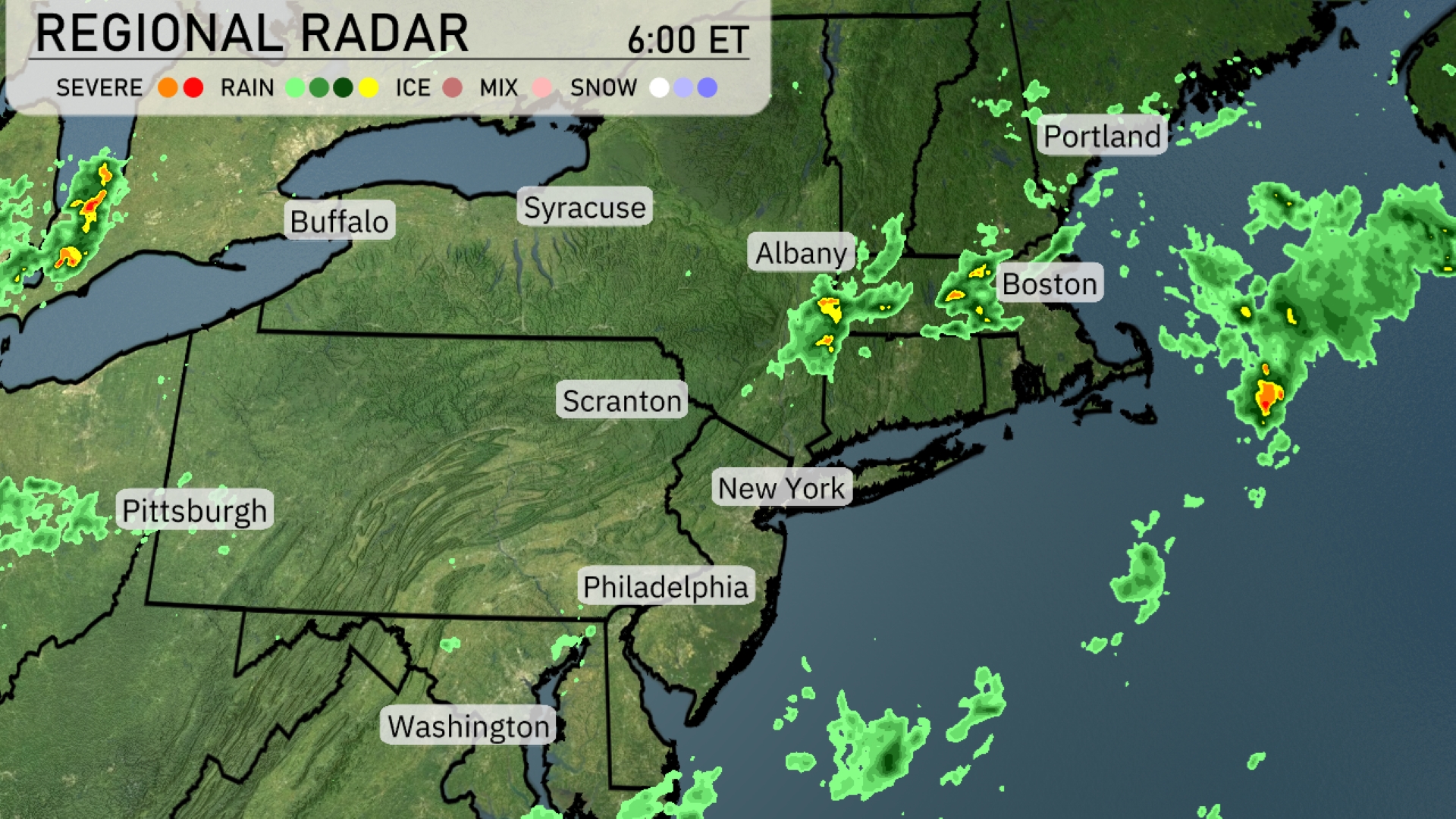
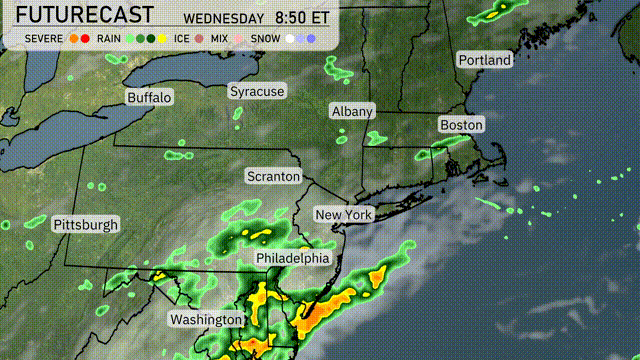
Showers and thunderstorms are currently moving through portions of the Northeast, particularly affecting areas around Albany and Boston. Rain is spreading over coastal regions, with Portland experiencing some light precipitation. In contrast, New York and Philadelphia remain clear, enjoying dry and calm conditions for now. Scranton and its surroundings are under a mix of cloud cover and sporadic rain showers.
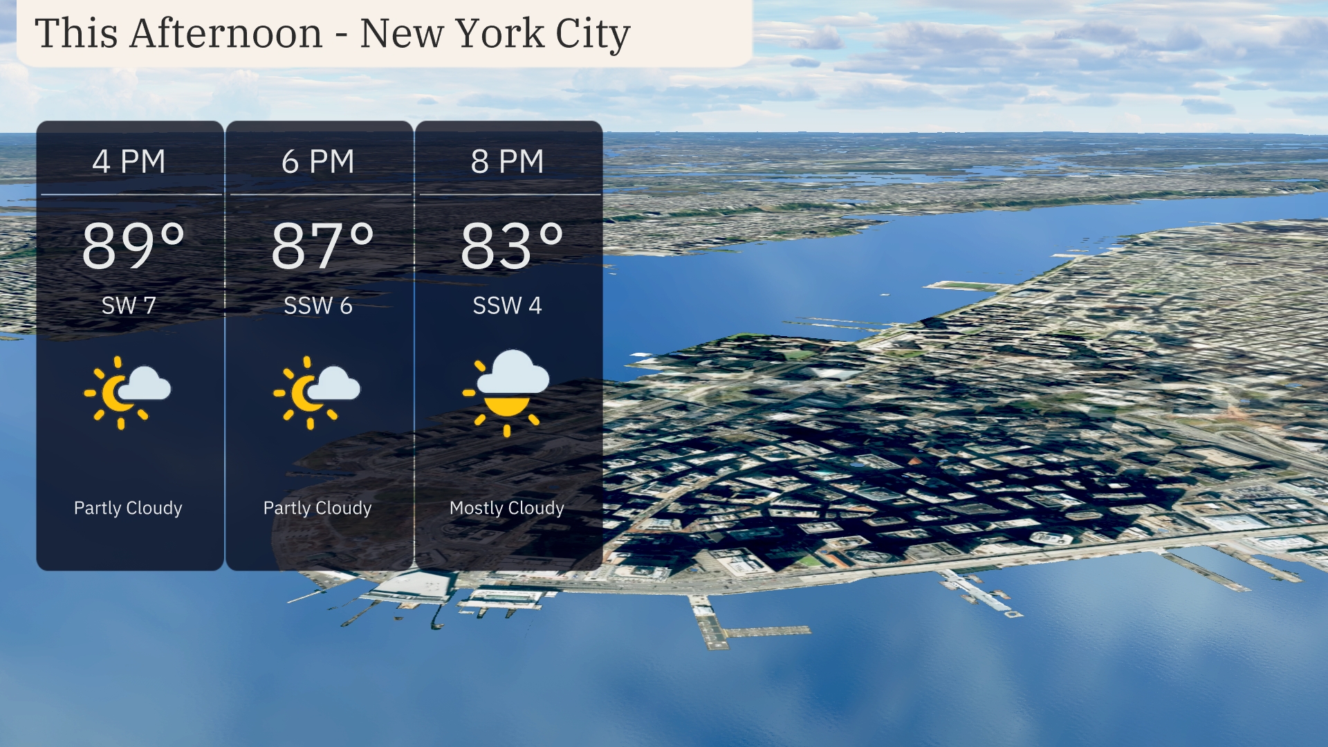
New York City will see partly cloudy skies this afternoon, with temperatures reaching 89 degrees by 4 PM. As we move into the early evening, the temperature slightly dips to 87 degrees by 6 PM, with winds shifting from southwest at 7 miles per hour to south-southwest at 6 miles per hour. By 8 PM, expect mostly cloudy skies with temperatures at 83 degrees and a gentle south-southwest wind at 4 miles per hour.
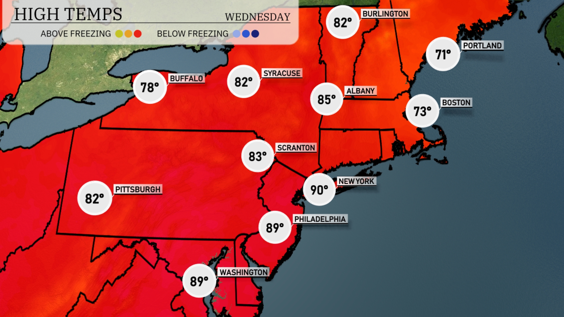
Today’s regional high temperatures show some impressive warmth in the Northeast. New York City is hitting a scorching 90 degrees, while Philadelphia isn’t far behind at 89. Scranton will see a comfortable high of 83 degrees, and Syracuse matches that with 82. In sharp contrast, Boston is on the cooler side at just 73 degrees, and Portland lags even further back with a high of 71. Buffalo rounds it out with a pleasant 78 degrees, making for a varied day across the region.
Tonight, Boston will see a low of 62 degrees, while New York City is expected to drop to 73. Scranton will cool down to 66 degrees, and Pittsburgh can expect a low of 69. Notably, temperatures are staying unseasonably warm across the Northeast, with no significant cold air patterns moving in.
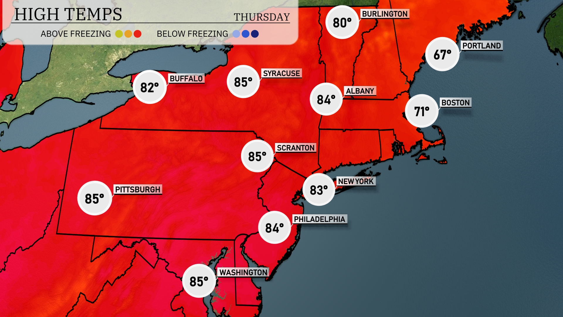
Tomorrow, the Northeast is set to experience a warm spell with several cities hitting above-average temperatures. New York will see a high of 83 degrees, while Philadelphia reaches 84. Scranton and Pittsburgh will both sizzle at 85 degrees, indicating a trend of warm conditions across the region. Albany is not far behind with a high of 84. Boston will enjoy a mild 71 degrees, with Portland slightly cooler at 67.
A warm front is moving into the Northeast tomorrow, bringing showers and thunderstorms across parts of Pennsylvania to New York, especially around Philadelphia and New York City. Watch for heavy rain in the morning hours, which could result in localized flooding, particularly in low-lying urban areas. Temperatures will remain mild for the region with highs in the upper 70s to low 80s. As the front moves northward, expect clearing skies by late afternoon, providing a calm evening across the region.
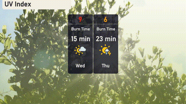
New York City’s UV index on Wednesday is at a high level of 9, indicating a quick burn time of approximately 15 minutes with sun exposure. As you plan for Thursday, the index lowers to 6 but still warrants caution, as burn times remain about 23 minutes.