This Week in NYC: From Sunny Days to Stormy Mornings!
By
Amy Freeze
From the tranquility of partly cloudy skies to the turmoil of potential thunderstorms, NYC will experience a dynamic weather week. Read on to find out day-by-day forecast details.
Meteorologist Amy Freeze guides you through a week of weather in NYC, highlighting serene skies, possible showers, and more!
Welcome to our detailed weather rundown with Amy Freeze. This week in NYC, expect a mix of partly cloudy days, sunshine, and a brewing storm. We’ll guide you through calm days and alert you ahead of heavy rains, ensuring you’re prepared whatever the weather. Enjoy the calm before the storm and stay tuned as we move through a varied Northeast forecast, complete with recommendations for each day’s conditions.
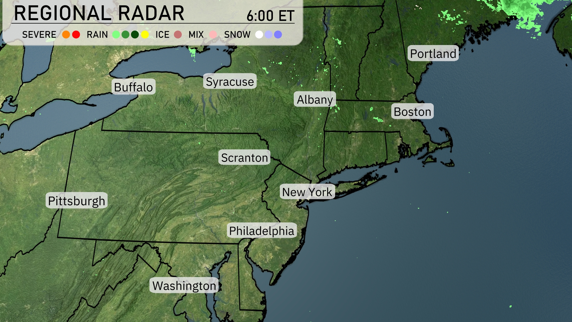
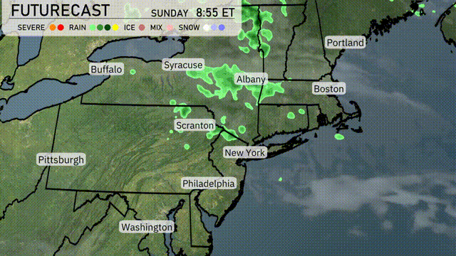
Over in the Northeast region, the radar shows calm weather dominating much of the area. Albany and Syracuse are under light, scattered precipitation moving southeast. Portland is experiencing the beginnings of these showers, but overall, conditions are rather peaceful. From Boston to New York, the skies remain clear with no significant weather disturbances. Washington and Philadelphia also enjoy tranquil skies, making for a pleasant start to the day.
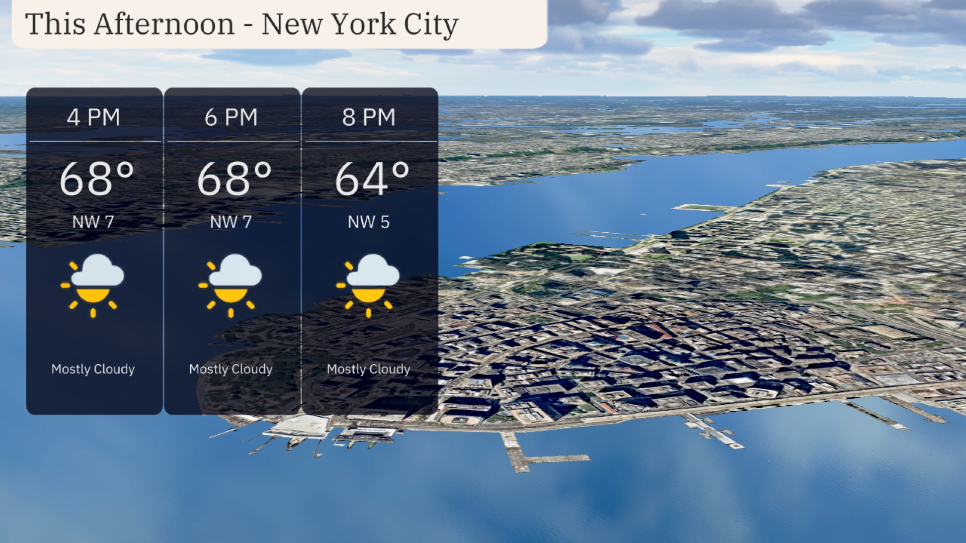
Temperatures in New York City this afternoon will remain steady around 68 degrees, accompanied by a gentle northwest breeze at 7 mph. Mostly cloudy skies will dominate, providing a muted sun-break through the day. As we transition towards evening, expect the temperature to gradually dip to 64 degrees by 8 PM, with the wind slowing to 5 mph, keeping the mostly cloudy theme.
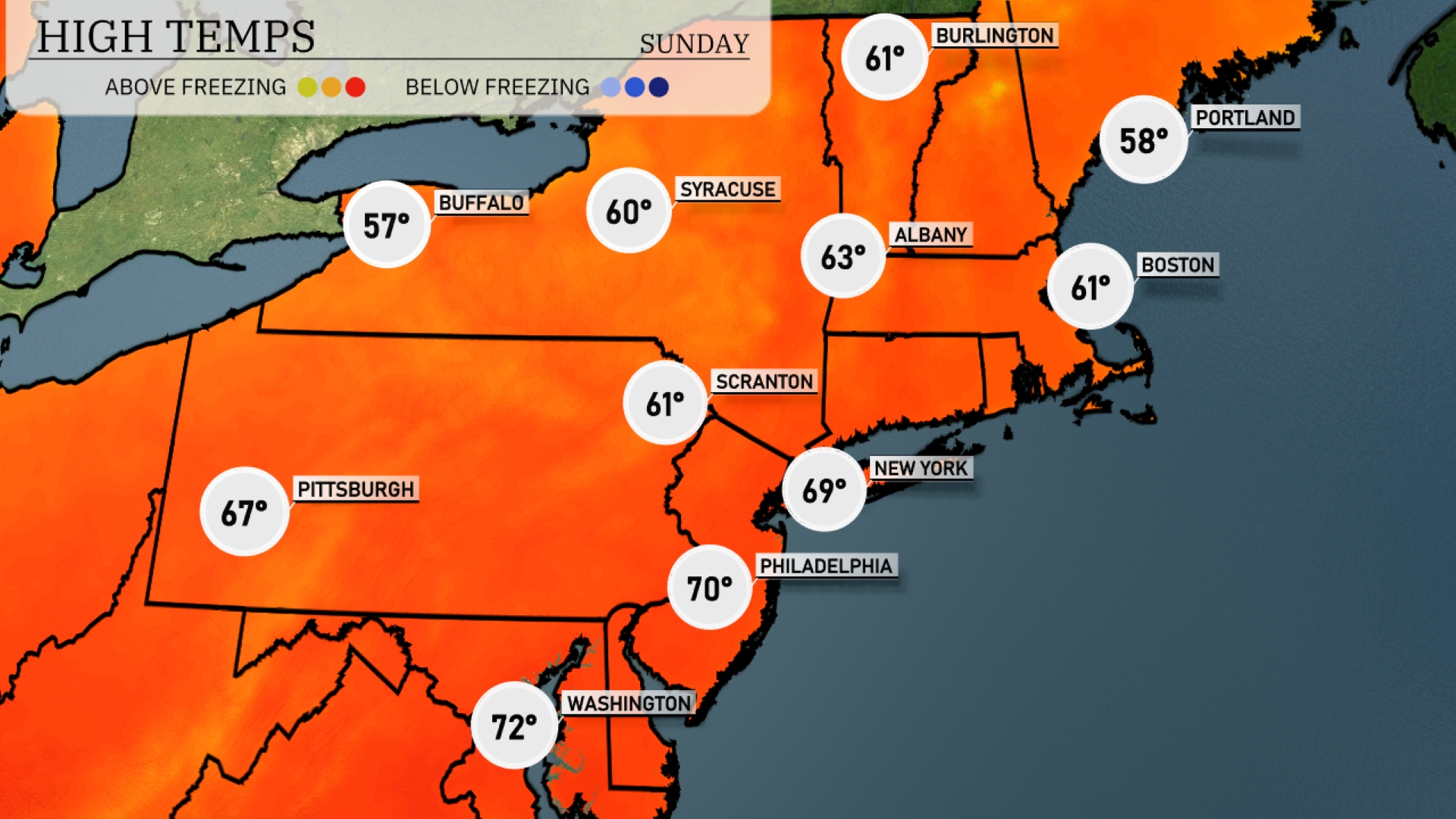
This afternoon New York City reaches a high of 69 degrees, while Philadelphia is a bit warmer at 70. To the north, Albany tops out at a cool 63 degrees, and Boston is not far behind with a high of 61. In contrast, Buffalo feels the chill with a high of just 57 degrees, while Syracuse is slightly later at 60. Scranton settles at 61 degrees, making it a comfortable day across much of the region.
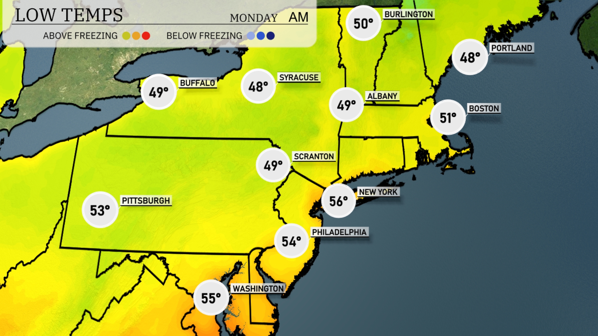
Tonight Buffalo and Syracuse are expected to drop to 49 and 48 degrees, respectively. New York City will see a low of 56 degrees, while Philadelphia will settle at 54 degrees. Pittsburgh will cool down to 53 degrees, and Boston is forecasted to hit 51 degrees. Scranton will also see a low of 49 degrees, establishing a chilly night across the region.
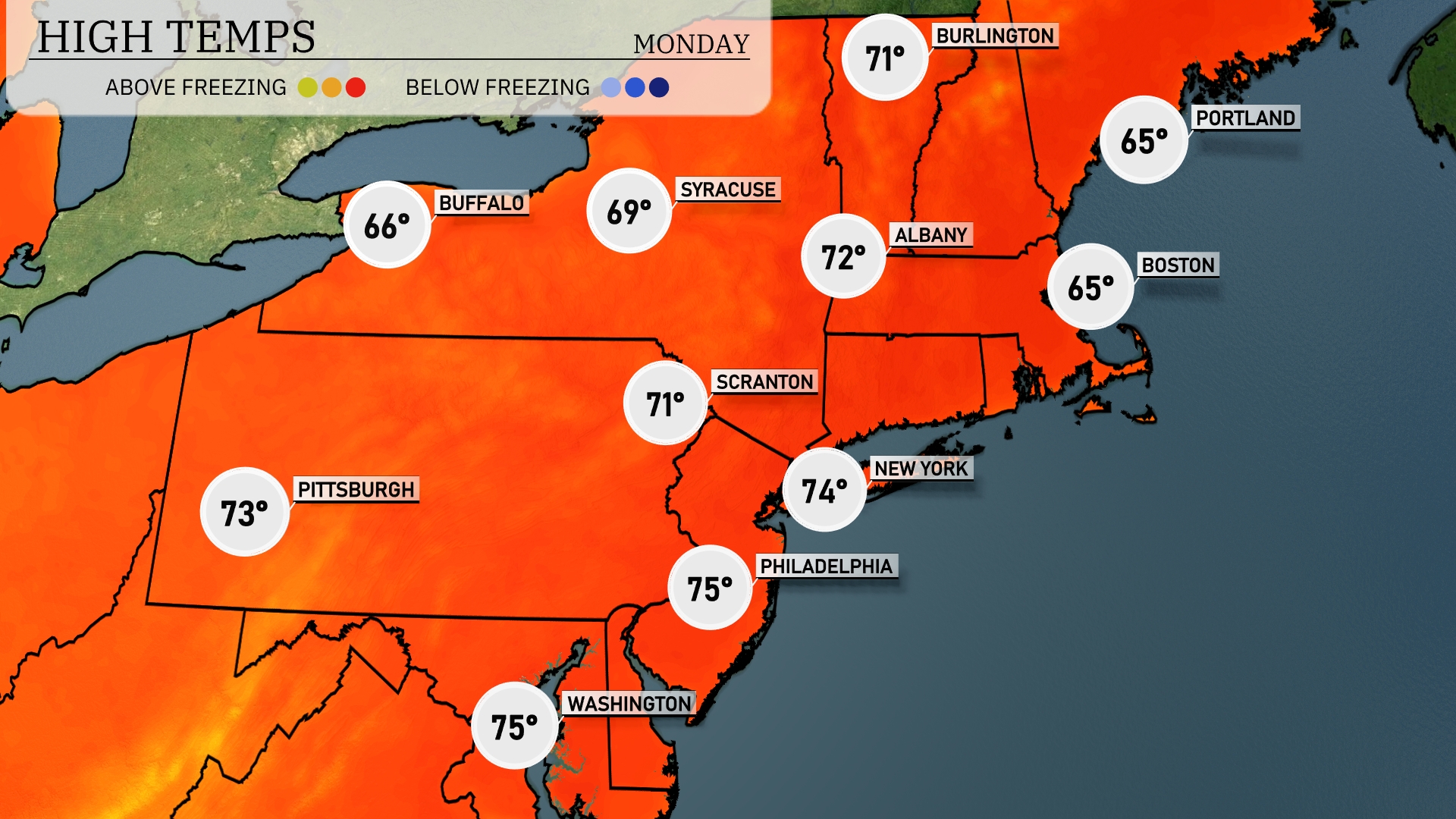
Tomorrow New York City is looking at a warm 74 degrees, while Philadelphia could reach up to 75 degrees. Scranton will see a high around 71 degrees, and Pittsburgh isn’t far behind at 73 degrees. In contrast, Boston and Portland will be cooler, both hitting 65 degrees. Syracuse will also remain moderate with a high of 69 degrees.
A line of showers and thunderstorms is expected to move through the Northeast beginning tomorrow morning, progressing from Pittsburgh to Albany, impacting areas like Scranton and New York City by midday. Expect occasional heavy downpours and gusty winds, with some areas potentially seeing over half an inch of rain. New York City commutes could be slick, so allow extra time on the roads. Cooler air will follow with temperatures dropping by late Wednesday, leading to a crisp and clear end of the workweek.
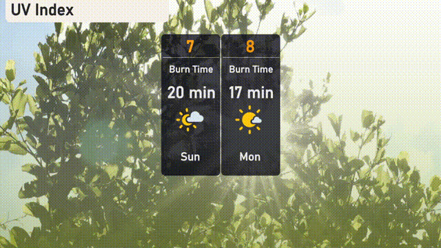
The UV index in New York City is high at 7 today, pointing to a burn time of approximately 20 minutes. As we move into Monday, the UV index nudges up to 8, with a quicker burn time of around 17 minutes.