Clear Skies and Crisp Nights: Your Detailed Southwest Weather Forecast
By
Amy Freeze
Dive into a comprehensive weather forecast for Phoenix and the Southwest with meteorologist Amy Freeze. From sunny days to chilly nights, understand what's happening in the skies above.
Catch the latest weather trends in Phoenix and the Southwest with a detailed forecast from Amy Freeze. From sunny skies to potential rain bands, be prepared for all scenarios!
Welcome to your detailed weather forecast for Phoenix and the Southwest region. As meteorologist Amy Freeze guides you through the current weather patterns, learn about the clear skies over Phoenix, potential rains in Northern California, and the expected temperatures for the coming days. Stay updated on potential weather changes and make sure to follow safety tips during varied weather conditions.
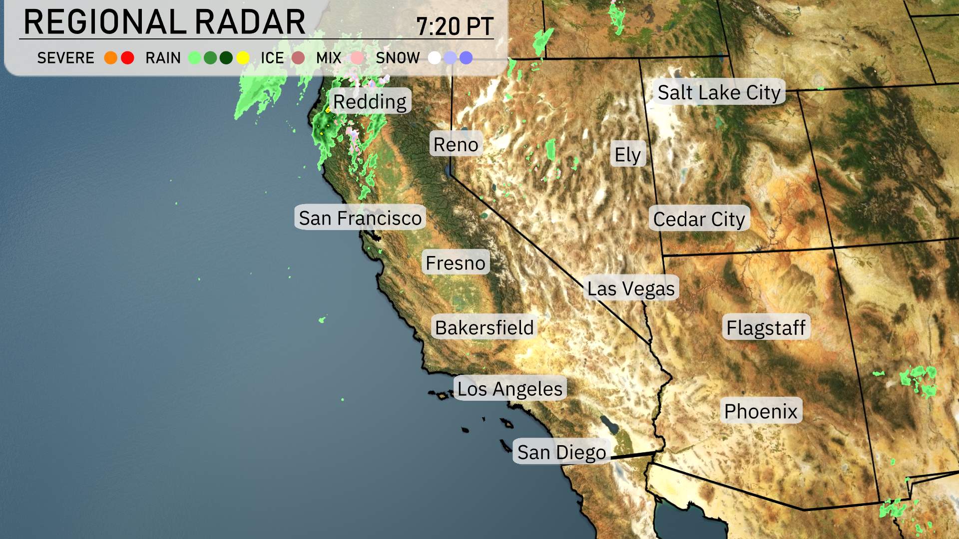
The Southwest region’s radar reveals a dynamic pattern today. Northern California, particularly around Redding, is in the midst of rain, extending inland and bringing some much-needed precipitation to the area. This line of rain showers also affects areas near Fresno, providing a damp start.
Farther south, the radar shows relatively dry conditions in places like Las Vegas and San Diego, though there are isolated rain showers near Cedar City. Flagstaff is poised to stay dry today, although the surrounding areas are seeing some cloud cover. In contrast, areas from Bakersfield to Flagstaff are currently under relatively clear skies, while Phoenix basks in sunny conditions, taking a respite from the precipitation.
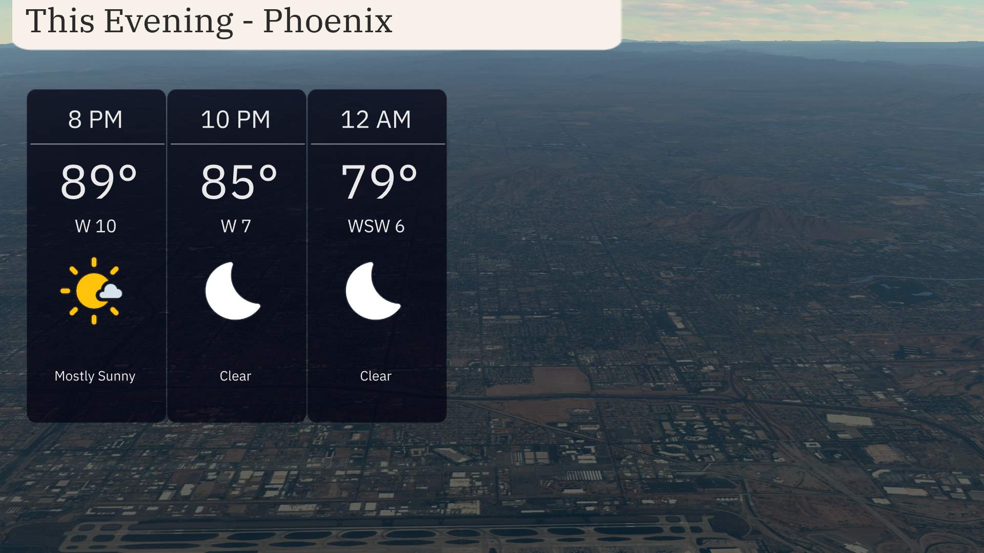
For this evening in Phoenix, temperatures will start at 89 degrees at 8 PM, dropping to 79 degrees by midnight. You’ll experience mostly sunny skies transitioning to clear conditions under the stars. Winds will be coming from the west at 10 miles per hour, calming to 7 miles per hour, and shifting to west-southwest at 6 miles per hour by midnight.
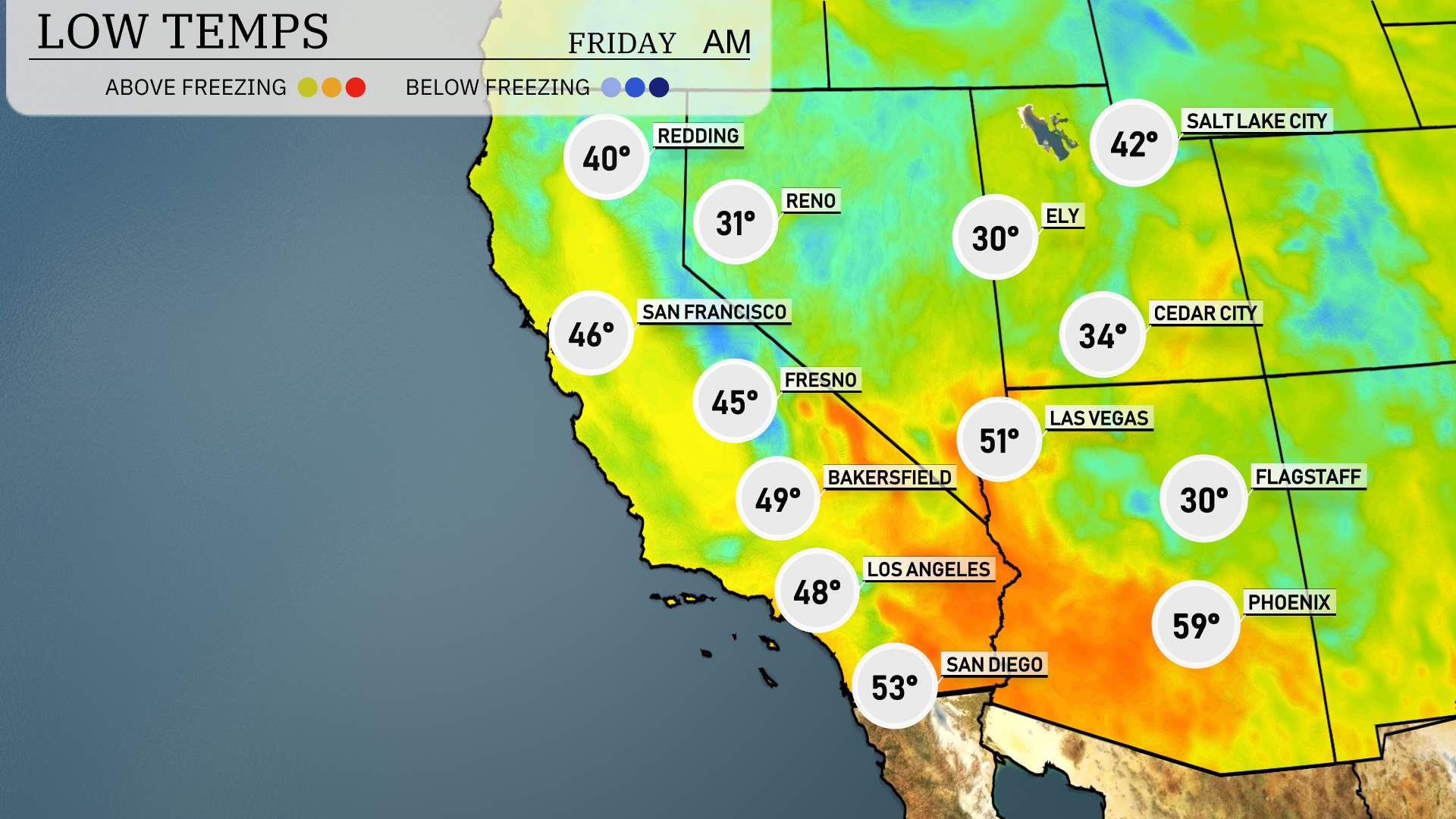
Tonight in the Southwest, temperatures are dipping into the chilly range. Ely will experience a brisk low of just 30 degrees. Over in Flagstaff, expect a similar chill with temperatures dropping to 30 as well. Las Vegas will stay relatively mild at 51 degrees. Meanwhile, Cedar City will be colder at 34 degrees. Bakersfield is forecasted to reach a low of 49, while Los Angeles will see a comfortable 48 degrees. In San Diego, the night will be mild at 53 degrees.
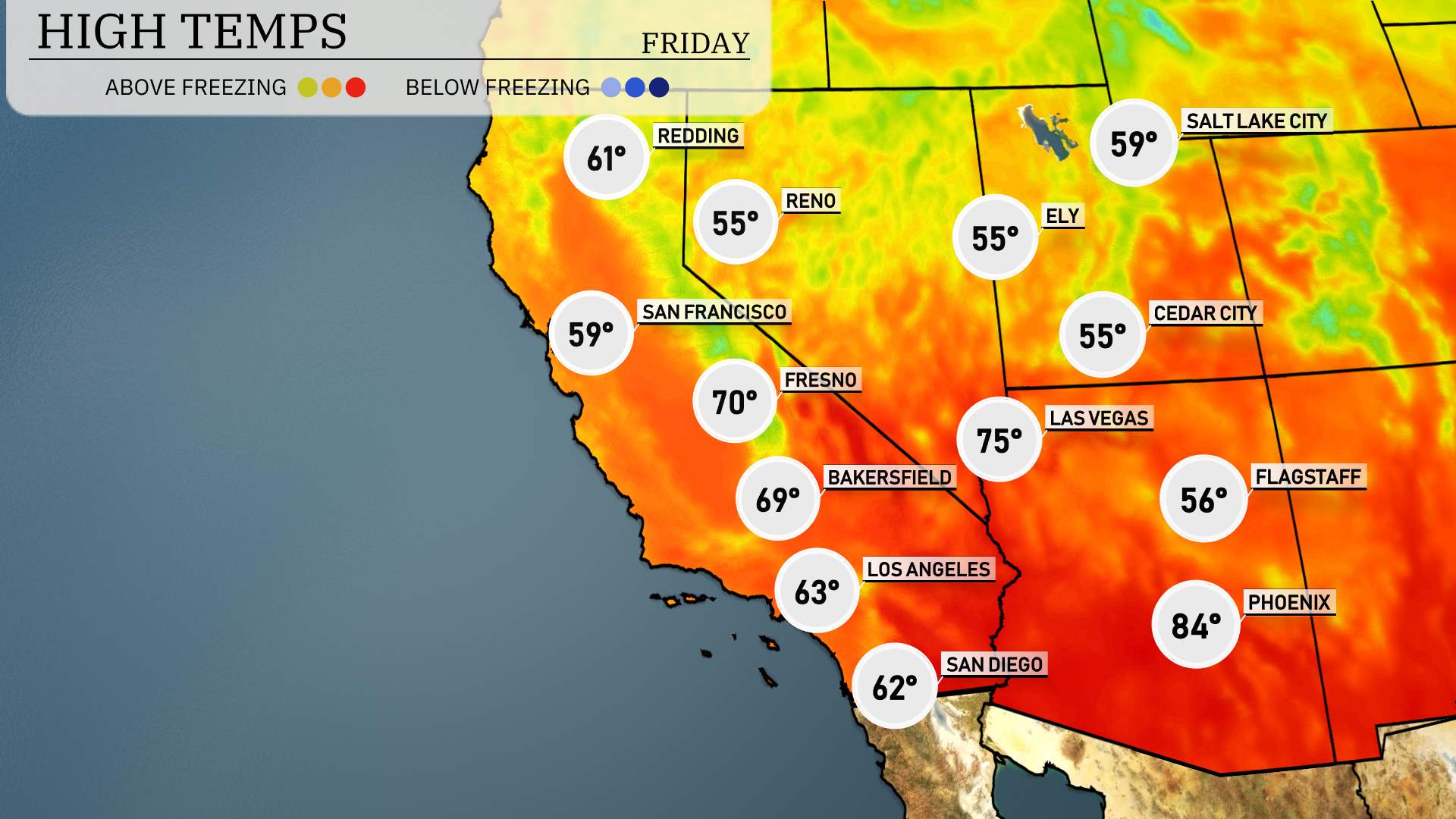
High temperatures for the Southwest region tomorrow are trending on the warmer side. In the heart of the desert, Phoenix is set to reach a sizzling high of 84 degrees, well above the seasonal average. Las Vegas will also feel the heat, with expected highs around 75 degrees, making for a pleasant day.
As we move toward California, Bakersfield will hit 75 degrees, while Fresno is slightly cooler at 70 degrees. Los Angeles is projected to see a high of 63 degrees, providing a more mild day for the coastal city. San Diego remains comfortable, with highs expected at 62 degrees.
Farther north, Redding will see highs of 61 degrees, and San Francisco will be cooler at 59 degrees.
The Southwest is set for a dynamic weather scenario tomorrow. A series of powerful rain bands are moving into Northern California, bringing significant precipitation to the region. This will impact travel, so expect tricky driving conditions, especially over higher terrains. Further south, Southern California could see scattered showers, adding to wet conditions around the San Bernardino Valley. While the deserts of Arizona and Nevada remain mostly dry, the Pacific front’s arrival late Thursday will bring more rain and breeze, signaling potential relief but also caution for flash flooding in vulnerable areas.
Phoenix will experience a very high UV index of 8 on Thursday, with a burn time of approximately 17 minutes in direct sunlight. Make sure to wear sunscreen and protective clothing. On Friday, expect a moderate UV index of 5.
For the Phoenix 7 Day Outlook:
Thursday: Expect clear skies with a high reaching up to 92 degrees and a low of 64 degrees.
Friday: Partly cloudy with a bit of cooling, as temperatures peak at 84 degrees, then dip to 59 degrees at night.
Saturday: Another partly cloudy day with highs near 82 degrees and lows at 60 degrees.
Sunday: Mostly clear conditions will continue, allowing temperatures to rise to 83 degrees in the daytime, with lows at 60 degrees.
Monday: Sun returns mostly clear with a high of 85 degrees and a low around 62 degrees.
Tuesday: Look for mostly clear skies again with temperatures reaching a high of 82 degrees and a low of 61 degrees.
Wednesday: Partly cloudy with a high of 75 degrees and a low of 58 degrees.