Explore the detailed forecast for Phoenix with our latest blog update by meteorologist Amy Freeze. Learn how the sunny trend will affect your week and what unexpected weather shifts to anticipate.
Phoenix is set to enjoy a stretch of clear skies and steadily climbing temperatures. Catch the full weekly forecast on our blog.
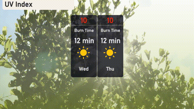
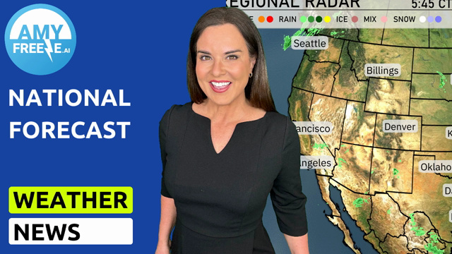
Greetings from your trusted meteorologist Amy Freeze! This week in Phoenix, we’re expecting nothing but clear skies and warmth. With daily highs climbing from 85 to 96 degrees, it’s essential to prepare for the sun’s strength, particularly mid-week when the UV index hits a high of 10. Our detailed blog post covers the entire week’s forecast, provides safety tips for high UV days, and insights into expected nighttime temperatures. Visit https://amyfreeze.ai/ for more info. The Southwest region is experiencing varied weather activity according to the regional radar. Rain is evident around Salt Lake City foothills, and also in the southern mountains of Utah, with Cedar City seeing light showers. Ely, is witnessing some light snow, providing a wintry scenario for the area. Redding appears to have some rain making its way from the north. Elsewhere, locations such as Reno, Las Vegas and Phoenix remain dry and clear under calm skies. Expect a bright and sunny start to your morning in Phoenix, with temperatures holding steady at 65 degrees until 10 AM. Winds will be light, shifting slightly from the west-southwest at 7 miles per hour early, decreasing to 5 miles per hour by mid-morning. As the day progresses, temperatures will rise to 70 degrees by noon, accompanied by a gentle south-southwest breeze at 6 miles per hour. Tomorrow Phoenix will sizzle with a high of 91 degrees, while Las Vegas also enjoys a toasty 87. Fresno is forecasted to reach 86, and Bakersfield will see similar conditions at 87 degrees. Coastal areas like San Diego will be milder at 69 degrees, with Los Angeles slightly warmer at 73. Expect a dry start to tomorrow in the Southwest, but conditions will change as a frontal passage brings scattered showers from northern Arizona into New Mexico by late afternoon. Temperatures will remain mild with highs in the upper 70s to low 80s across the desert regions. Watch for isolated thunderstorms over central New Mexico, as the system could intensify in the evening with possible gusty winds. No severe weather is anticipated, but stay informed as the next round of rain could affect travel late Tuesday into Wednesday. Phoenix will experience an extreme UV index of 10 on both Wednesday and Thursday. With a burn time of just 12 minutes, it’s crucial to take precautions. For the Phoenix 7 Day Outlook:
Wednesday: It’s mostly clear with a high reaching up to 85 degrees and a low of 64.
Thursday: Expect clear skies with temperatures climbing to 91 degrees and a low of 66.
Friday: Mostly clear, with highs around 95 degrees and lows near 68.
Saturday: Another clear day with temperatures peaking at 95 degrees during the day and dropping to 67 at night.
Sunday: The sky will be partly cloudy with daytime highs of 83 degrees and nighttime lows around 64.
Monday: Enjoy clear skies, temperatures will rebound to 88 degrees for the high and settle to 67 for the low.
Tuesday: Clear conditions persist, with highs climbing to 96 degrees and lows at 70.