Phoenix in Full Bloom: Weather Wonders and Warnings for April 28, 2025
By
Amy Freeze
Explore the lively dynamics of Phoenix's weather on April 28, 2025, with Meteorologist Amy Freeze. From a bright and sunny start to cautionary advisories for a high UV index, stay informed and prepared with our detailed analysis.
Meteorologist Amy Freeze highlights a bright forecast for Phoenix with warmer temperatures. Dive into our full report for details on UV indices and how to stay safe in the sun!
With Phoenix set to experience clear skies and rising temperatures, Meteorologist Amy Freeze provides an expert look at what to expect on April 28, 2025. Early morning start at 63°F climbs to 88°F in the afternoon, with a UV index hitting a high of 9, suggesting protective measures against potential sunburns. The blog explores daily temperature fluctuations, UV safety tips, and precautionary measures for upcoming scattered showers.
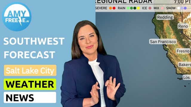
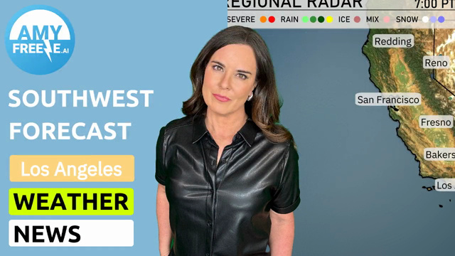
The clear skies dominate much of the Southwest on this April evening, but there’s rain pressing in from the north into Salt Lake City. Snow showers are visible to the east of Ely and Cedar City. As you move towards the Sierra Nevada, Redding is experiencing scattered rain showers, bringing some moisture to Northern California. The precipitation is keeping away from the southern parts, with locales like Las Vegas and Phoenix enjoying dry conditions. Meanwhile, San Diego and Los Angeles bask under clear skies, making it a perfect night to step outside and enjoy the weather.
Expect a clear and sunny start to your morning in Phoenix. Temperatures will gradually rise, starting at 63 degrees at 7 AM and reaching 71 degrees by 11 AM. Winds will be light and from the east-southeast at around 4 miles per hour. Enjoy the bright and calm weather!
High temperatures in the Southwest tomorrow are expected to soar above average, influenced by a strong warming trend across the region. Phoenix will experience a sizzling high of 88 degrees, while Las Vegas checks in at a warm 83. In Southern California, Los Angeles will see highs around 72 degrees, and San Diego is expected to reach 70 degrees. Further inland, Fresno will be quite warm at 83 degrees, and Bakersfield matches that with another 84. Meanwhile, San Francisco remains cooler at 63 degrees, highlighting the coastal temperature disparity.
A frontal system is approaching the Southwest on Tuesday, bringing scattered showers and a few thunderstorms to the area. Expect rainfall mainly along the coastline from Los Angeles to San Diego, with heavier downpours likely in the afternoon. Inland, places like Phoenix will enjoy largely clear skies with temperatures rising to the low 80s. By Wednesday, the system moves eastward, with pockets of rain extending into Nevada. Be cautious of potential flash flooding in low-lying areas.
The UV index in Phoenix is at a very high 9 for both today and Tuesday, meaning sunburns can occur in as little as 15 minutes. With bright conditions expected, focus on using SPF 30 or higher, and don’t forget your hat and sunglasses. If you plan to spend extended time outdoors, frequent shade breaks will help keep you safe. Always remember to stay hydrated and look out for any local advisories.
Tuesday: Gear up for a warm day with partly cloudy skies and highs reaching 91 degrees, cooling down to 67 degrees overnight.
Wednesday: The temperatures continue to rise with partly cloudy conditions, peaking at 92 degrees and a low of 68 degrees.
Thursday: Expect more warmth with partly cloudy skies and a daytime high of 93 degrees, dropping to 68 degrees at night.
Friday: It’s a bright and sunny day with clear skies; temperatures will soar to 95 degrees with a low of 67.
Saturday: A cooler day ahead with mostly clear skies, a high of 75 degrees, and a nighttime low of 56 degrees.
Sunday: Mostly clear, wrapping up the week with a comfortable high of 76 degrees and a low of 58 degrees.
Enjoy the sunshine and stay hydrated!