Salt Lake City Morning Forecast & Southwest Running Hot!
By
Amy Freeze
Dive into the detailed morning weather forecast for Salt Lake City and a glimpse at the scorching conditions across the Southwest. Stay prepared and informed!
Get the latest on tomorrow morning’s weather in Salt Lake City, with clear skies and a mild breeze. Plus, see how the Southwest is gearing up for another warm day!
Welcome to our weather deep dive! Tomorrow morning in Salt Lake City starts with clear skies and a mild southeast breeze. Across the Southwest, however, temperatures are heating up with high readings in Phoenix, Las Vegas, and more. Don’t miss our full forecast and what these temperatures mean for you!
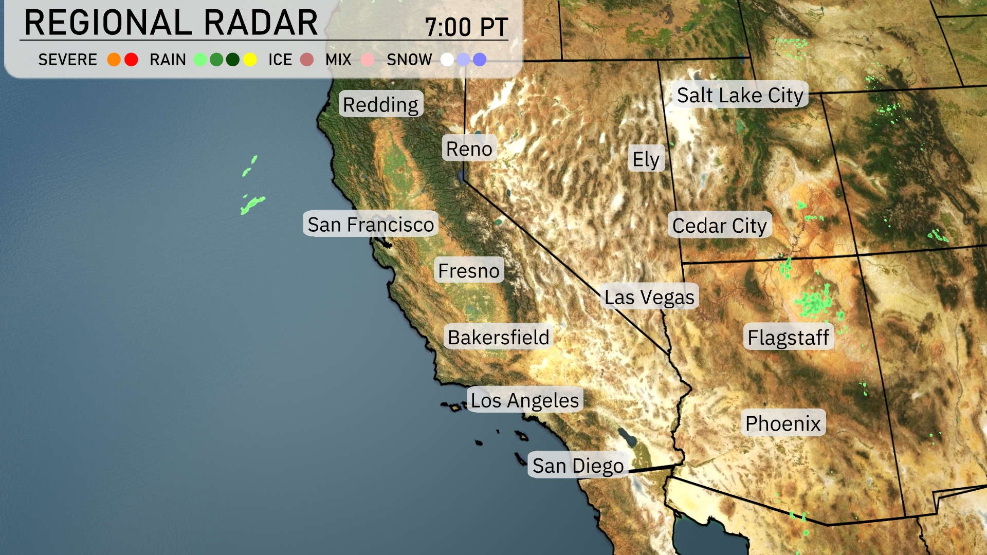
The Southwest is observing mostly clear conditions with some activity on the radar. Light showers are developing off the coast near San Francisco, bringing a hint of rain. Ely and Cedar City are seeing some precipitation, with areas of light rain and cloud cover extending east from those regions. The rest of the region, including major cities like Los Angeles, Phoenix, and Las Vegas, remains dry and free of significant weather disruptions at the moment.
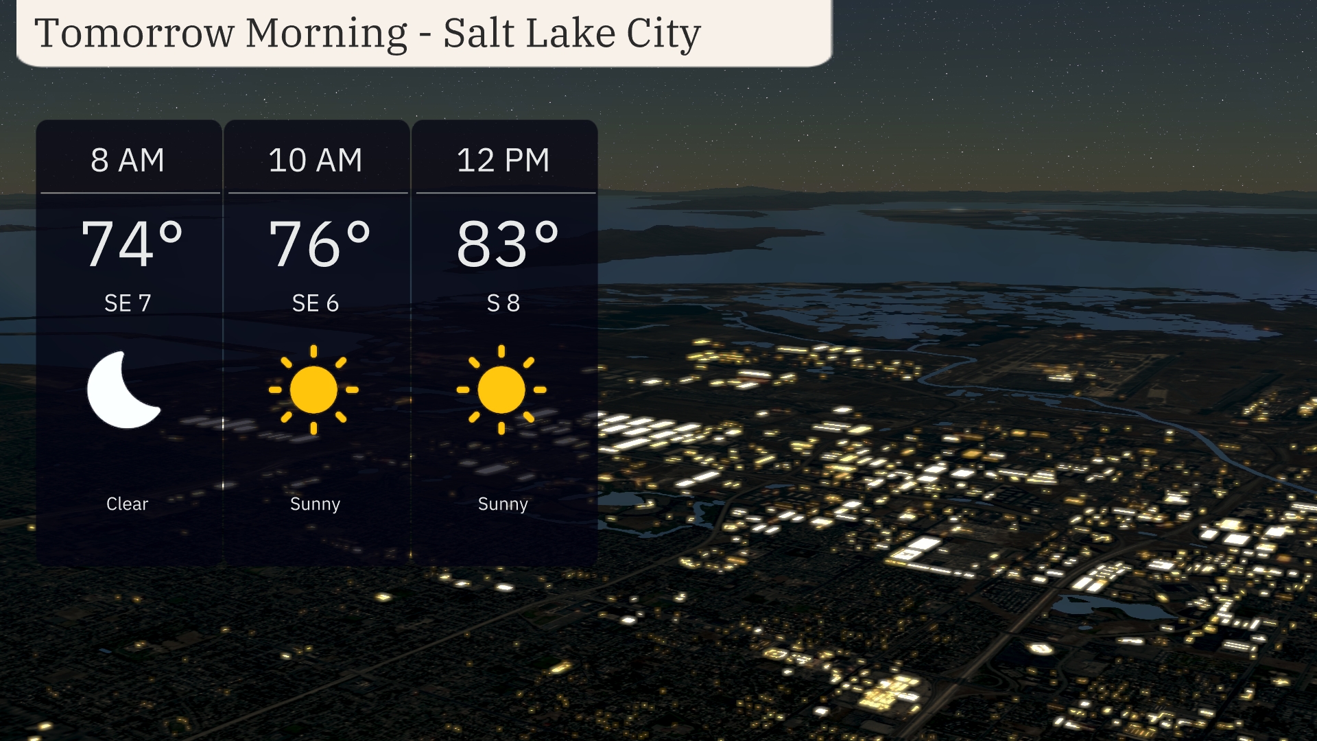
Begin your morning in Salt Lake City with clear skies and a mild breeze from the southeast. Temperatures will start at 74 degrees at 8 AM. As the morning progresses, sunshine boosts temperatures to 76 degrees by 10 AM with a gentle southeast wind of 6 mph. By midday, temperatures rise to 83 degrees, with the wind shifting slightly from the south at 8 mph and staying sunny.
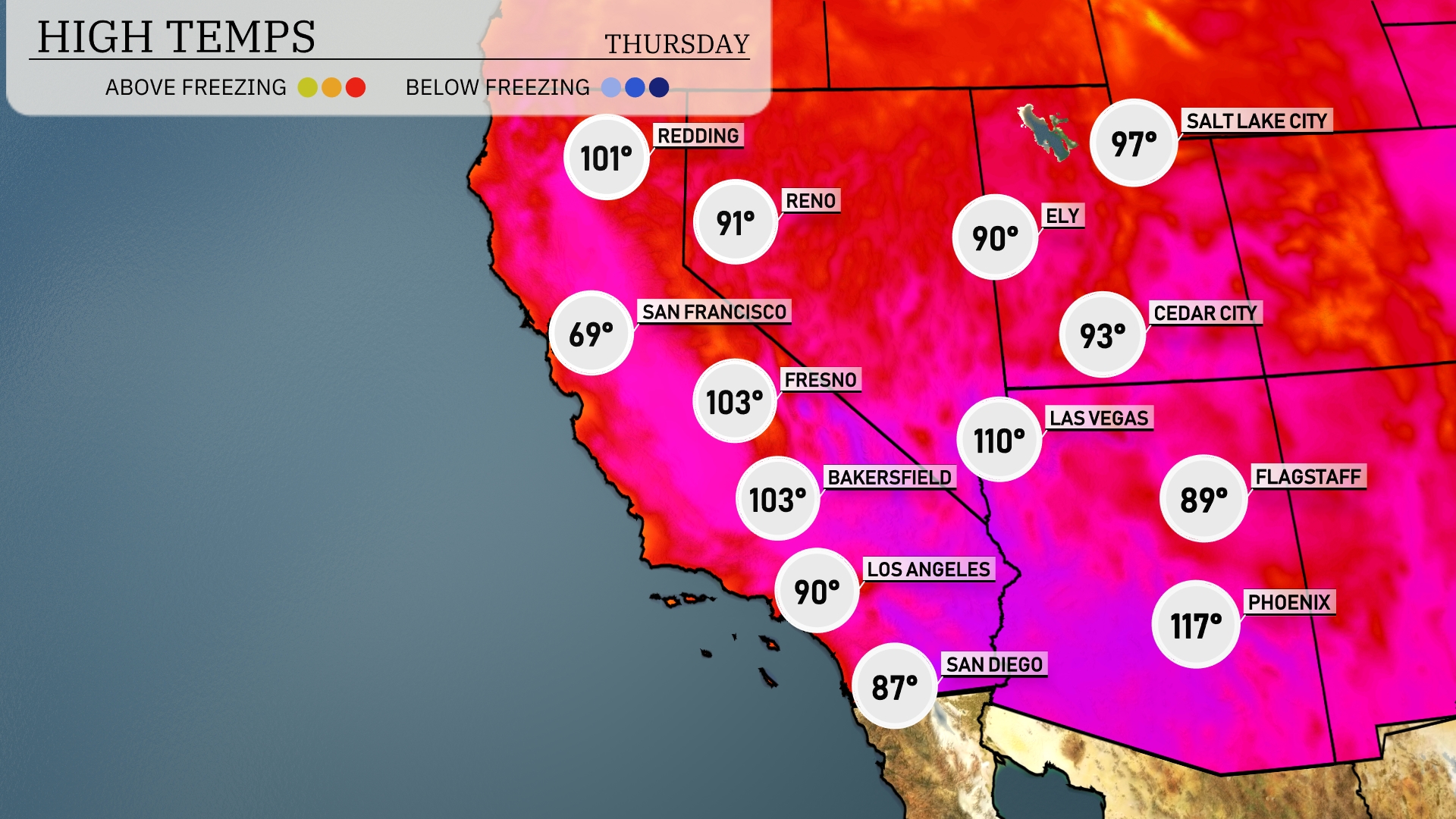
Tomorrow in Phoenix, expect scorching temperatures reaching a high of 117 degrees, well above average for this time of year. Las Vegas won’t be far behind with a sizzling high of 110 degrees, also above seasonal norms. Over in Bakersfield and Fresno, the afternoon highs will hit 103 degrees, indicating a significant heat wave impacting the region. San Diego remains cooler at 87 degrees, but still warmer than usual. San Francisco will enjoy a much more mild day with a high of 69 degrees, showcasing stark contrasts within the Southwest.
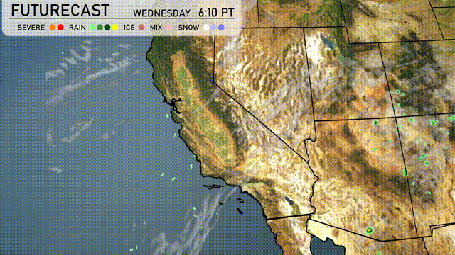
A weather system is bringing unsettled conditions to the Southwest, where scattered showers and thunderstorms are expected on Wednesday. In Arizona, expect localized heavy downpours that may lead to flash flooding, especially in the desert areas. Temperatures across the region remain warm, with a slight cooling trend as the system moves through. Southern Nevada should brace for windy conditions accompanying the storm system. By late Thursday, conditions are expected to stabilize, giving way to clearer skies by the end of the week.
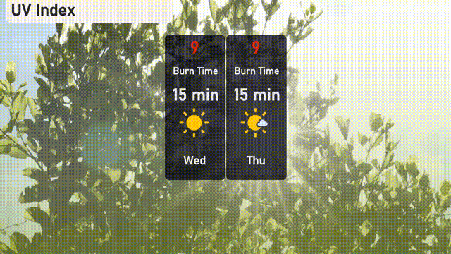
The UV index in Salt Lake City is expected to be very high at 9 today, with a burn time of just 15 minutes in direct sunlight. On Thursday, anticipate similar conditions with the UV index remaining at 9.
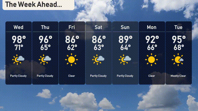
Here’s the 7-day forecast for Salt Lake City:
Wednesday: Partly cloudy skies with a high of 98 degrees and a low of 71 degrees.
Thursday: Still hanging onto the clouds with a high reaching 96 degrees and nighttime temperatures falling to 65.
Friday: Clear skies with plenty of sunshine. Expect temperatures to climb to 86 degrees during the day and cool to 62 at night.
Saturday: Partly cloudy once more, with a high of 86 degrees and a low around 63.
Sunday: A mix of sun and clouds will give us another partly cloudy day, with a warm high of 89 degrees and a low of 64 degrees.
Monday: The skies clear up again, bringing a high of 92 degrees and a refreshing low of 66 at night.
Tuesday: Mostly clear conditions, with temperatures peaking at 95 degrees and dropping to 68 in the evening.