Tomorrow’s Weather in Salt Lake City: A Cloudy Start with a Sunny Outlook!
By
Amy Freeze
Get ready for a detailed look at tomorrow’s weather in Salt Lake City, along with insights into the swirling weather patterns affecting the Southwest. From nightly dips to sunny peaks, find out what the weather holds!
Expect partly cloudy skies in Salt Lake City with morning temperatures starting at a cool 64°F, warming slightly as the day progresses. Keep an eye on the changing weather across the Southwest!
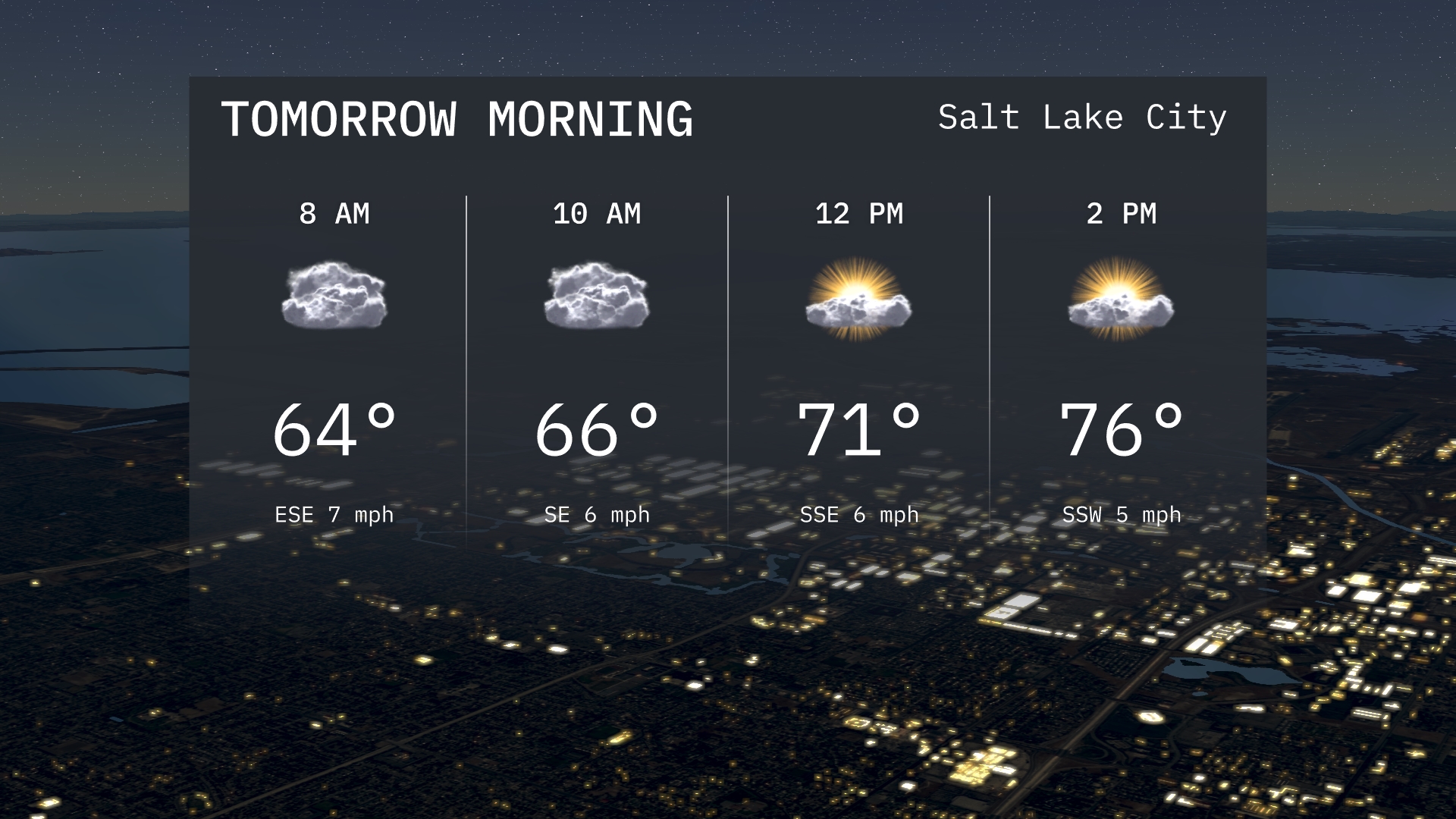
Salt Lake City wakes up to partly cloudy skies tomorrow morning, with temperatures gradually warming from 64°F to 66°F by mid-morning. The region, particularly San Francisco through to Los Angeles, is dancing between light rains and clear conditions, setting a varied stage across the Southwest. As the day unfolds, expect a clear shift with potential thunderstorms rolling into places like Las Vegas by afternoon. Dive deeper into our full report and equip yourself with everything you need to know about tomorrow’s weather dynamics!
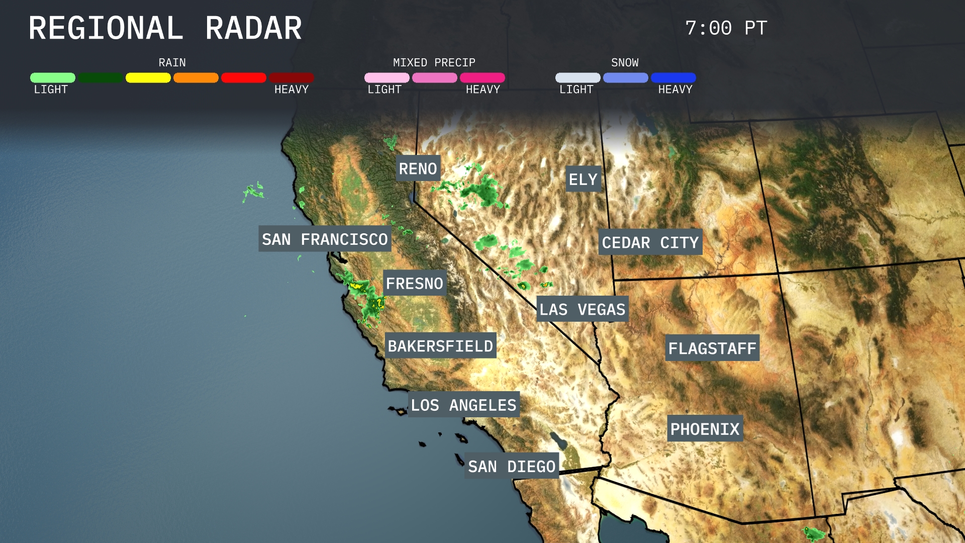
A band of rain showers is intensifying around San Francisco, stretching southward towards Fresno and Bakersfield. Light rain is observed along the immediate coastline near Los Angeles and San Diego, bringing some temporary relief. Clear conditions dominate across the deserts, including Las Vegas and Phoenix, while Ely remains dry under partly cloudy skies. Cedar City and Flagstaff are experiencing increasing cloud cover, signalling potential weather changes ahead.
Tomorrow morning in Salt Lake City, temperatures start at 64 degrees at 8 AM, with gradual warming to 66 degrees by 10 AM. Clouds will dominate early on, creating a mostly overcast morning.
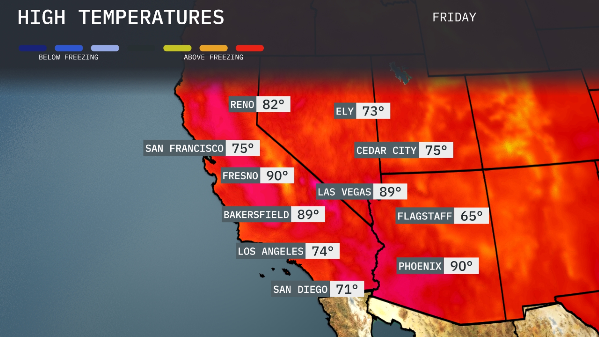
Tomorrow in the Southwest, temperatures are heating up significantly. Phoenix will reach a high of 90 degrees, while Las Vegas isn’t far behind at 89 degrees. In California, Bakersfield and Fresno will soar to 89 and 90 degrees respectively. Meanwhile, San Diego will see a more moderate temperature of 71 degrees. Overall, most areas are experiencing above-average readings as warm air dominates the region.
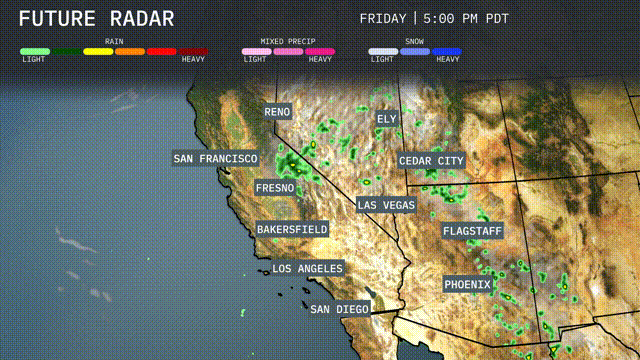
Tomorrow, the Southwest region will experience scattered rain showers, particularly impacting areas like Ely and Cedar City, with the potential for thunderstorms in the vicinity of Flagstaff. A shift in weather patterns brings a risk of heavy rain and potential flash flooding, especially in lower elevations around the San Bernardino Valley. By afternoon, Las Vegas may see thunderstorms developing as moisture increases. Remaining regions, including Phoenix and San Diego, can expect dry conditions with partly cloudy skies, while Northern California remains clear. Daytime temperatures across the Southwest are set to remain warm, ensuring any precipitation will be short-lived before clearing out by evening.
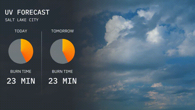
The UV index in Salt Lake City today is 6, indicating moderate sun exposure with a burn time of about 23 minutes if you’re soaking up those rays. Tomorrow, expect similar conditions with the UV index again at 6 and a burn time of 23 minutes. Don’t forget your sunscreen and a hat to stay protected!
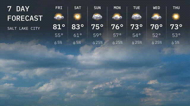
Friday: Expect a high of 81 degrees with mostly cloudy skies and a low around 55 degrees.
Saturday: Sunny and warmer with temperatures reaching 83 degrees during the day and a low of 61 degrees at night.
Sunday: A high of 75 degrees with partly sunny weather, and an overnight low of 59 degrees.
Monday: Cloudy with a chance of rain, temperatures peak at 76 degrees, cooling down to 57 degrees later.
Tuesday: Rain likelihood continues with a cooler high of 73 degrees and a nighttime low of 54 degrees.
Wednesday: More rain expected with a high of 70 degrees, dipping to 52 degrees overnight.
Thursday: Slightly warmer with partly cloudy skies and a high of 73 degrees, low near 53 degrees.