Weather Whirlwind: Sunny Days and Stormy Nights Across the Southwest
By
Amy Freeze
Explore the dynamic weather patterns sweeping through Salt Lake City and neighboring areas, from balmy afternoons to chilly evenings.
Salt Lake City greets the day with partly cloudy skies and a refreshing breeze. As temperatures vary across the Southwest, expect weather surprises from rain to sunshine!
Tomorrow morning in Salt Lake City starts with partly cloudy skies and temperatures in the mid-40s. As the day progresses, regional radar highlights a band of rain moving from San Francisco towards Reno, while Phoenix enjoys clear skies. The diverse weather conditions highlight the unique climate patterns of the region. Dive deeper into the forecasts for the upcoming days, with a focus on fluctuating temperatures and potential thunderstorms in key cities.
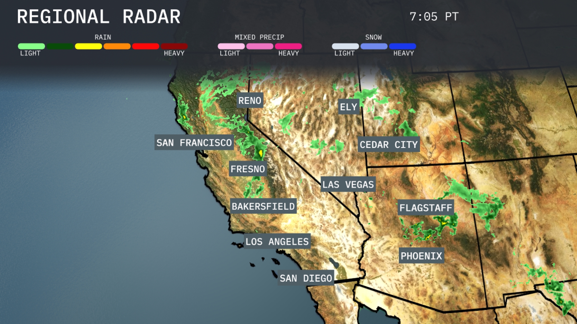
On the Regional Radar for the Southwest, a band of rain is sweeping through San Francisco and extending towards Reno, providing some moisture relief. Ely is experiencing a mix of rain and snow, highlighting the region’s elevation differences. Flagstaff should be prepared for some scattered showers, while Phoenix remains dry with clear skies. In contrast, the coastal areas, including San Diego and Los Angeles, are enjoying clear conditions with no precipitation in sight.
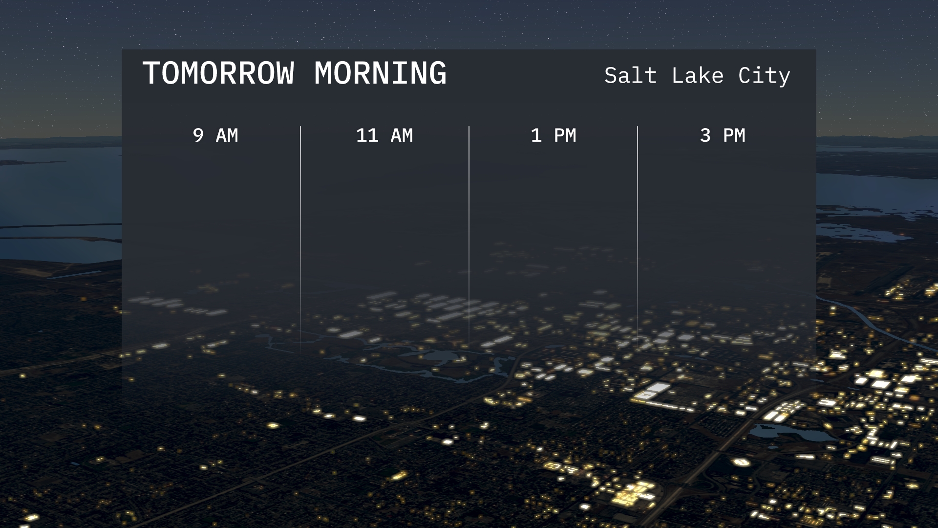
Salt Lake City kicks off tomorrow morning with partly cloudy skies. Expect temperatures around 62 degrees at 9 a.m., inching up slightly by 11 a.m. A gentle breeze will accompany the morning hours, ensuring a refreshing start to the day.
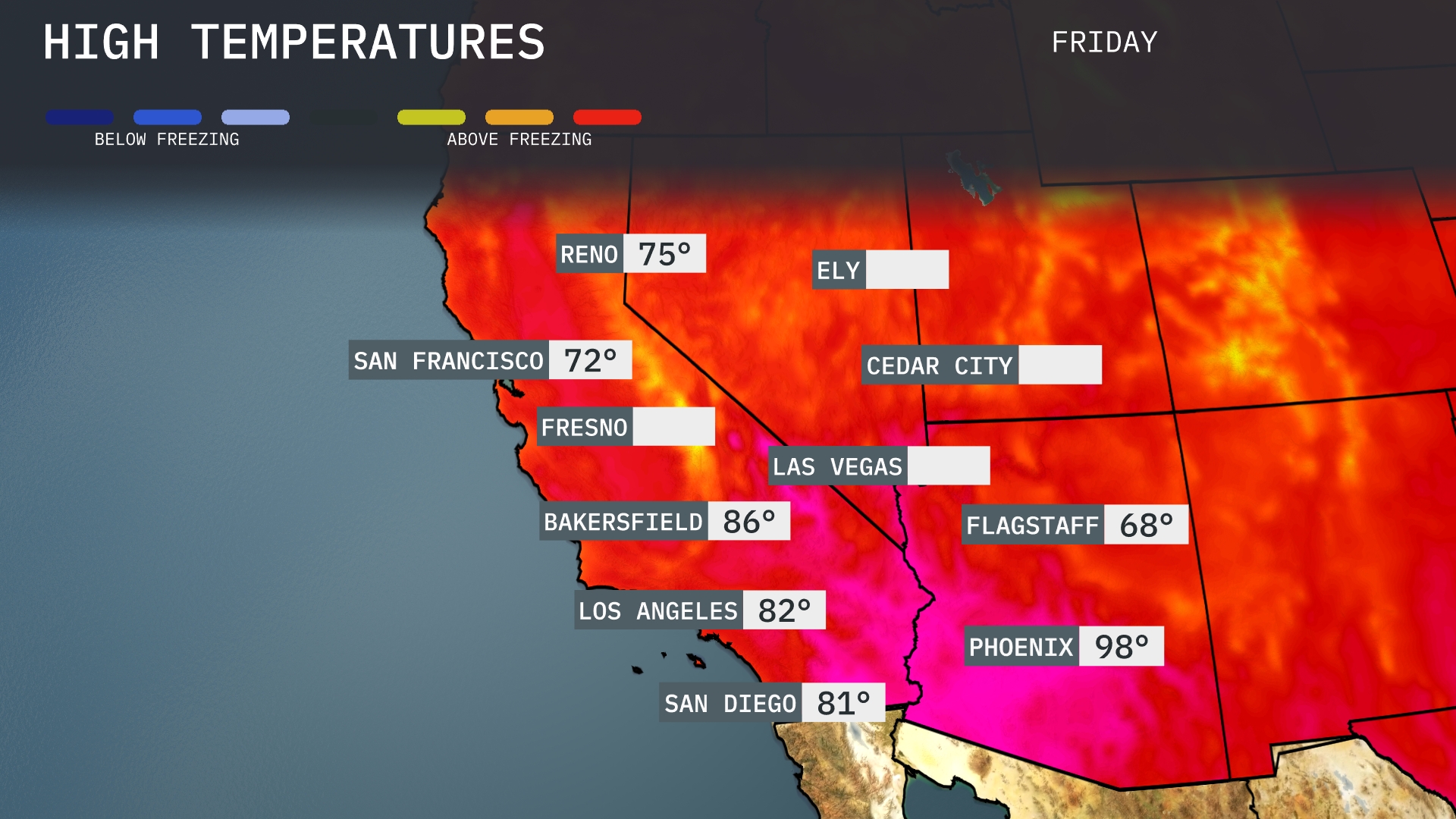
Tomorrow, Phoenix will soar to a scorching 98 degrees, well above average for this time of year. Las Vegas isn’t far behind, with highs reaching 86 degrees. Los Angeles will enjoy a warm day at 82 degrees, while Bakersfield expects a high of 86 degrees as well. San Diego will be a bit milder at 81 degrees. Flagstaff remains cooler with a high of 68 degrees, serving as a refreshing contrast to the surrounding heat.
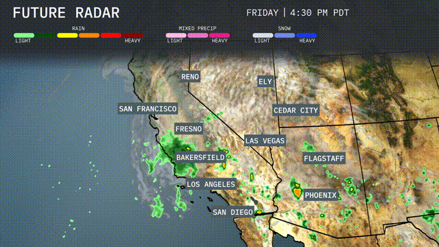
In the Southwest, expect scattered showers and thunderstorms around the region as a weather system passes through. While the core of the activity centers over Southern California and the Sierra Nevada, keep an eye on potential heavy rainfall leading to localized flooding, especially in Bakersfield and Fresno. Thunderstorms may develop right over Las Vegas and Phoenix, bringing gusty winds and brief heavy downpours. As the system progresses, a mix of sun and clouds with cooler, more comfortable temperatures sets in for Ely and Flagstaff, moving into late tomorrow.
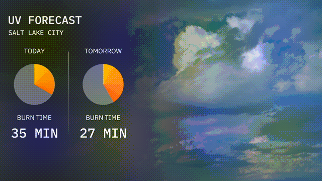
Expect a high UV index of 7 today in Salt Lake City, with sun exposure risks yielding a burn time of just 35 minutes. For tomorrow, the index will slightly decrease to 6, offering a burn time of about 27 minutes.
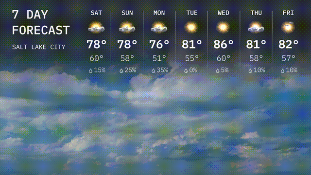
Saturday: Expect partly cloudy skies with a high of 78 degrees and a low of 60 degrees.
Sunday: The weather continues with partly cloudy conditions, reaching a high of 78 degrees and cooling to 58 degrees at night.
Monday: A little cooler with mostly sunny skies, highs around 76 degrees and an overnight low of 51 degrees.
Tuesday: It warms up nicely, bringing plenty of sunshine with a high of 81 degrees and a low of 55 degrees.
Wednesday: Enjoy clear skies and sunshine all day, with temperatures peaking at 86 degrees!
Thursday: Another sunny day, slightly cooler, with a high of 81 degrees and a low of 56 degrees.
Friday: Finish the week with mostly sunny skies, reaching a high of 82 degrees, with temperatures dropping to 57 degrees overnight.