Sizzling Southwest: Navigating Through Clear Skies and Intense Heat Waves
By
Amy Freeze
Get the latest weather insights for the Southwest, including temperature spikes and serene evenings in Salt Lake City.
Check out the latest on the Southwest’s weather: clear skies in Salt Lake City, intense heat in Phoenix, and more. Stay prepared with our detailed report!
This detailed blog explores the diverse weather conditions across the Southwest. From the serene evenings in Salt Lake City to the blistering heat in Phoenix, each city brings a unique story. We cover temperature trends, UV index warnings, and necessary precautions for upcoming weather changes. Join us as we delve deep into meteorological insights!
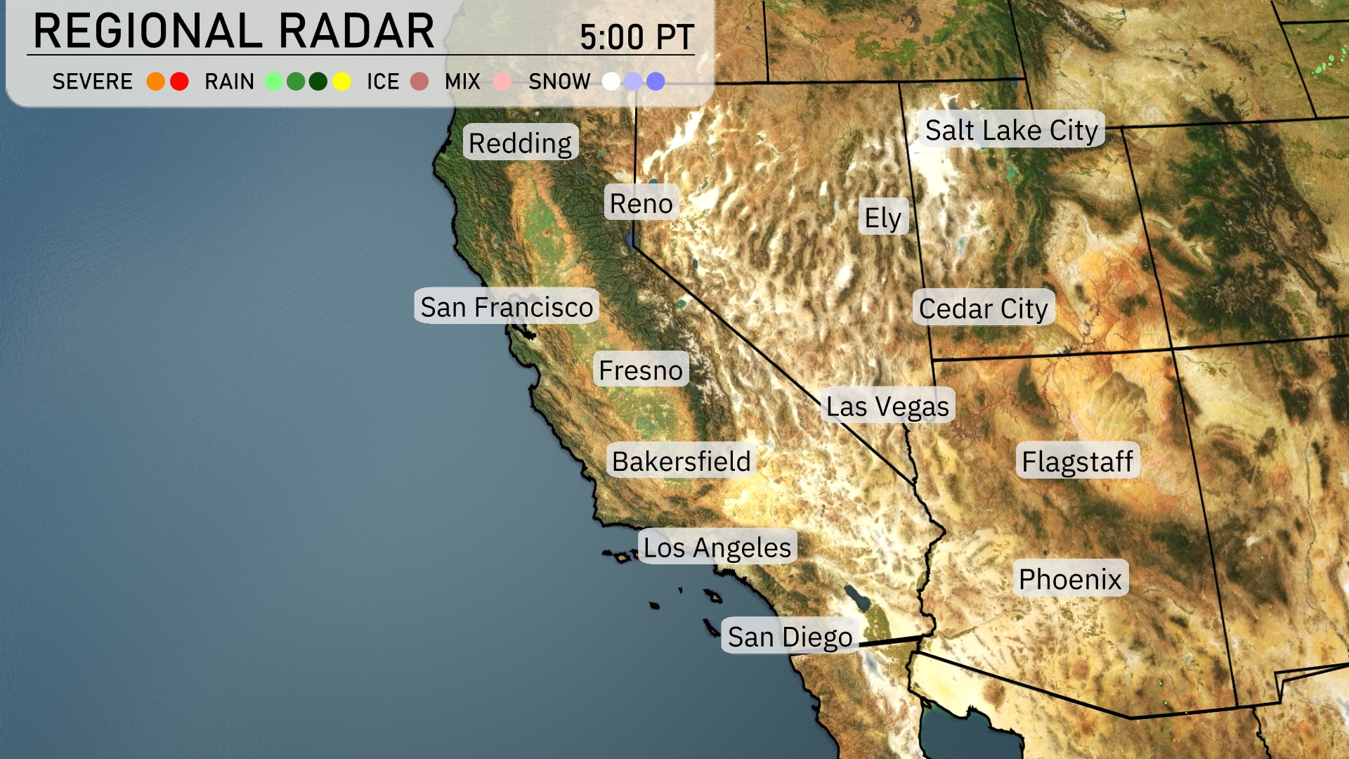
A formidable line of storms stretches from Reno down through Fresno, bringing bouts of heavy rain and localized severe conditions in central California. Las Vegas stays dry under clear skies, while Flagstaff could see increasing cloud cover as the day progresses. San Diego encounters light rain, enhancing cooler conditions along the coast. Salt Lake City remains mostly dry with some patchy cloud cover drifting across the region.
Evening temperatures in Salt Lake City will gradually decrease, starting at 90 degrees at 9 pm, cooling to 78 degrees by 1 am. Winds will shift slightly from north-northwest at 9 mph to east-southeast at 6 mph. Expect clear skies throughout the evening, providing a beautifully calm night.
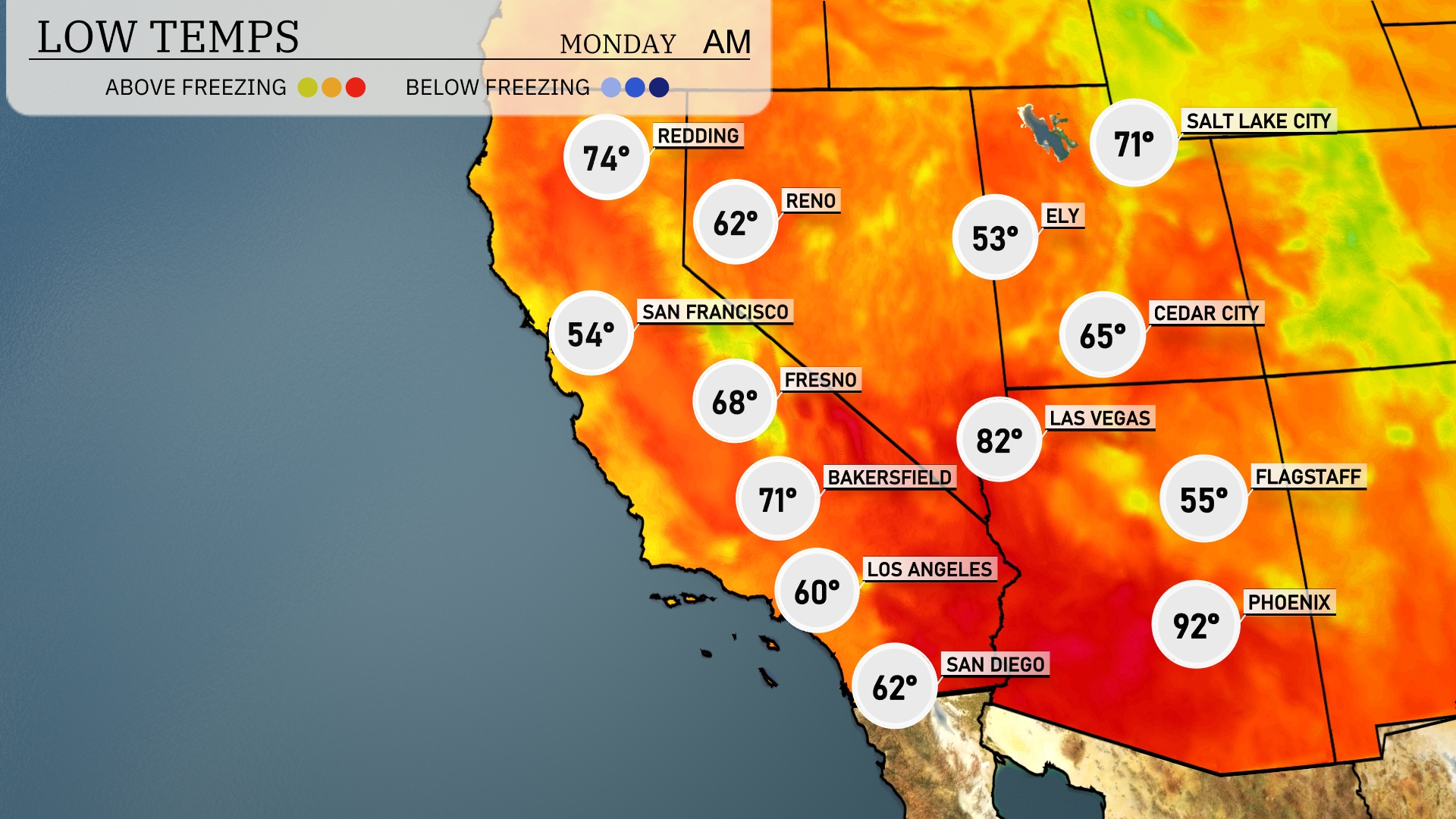
Tonight, low temperatures across the Southwest will see Flagstaff dipping to 55 degrees. Las Vegas will be cooler with a low of 65, while Bakersfield is set to drop to 71. Expect Los Angeles to experience a low of 60 degrees, and San Francisco will be the coolest major city tonight at 54 degrees.
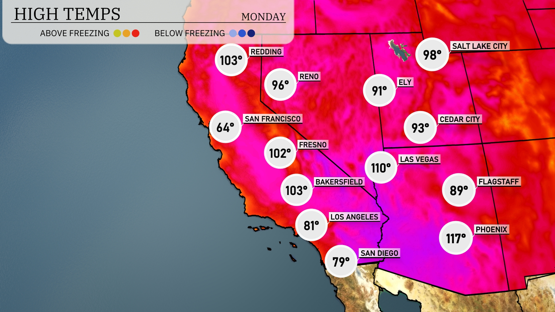
Tomorrow, Phoenix will sizzle with a high of 117 degrees, well above the seasonal average. Las Vegas is also feeling the heat, reaching a blistering 110 degrees. In the state of California, Bakersfield is forecasted to hit 103 degrees, while Fresno will warm up to 102. Up north, San Francisco stays significantly cooler at 64 degrees. Patterns of high pressure are contributing to these elevated temperatures across the Southwest.
A high-pressure system maintains clear skies and warm temperatures across the desert southwest, pushing daytime highs up to the mid-90s tomorrow. The coastal regions of Southern California will experience morning marine layer clouds but will clear by afternoon, with highs in the upper 70s. Northern California braces for scattered showers, especially in the afternoon, potentially making mountain passes slick. No severe weather threats are anticipated, but do watch for localized minor flooding in low-lying areas due to heavier rain bursts. Overall, it’s a typical summer day with a pleasant temperature gradient from coast to desert.
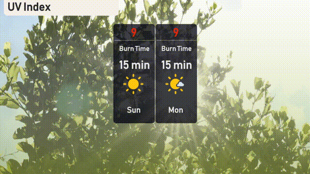
The UV index in Salt Lake City is at a very high level of 9 on both Sunday and Monday. Expect burn times of about 15 minutes in direct sunlight, so be sure to use ample sunscreen and seek shade to avoid the intense sun exposure.
Sunday: Clear skies with a high of 93 degrees and a low of 67 degrees.
Monday: Mostly clear, warming up to 97 degrees with a low of 70 degrees.
Tuesday: Mostly cloudy conditions, maintaining a high of 97 degrees and a low dipping to 71 degrees.
Wednesday: Cloudy skies dominate with temperatures reaching 90 degrees during the day and cooling to 68 degrees at night.
Thursday: Expect partly cloudy skies with a high of 84 degrees and a low of 63 degrees.
Friday: Partly cloudy once more, climbing to a high of 89 degrees and a low of 64 degrees.
Saturday: Mostly clear with a high of 90 degrees and a low of 64 degrees.