Southeast Weather Alert: From Partly Cloudy to Stormy Skies
By
Amy Freeze
Meteorologist Amy Freeze reports on the latest weather developments impacting the Southeast, from stormy advances to the highs and lows of regional temperatures.
Catch up with Meteorologist Amy Freeze as she discusses the latest weather updates affecting the Southeast. From Miami’s cloudy evenings to potential storm impacts, stay ahead of the weather with our detailed reports.
Hello, Southeast residents and weather enthusiasts! Meteorologist Amy Freeze here with an in-depth look at what to expect weather-wise in our region. We’re seeing a variety of weather patterns from partly cloudy skies in Miami to storm warnings across the Southeast. This blog post covers everything from nightly temperature details in major cities to precautions for the incoming severe weather. For consistent updates, check back here or visit our main site at https://amyfreeze.ai/.
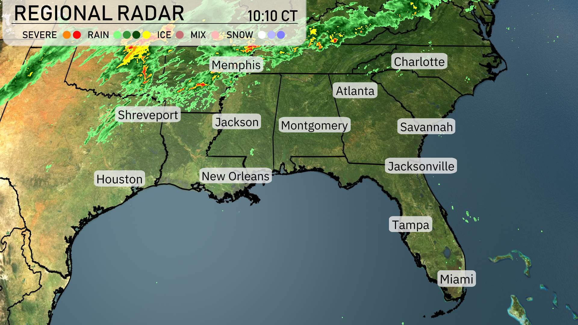
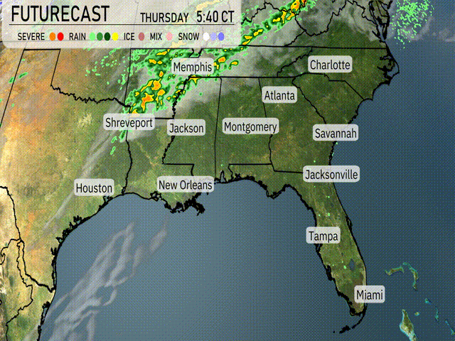
On the Regional Radar, a line of storms is advancing toward the Southeast. Memphis is currently experiencing these strong storms moving eastward. Rain is prevalent over Jackson, extending northeast towards Atlanta. Spots farther southeast, such as Montgomery, should be prepared for incoming showers and possible thunderstorms.
In the meantime, rain continues to impact Georgia, heading towards the Carolinas, with increasing cloud cover in its path. Eastern Louisiana is experiencing scattered showers today. Over coastal areas like Savannah and Charleston, there’s a temporary break from precipitation, with clear skies expected in Jacksonville and northern Florida providing a brief respite from the cloudy conditions elsewhere.
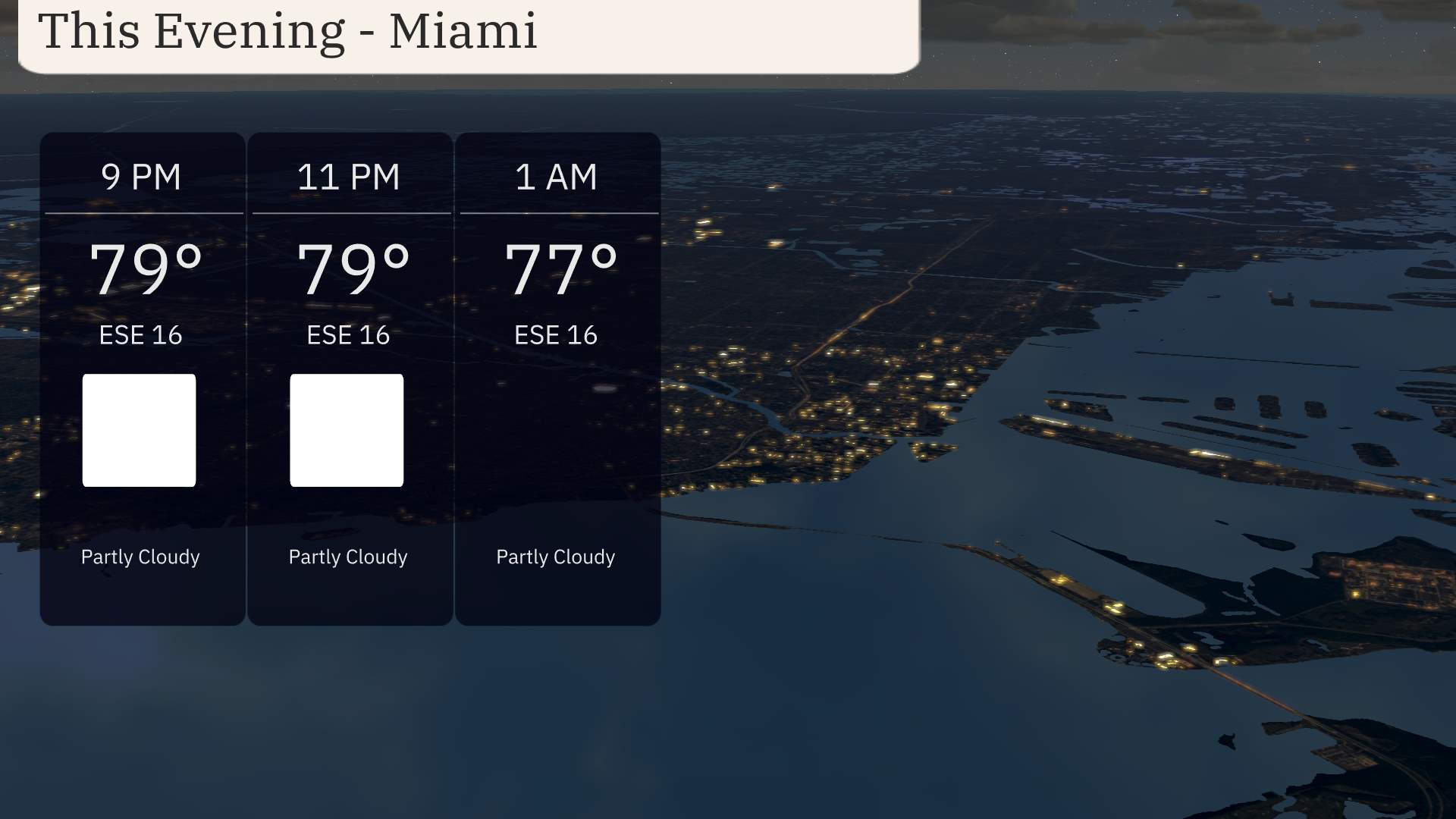
For this evening in Miami, anticipate partly cloudy skies with temperatures holding steady at 79 degrees around 9 PM and 11 PM, before slightly tapering off to 77 degrees by 1 AM. An east-southeast wind will keep conditions breezy, blowing consistently at 16 miles per hour throughout the evening.
Expect Memphis to chill down to 38 degrees, while Nashville will see a low of 36. Shreveport is forecast to hit 45, with Jackson cooling down to 44. Montgomery will stay mild at 49 degrees, but Atlanta will experience a significant drop with a low of 41. In Florida, Jacksonville will see 54 degrees, while Tampa will be a bit warmer at 57. Miami will remain the warmest in the region at 65 degrees, but that’s still a few degrees cooler than recent nights.
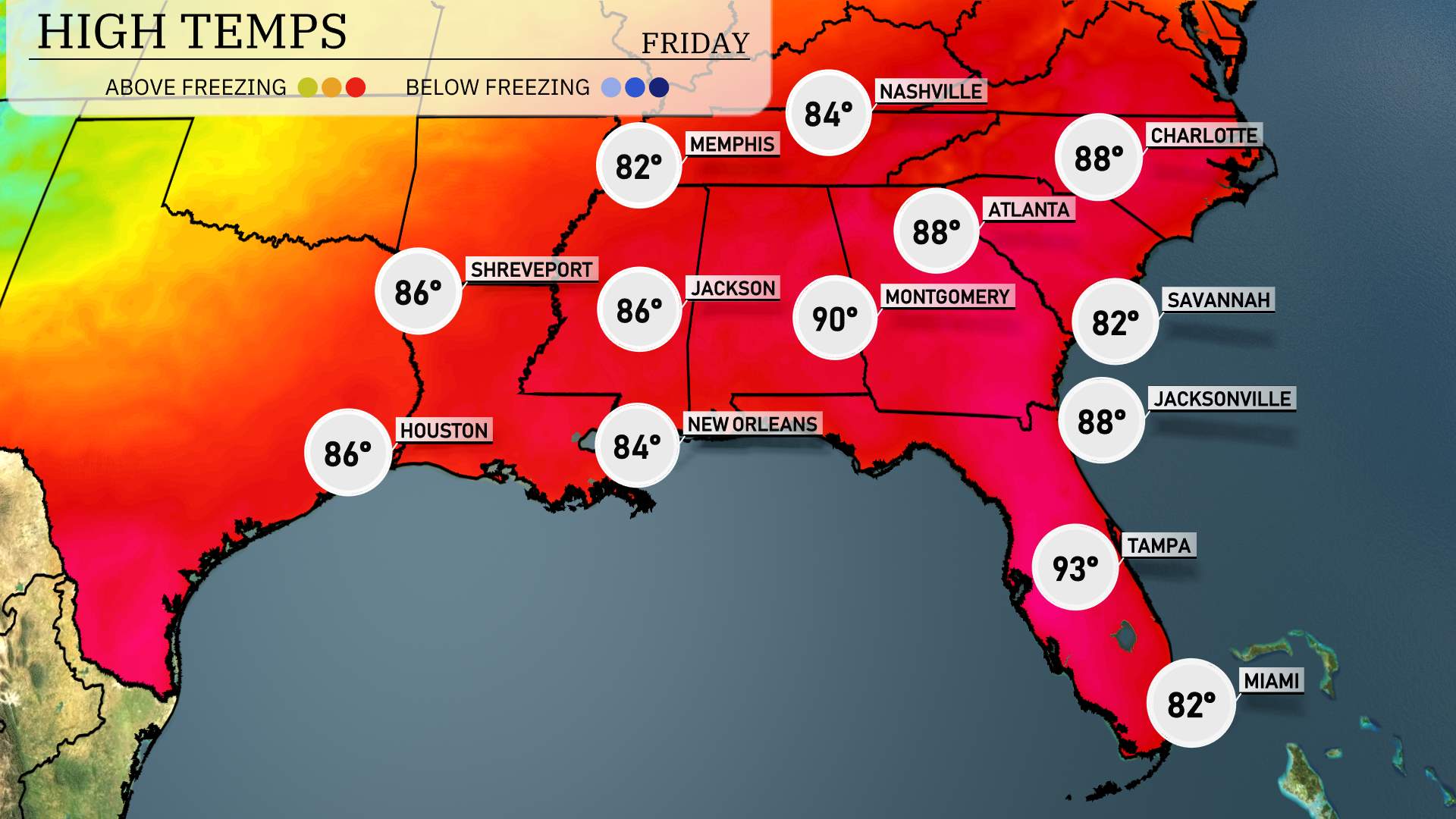
High temperatures across the Southeast tomorrow will be notably warm, with several cities approaching record highs.
Atlanta will reach 88 degrees, making it significantly warmer than average for this time of year. Montgomery is even hotter, expecting a high of 90 degrees. In Jacksonville, temperatures will climb to 88 degrees, reflecting a trend of rising warmth across the region.
New Orleans will see a high of 84 degrees, while Memphis will get a more mild 82 degrees. Shreveport, in Louisiana, is forecasted to hit 86 degrees, contributing to the overall warm atmosphere.
To the south, Tampa will experience extreme heat with a high of 93 degrees, indicative of persistent warm air masses influencing the area. Savannah is projected to reach 82 degrees, slightly less than some neighboring cities but still well above average.
The approaching cold front over the Southeast will bring a variety of weather impacts. Expect rain and thunderstorms from Memphis to Shreveport tonight. As the front advances, areas like Jackson, Mississippi, and Montgomery, Alabama, could experience heavy rain with potential strong thunderstorms by midday. Watch for localized flooding in low-lying areas.
In Georgia and the Carolinas, scattered thunderstorms could disrupt commutes from Atlanta to Charlotte Wednesday morning. Thunderstorms will progress to Jacksonville and Savannah Wednesday evening, accompanied by gusty winds and periods of heavy rainfall.
Pay attention to weather alerts, as the SPC places parts of the region under a severe weather risk outlook. Once the front passes, cooler and drier air will set in by Thursday evening, bringing pleasant weather into the weekend across the Southeast.
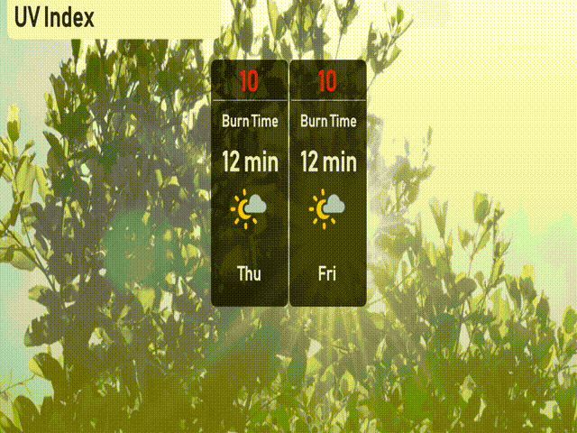
In Miami, today and tomorrow both feature a high UV index of 10, with a burn time of approximately 12 minutes in direct sunlight. Ensure you apply sunscreen, wear sunglasses, and take frequent shade breaks to protect your skin. Stay sun-safe!
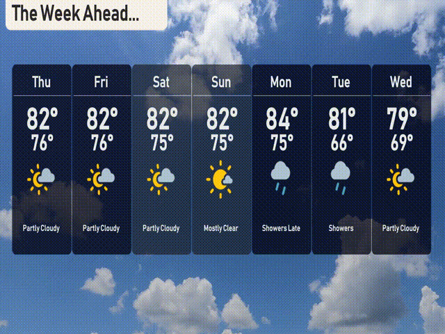
Thursday: Enjoy partly cloudy skies with a warm high of 82 degrees and a low of 76.
Friday: Expect similar weather with partly cloudy conditions, a high of 82 degrees, and a low of 76 degrees.
Saturday: Another partly cloudy day, with temperatures reaching a high of 82 degrees and cooling to 75 at night.
Sunday: Mostly sunny skies to brighten up your day, maintaining a high of 82 degrees with a low of 75.
Monday: Showers are expected late in the evening, peaking temperatures at 84 degrees with a low around 75.
Tuesday: Showers continue, cooling down to a high of 81 degrees and a low of 66.
Wednesday: Partly cloudy skies return, with a high of 79 degrees and a comfortable low of 69.
Stay safe and enjoy your week!