Clear Skies to Stormy Nights: Navigating the Southeast’s Weather Shifts
By
Amy Freeze
Explore the fluctuating weather patterns from sunny mornings in Atlanta to severe storms across the Southeast, as explained by Meteorologist Amy Freeze.
Meteorologist Amy Freeze brings you the latest weather updates for the Southeast, featuring sunny mornings in Atlanta and stormy afternoons across the region. Get ready for a week of dynamic weather!
Amy Freeze here with your detailed Southeast weather forecast. Atlanta kicks off with clear skies and a gentle breeze, ideal for morning activities, while the afternoon brings shifts with a wave of severe storms from New Orleans to Shreveport. Discover what these fluctuations mean for your daily plans and how to stay prepared with expert insights into the upcoming weather patterns and temperature changes!
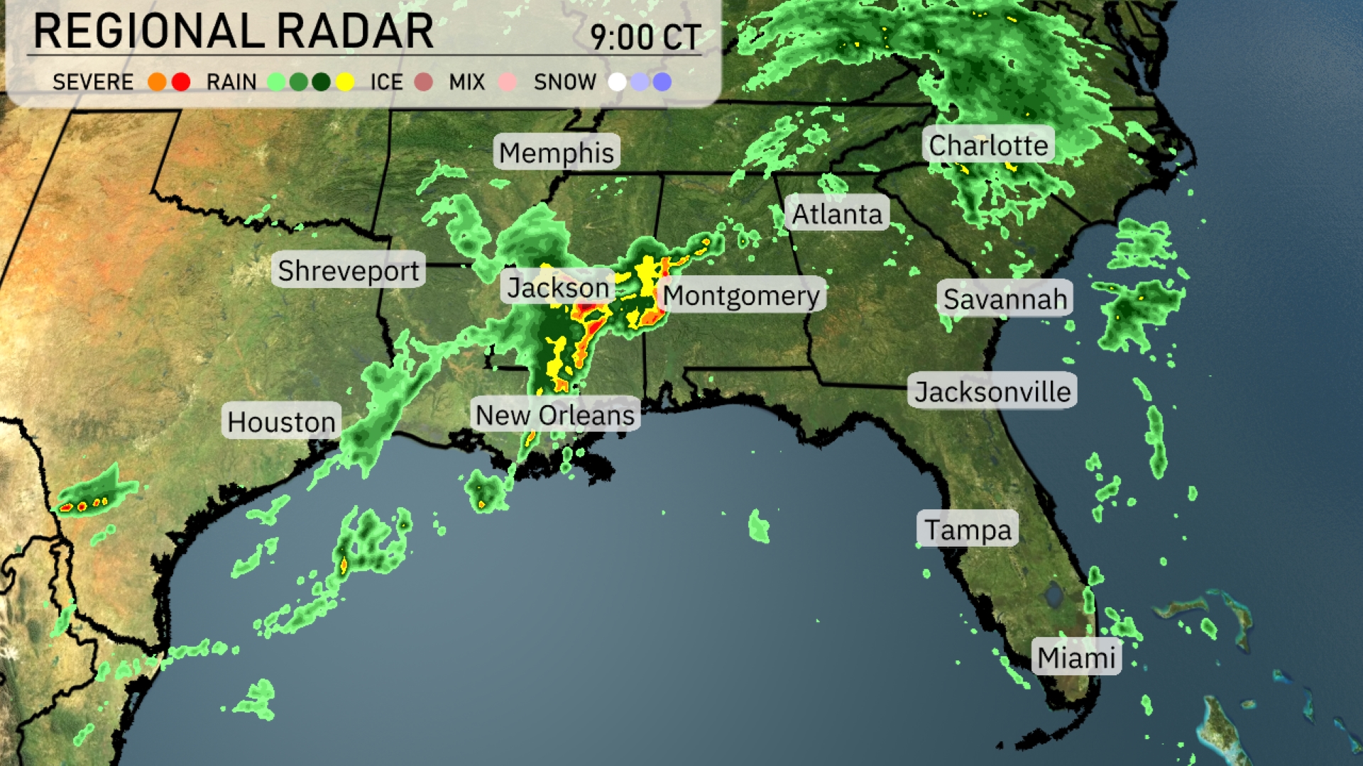
The regional radar indicates a line of storms, identified as severe, making their way eastward from Jackson to Montgomery. Shreveport and New Orleans are experiencing heavy rain, with storm activity moving toward the Gulf Coast. Memphis is under cloud cover, while rain extends over Atlanta toward Charlotte. Areas like Jacksonville and Savannah are enjoying clearer conditions. Elsewhere, scattered showers persist over eastern Louisiana.
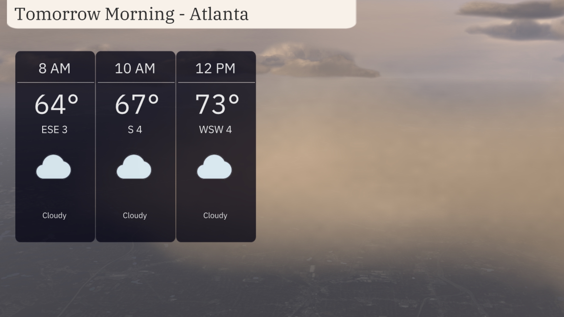
Tomorrow morning in Atlanta, temperatures will start at 64 degrees at 8 AM and climb to 67 degrees by 10 AM. The sky will be cloudy, and winds will shift from the east-southeast to the south at around 4 miles per hour. By midday, temperatures will rise to 73 degrees, with winds coming from the west-southwest at 4 miles per hour.
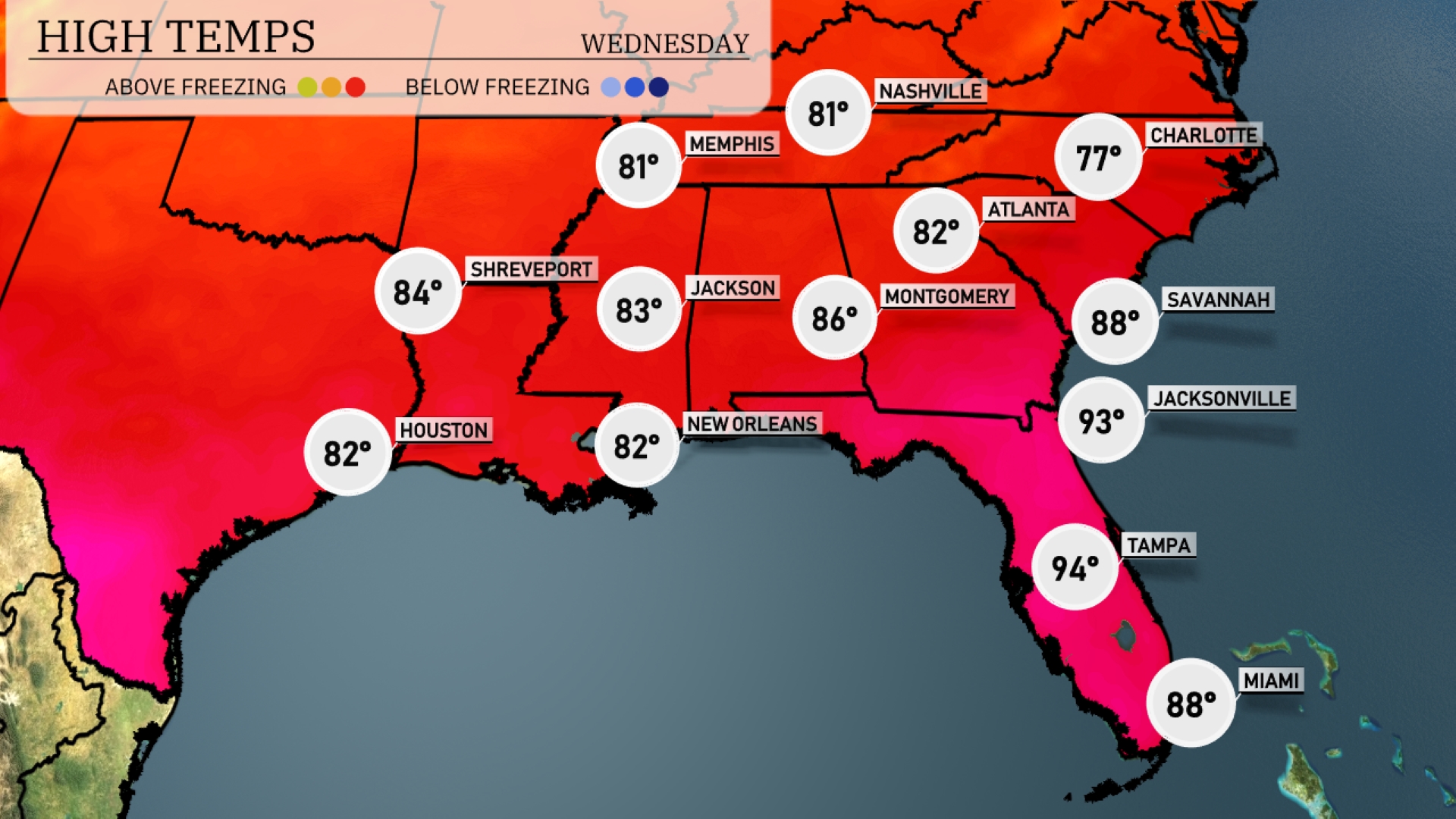
Tomorrow Atlanta is expected to reach 82 degrees, while Montgomery will be warmer at 86. In Jacksonville, highs will climb to a scorching 93 degrees, and Tampa could hit an impressive 94 degrees. New Orleans and Houston both anticipate highs around 82 degrees, while Shreveport will warm up to 84 degrees. High humidity will accompany these temperatures, making it feel even warmer throughout the region.
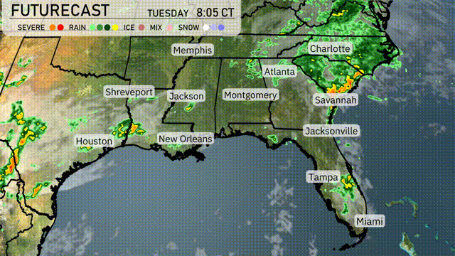
A dynamic weather pattern is set to impact the Southeast through tomorrow. A cold front, currently triggering showers and storms from New Orleans to Shreveport, will advance eastward. Expect storms in the early hours over Jackson and into Montgomery, with rainfall intensifying by morning. Atlanta should prepare for midday thunderstorms potentially affecting the commute. Stormy conditions are forecast for coastal areas from Savannah to Jacksonville.
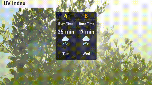
The UV index in Atlanta will be moderate on Tuesday with a value of 4, indicating a burn time of about 35 minutes in direct sunlight. For your Wednesday plans, the UV index jumps to a very high 8, with a quicker burn time of 17 minutes!
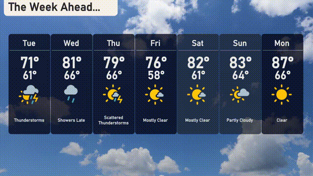
For the 7 Day Forecast in Atlanta:
Tuesday: Thunderstorms expected with a high of 71 degrees and a low of 61.
Wednesday: Showers will develop late; prepare for a warmer day with a high of 81 degrees and a low of 60.
Thursday: Scattered thunderstorms continue with temperatures peaking at 79 degrees and dipping to 66 overnight.
Friday: Mostly clear skies are on the way, bringing a high of 76 degrees and a low of 58.
Saturday: It’s mostly clear with a delightful high of 82 degrees and a low of 61.
Sunday: Partly cloudy conditions are forecasted, with temperatures reaching up to 83 degrees and cooling down to 64 at night.
Monday: Clear skies return, wrapping up the week with a high of 87 degrees and a low of 66.