Navigating the Weather Maze: A Comprehensive Forecast of the Southeast
By
Amy Freeze
Explore a detailed analysis of the current weather across the Southeast with Amy Freeze. From clear skies in Atlanta to stormy threats in Montgomery, get the full scoop here!
Meteorologist Amy Freeze brings you the latest weather trends across the Southeast. Visit our blog for detailed forecasts and weather safety tips.
Welcome to our detailed weather discussion for the Southeast, as narrated by meteorologist Amy Freeze. Tonight, while Atlanta enjoys partly cloudy skies, dynamic changes are afoot with potential storms from Miami to Montgomery. This guide dives deep into the crisp details of regional temperatures, storm predictions, and the impacts of a moving cold front. With a UV index peaking, and varying temperatures across cities, this blog is your go-to source for planning ahead and ensuring safety during fluctuating weather conditions.
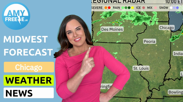
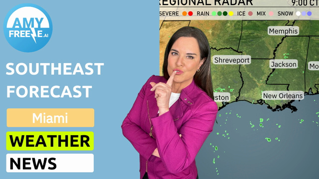
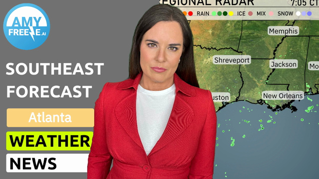
The regional radar reveals a dynamic weather situation across parts of the Southeast. Jacksonville is currently experiencing rain showers, while clouds are spreading from Montgomery towards Atlanta, indicating potential rainfall moving in. Most notably, strong storms are forming off the coast near Miami, with a clear trajectory towards the northeast. Clear skies dominate farther west around Houston and New Orleans, providing a break from inclement weather. Memphis and Shreveport remain under mild conditions with minimal cloud cover, allowing for clearer skies in those areas. Savannah enjoys a break from the rain, though cloud cover is increasing across the region.
For this evening in Atlanta, anticipate clear skies throughout. Temperatures transition from 68 degrees at 8 PM to 58 degrees by midnight. Winds will generally be light, coming from the west-northwest between 7 and 8 miles per hour.
Now for the low temperatures, the Southeast will experience quite a chilly night ahead. Nashville dips to a cool 43 degrees, while Memphis is forecasted to reach 39. In the heart of Mississippi, Jackson will see a low of 55. Moving down south, Montgomery is anticipated to drop to 49 degrees. Atlanta will cool down to a brisk 44. Savannah will rest at 51 degrees. Over in Florida, Jacksonville should see a low of 55, while Tampa is slightly warmer at 60. Miami remains the warmest overnight with a mild 69 degrees.
High temperatures for tomorrow across the Southeast region are shaping up to be quite warm. Atlanta will reach 75 degrees, with the temperature in Nashville also hitting 70 degrees. In New Orleans, expect a high of 82 degrees, while Jackson will see a slightly warmer 79. Montgomery is on track for 80 degrees, reflecting a comfortable afternoon.
To the east, Jacksonville is forecasted to reach 82 degrees, and further south in Tampa, highs are projected to be around 86 degrees, which is notably above average for this time of year. Miami will maintain a high of 82 degrees, keeping that tropical vibe alive.
“Ahead for the Southeast, the weather pattern evolves with potential impacts. Tomorrow, the cold front moves across Mississippi and Alabama, ushering in thunderstorms from Jackson to Montgomery by midday. Rain showers are anticipated farther south from New Orleans into Tallahassee. A severe weather risk hovers over Georgia, with isolated strong thunderstorms potentially producing gusty winds and heavy downpours. By late Wednesday, the front reaches the coast, bringing showers from Jacksonville to Savannah. Keep up to date with weather alerts as conditions may lead to flash flooding in more vulnerable areas.”
The UV index in Atlanta is high at 7 for both Tuesday and Wednesday, meaning sunburn can occur in about 20 minutes with direct exposure.
For the 7-day forecast in Atlanta:
Wednesday: Expect clear skies with a high of 74 degrees and a low of 43.
Thursday: Another clear day, warming up to 77 degrees with a low of 49.
Friday: Partly cloudy conditions with afternoon highs reaching 82 degrees and the low at 59.
Saturday: Cloudy skies are expected with temperatures peaking at 75 degrees and a low of 60.
Sunday: Showers move in with highs around 80 degrees and lows of 62.
Monday: Isolated thunderstorms possible, with a high of 76 degrees and a low of 52.
Tuesday: Showers likely later in the day, with a high of 74 degrees and a low of 51.