Temperatures and Tempests: Your Southeast Weather Forecast
By
Amy Freeze
Partly cloudy skies, rising temperatures, and potential thunderstorms—stay updated with our comprehensive Southeast weather forecast.
Explore what the weather has in store for Miami and the Southeast with our latest forecast. Expect partly cloudy skies, rising temperatures, and a chance of thunderstorms across the region.
In Miami, morning temperatures will begin in the low 80s, climbing into the mid-80s by midday. Expect partly cloudy skies with a gentle breeze. Across the Southeast, conditions vary from city to city with temperatures reaching up to the low 90s in places like Tampa and Jacksonville. A significant cold front is expected to bring storms and potential heavy rains. Stay prepared with our detailed breakdown of the coming week’s weather, potential storm impacts, and safety tips.
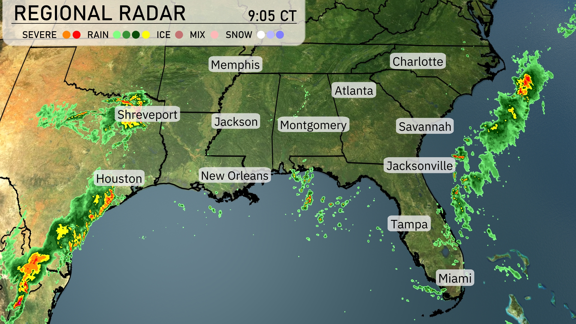
Rain showers are pushing into Houston from the west, with a more intense line of rain stretching south towards the Gulf of Mexico. The precipitation continues to develop, leading to scattered showers in Shreveport and extending eastwards across northern Louisiana. As we look towards the southeastern coast, light rain bands are brushing past Jacksonville with more activity off the coast and heading towards Charleston.
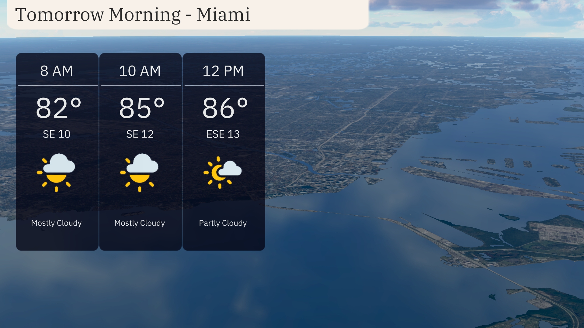
Tomorrow morning in Miami, temperatures start at 82 degrees at 8 AM, rising to 85 degrees by 10 AM. Expect mostly cloudy skies with a southeast wind blowing at 10 to 12 miles per hour. By noon, the temperature will reach 86 degrees with partly cloudy conditions and a gentle breeze at 13 miles per hour.
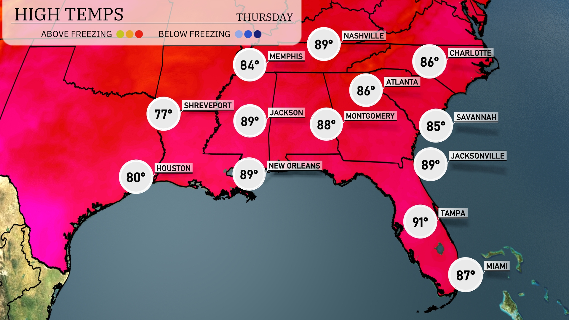
Tomorrow, we’ll see high temperatures soaring across the Southeast. New Orleans and Jackson will both reach a warm 89 degrees, while Shreveport sits slightly cooler at 77. Atlanta is expected to enjoy a high of 86 degrees, with Montgomery close behind at 88. Tampa is on track for a steamy 91 degrees, contributing to above-average conditions for this time of year. Jacksonville will also feel the warmth with a high of 89 degrees, making it a hot day across much of the region.
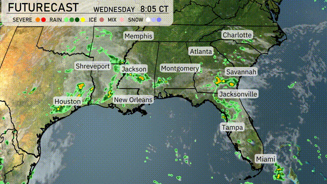
A cold front is pushing through the Southeast, bringing storms from Houston to Jacksonville late tonight into Wednesday. Expect scattered thunderstorms, with potential for heavy rain and gusty winds from New Orleans to Savannah. Be prepared for localized flooding in areas with persistent rainfall. Temperatures will gradually dip behind the front, with a brisk breeze cooling things off into Thursday.
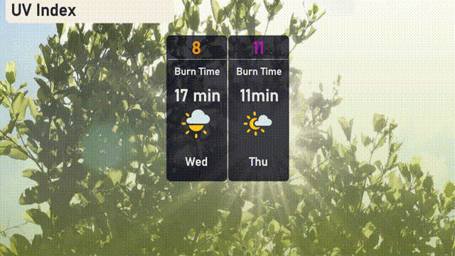
The UV index in Miami hits an 8 on Wednesday, with a burn time of just 17 minutes in direct sun. Thursday will see an even higher UV index of 11, shortening the burn time to a mere 11 minutes!
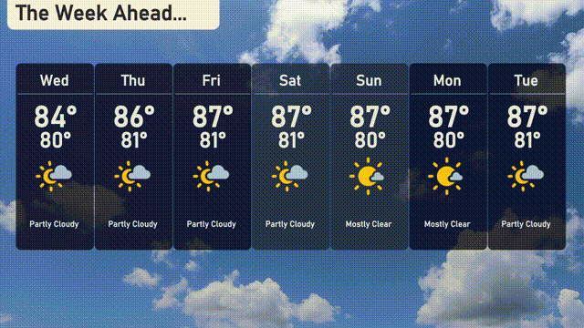
For the 7-day forecast in Miami:
Wednesday: Partly cloudy with a high of 84 degrees and a low of 80 degrees.
Thursday: Expect partly cloudy skies again, warming slightly to a high of 86 degrees, with a low of 81 degrees.
Friday: Partly cloudy conditions continue, reaching 87 degrees for the high and cooling to 81 degrees at night.
Saturday: The partly cloudy trend persists with another high of 87 degrees and a low of 81.
Sunday: Skies clear up with mostly clear conditions and a high of 87 degrees, the low remains at 80 degrees.
Monday: Another mostly clear day, highs will again be around 87 degrees, dipping to 80 degrees overnight.
Tuesday: Finish the week with partly cloudy skies. Expect a high of 87 degrees and a low of 81 degrees.