Sunny Delights & Storm Alerts: Your Essential Southeast Weather Guide
By
Amy Freeze
Explore today's bright skies in Miami and the developing storm fronts across the Southeast. Learn what this means for your weekend plans!
Today in Miami, enjoy the sun! But don’t miss our storm tracking across the Southeast with potential impacts in your area. Full details on our blog!
This Saturday in Miami beams with mostly sunny skies, perfect for outdoor fun. However, our detailed weather update notes scattered showers moving northeast from Louisiana to Atlanta. Catch the full scoop on how these systems develop and what they mean for places like Tampa, Jacksonville, and beyond. Stay weather-wise with our full guide at https://amyfreeze.ai/
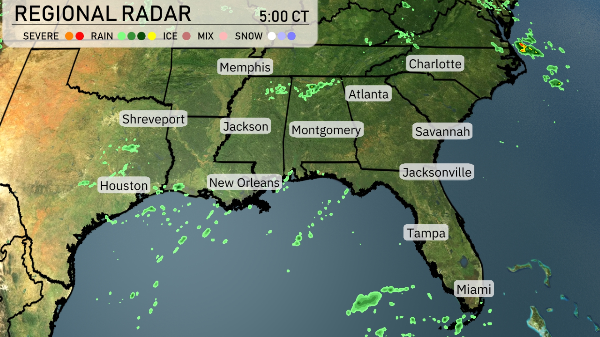
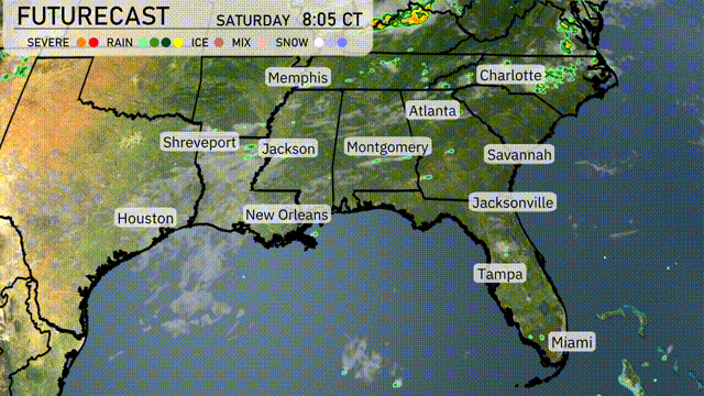
On the Regional Radar, we’re seeing scattered showers across eastern Louisiana and parts of Mississippi, particularly near Jackson. These showers are gradually moving northeast, poised to impact areas like Montgomery and Atlanta later in the day. A cluster of rain showers off the western coast of Florida is making its way toward Tampa. The rest of the Southeast, including areas like Shreveport and Jacksonville, remains relatively clear for now but with increasing cloud cover.
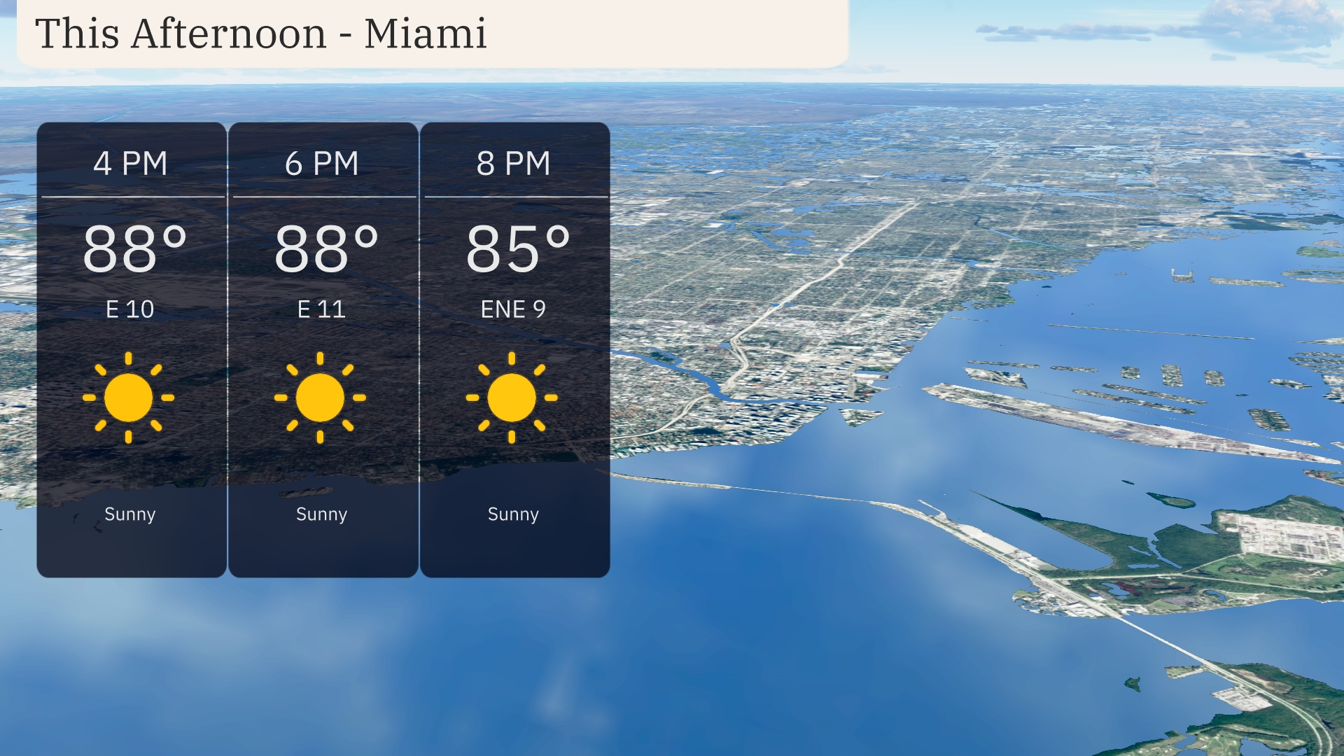
Sunny skies will dominate the Miami afternoon with temperatures holding steady at 88 degrees. An easterly breeze at 10 miles per hour adds a refreshing touch to the warm weather. By evening, temperatures will dip slightly to 85 degrees with winds coming from the east-northeast at 9 miles per hour.
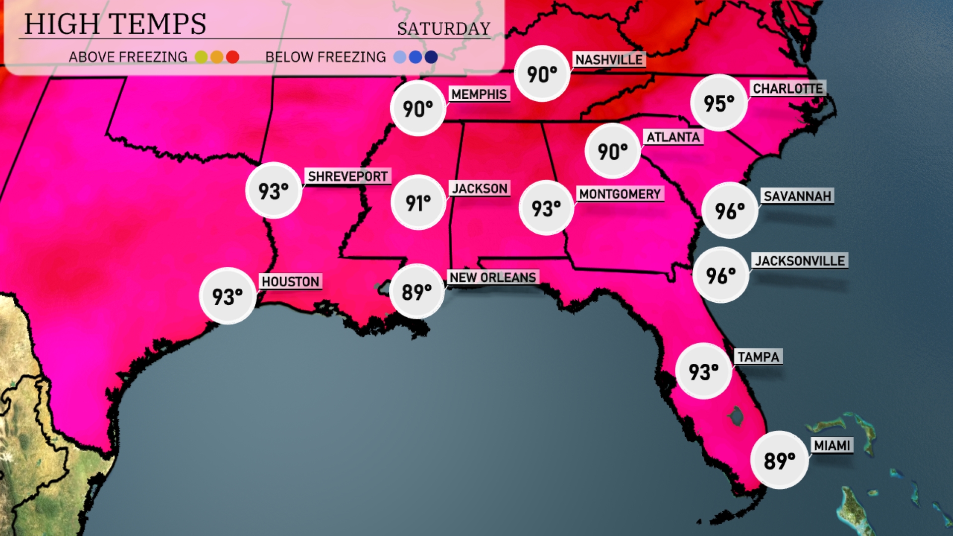
Check out the regional high temperatures across the Southeast today. In Atlanta, we’re expecting a high of 90 degrees, while Memphis will hit the same mark of 90. Further south, Savannah and Jacksonville are warming up to a steamy 96 degrees, making it feel quite tropical. New Orleans is slightly cooler with a high of 89 degrees, while Tampa will reach a warm 93.
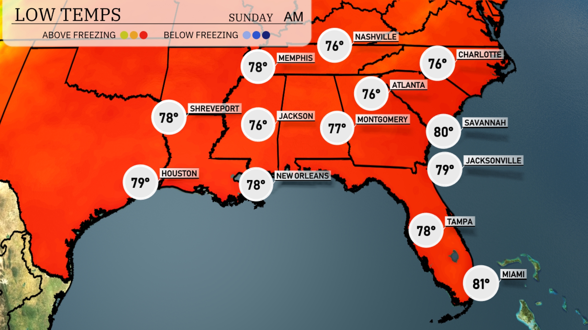
Tonight in the Southeast, temperatures will remain warm, with Memphis experiencing a low of 76 degrees. Jackson will settle at 76, while Montgomery is expected to drop slightly to 77. Atlanta will see a similar low at 76 degrees, and Savannah is looking at a balmy 80 degrees. Jacksonville will cool down to 79 degrees, making for a milder night across the region.
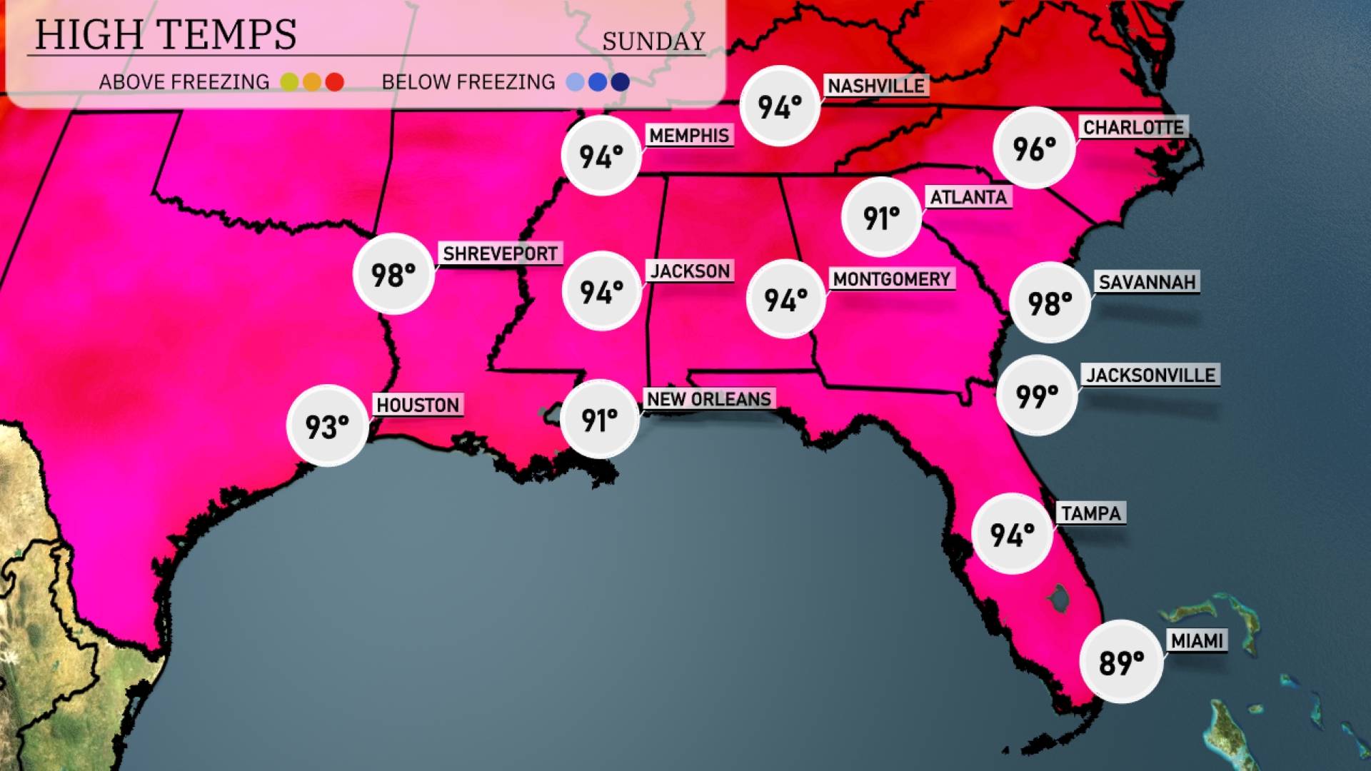
Tomorrow in Nashville, expect a high of 94 degrees, while Memphis also reaches 94. Atlanta will be slightly cooler at 91 degrees. Over in Florida, Jacksonville is poised for a sizzling 99 degrees, and Savannah isn’t far behind at 98. New Orleans will see highs around 91 degrees, reflecting above-average temperatures across the region due to high pressure dominating the Southeast.
The cold front pushing through the Southeast will trigger showers and thunderstorms, impacting areas from New Orleans to Atlanta through tomorrow. Heavy downpours are likely, and there’s potential for localized flooding, especially in low-lying areas. Expect a notable temperature drop post-front, with cooler air bringing relief from recent heat. Southeastern cities such as Montgomery and Jacksonville should prepare for a wet morning, with rain extending into the afternoon. Keep an eye on conditions, as the most intense weather may include strong winds and heavy rain as the front passes.
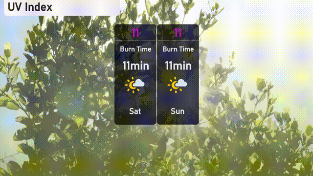
The UV index in Miami is expected to be very high at 11 for both Saturday and Sunday. This indicates a quick burn time of around 11 minutes, so it’s essential to apply sunscreen frequently and seek shade during peak hours.