Amy Freeze’s Evening Forecast: Serene Skies Over the Southeast
By
Amy Freeze
Meteorologist Amy Freeze brings you an exclusive Southeast weather forecast. Discover partly cloudy skies, gentle winds, and what to expect in the coming days across the region.
Catch Meteorologist Amy Freeze’s latest weather insights for the Southeast. Learn about tonight’s forecast for Atlanta and what’s brewing off the east coast!
Hello Southeastern residents and weather enthusiasts! Meteorologist Amy Freeze here with a detailed look at your weather. While Atlanta enjoys a serene evening, some neighbors might catch a shower. Also, look out for a high-pressure system bringing warmth and then a cold front with potential storms. Dive into the full 7-day forecast with me on the blog!
The Southeast is largely calm at present, with notable activity off the east coast where we see rain wrapping around. Savannah and Jacksonville are experiencing overcast skies, but the rain remains just offshore. Showers are making their way toward Miami, likely affecting outdoor plans later in the day. A band of rain is moving southeastward through the Gulf, nearing New Orleans and Houston, suggesting those areas could see precipitation shortly. The northern parts, including Memphis, remain dry and clear, providing a reprieve from any wet weather.
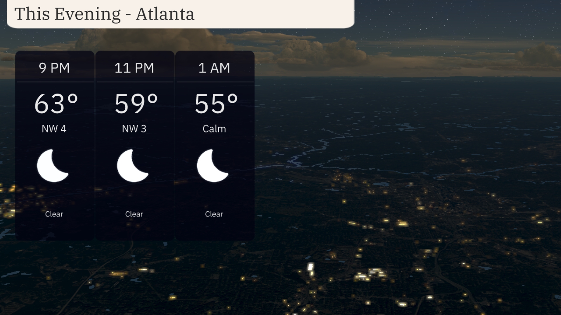
This evening in Atlanta, anticipate clear skies with temperatures beginning at 63 degrees at 9 p.m., cooling to 59 degrees by 11 p.m., and reaching 55 degrees by 1 a.m. Winds will be gentle from the northwest at 4 to 3 miles per hour, easing to calm conditions later on.
Tonight, Memphis will dip down to 56 degrees, while Nashville can expect a low of 58. Montgomery will be around 61 degrees, and Jackson will hit 63. Down in Florida, Tampa will stay milder with a low of 72, while Miami remains warm at 76. Some areas will feel a noticeable drop compared to recent nights, especially in the Tennessee River Valley.
Tomorrow, the Southeast sees a widespread warm-up with notable highs. Atlanta will reach 79 degrees, while Birmingham and Montgomery will see even warmer temperatures, hitting 82 and 84 degrees, respectively. Jacksonville is set to soar to a sizzling 90 degrees, significantly above the seasonal average. Coastal cities like New Orleans will enjoy a pleasant 79 degrees, and Miami is expected to hit 84. This warm spell is influenced by a high-pressure system moving through the region, providing clear skies and plenty of sunshine.
A cold front is projected to push through the Southeast from Mississippi to Georgia early Tuesday, bringing a line of thunderstorms. Expect heavy rain and gusty winds, especially from Jackson to Atlanta, with possible localized flooding due to downpours. By mid-morning, storms will stretch from New Orleans to Montgomery, impacting the morning commute. As the front moves east, precipitation will clear up by late evening, leaving cooler and drier weather in its wake. Temperatures will drop slightly behind the front, providing a refreshing break from the recent warm spell.
The UV index in Atlanta will be very high at 9 on both Monday and Tuesday, with a burn time of just 15 minutes under direct sunlight.
For the 7-day forecast in Atlanta:
Monday: Enjoy mostly clear skies with a high of 72 degrees and a low of 48.
Tuesday: Warmer and mostly cloudy, reaching up to 80 degrees during the day, cooling to 58 at night.
Wednesday: Showers late in the day, with temperatures climbing to 73 degrees and dipping to 59 overnight.
Thursday: More showers anticipated late, with a daytime high of 80 degrees and a low around 61.
Friday: Showers continue, peaking at 73 degrees and a nighttime low of 58.
Saturday: Partly cloudy skies with the temperature rising to 68 degrees, a cool 55 overnight.
Sunday: Wrap up the week with partly cloudy conditions, a high of 70 degrees, and a low of 56.