Southern Plains Sizzle: Austin’s Evening Forecast and Beyond
By
Amy Freeze
Explore Austin’s evening weather with a comprehensive forecast for the Southern Plains region, including storm alerts and temperature trends.
Expect a warm evening in Austin with temperatures starting at 86°F, cooling slightly throughout the night. Tune in to our detailed forecast for the Southern Plains as some areas brace for storms while others enjoy clear skies.
This detailed blog post covers the dynamic weather conditions across the Southern Plains, with a spotlight on Austin’s evening. It delves into regional temperature variations, storm forecasts, and the upcoming weather trends. Whether you’re in Austin or anywhere in the Southern Plains, find out what to expect from the weather this week, including potential impacts on your plans.
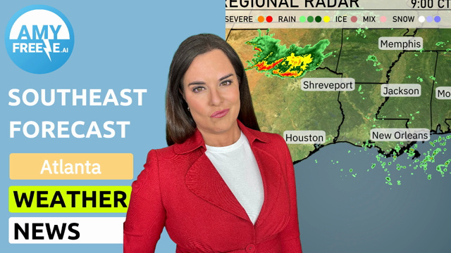
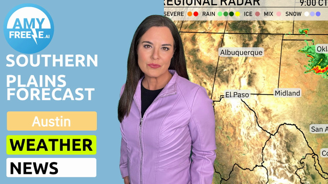
The Southern Plains region is witnessing some lively weather, with a line of storms making its way across Kansas City, heading towards Little Rock. Oklahoma City is seeing rain showers with the potential for stronger storms later. Scattered showers are also developing near San Antonio, providing a bit of precipitation for the area. Clear skies prevail over El Paso and Albuquerque, maintaining dry conditions for the southwest part of the region.
This evening in Austin, temperatures will be warm, starting at 86 degrees at 9 PM and cooling slightly to 81 degrees by 1 AM. Expect mostly sunny skies initially, transitioning to clear skies later in the night. Winds will be gentle from the south-southeast at about 6 mph. Enjoy a calm and pleasant evening in the Texan capital.
Tonight, temperatures will cool down significantly across the Southern Plains. Expect lows of 71 degrees in Oklahoma City and Dallas, while Midland will dip to 73. Albuquerque will cool off to 67 degrees. San Antonio will see a mild low of 74 degrees, whereas El Paso remains warmer at 78.
By tomorrow afternoon, El Paso will see a scorching high of 107 degrees, while Midland will also be quite warm at 100 degrees. San Antonio is expected to reach 93, and Corpus Christi will have a high of 92. Dallas tops out at 90 degrees, with Oklahoma City closely following at 89. In contrast, temperatures in Little Rock will be more moderate at 87 degrees, and Jackson will hit 86.
A cold front is advancing through the Southern Plains, bringing scattered showers from Midland to San Antonio and stretching to Corpus Christi. Oklahoma City and Dallas should remain vigilant for stronger storms due to unstable air masses, which heighten severe weather risks into the evening. Little Rock to New Orleans will experience increasing rain chances through Saturday, possibly impacting outdoor plans. Temperatures will fluctuate as clouds and rainfall provide brief relief from the summer heat. As the front moves eastward, anticipate clearer skies and slightly cooler conditions by late Sunday.
In Austin, the UV index will soar to 10 on Saturday, posing a high risk of sun exposure with a burn time of just 12 minutes. On Sunday, it climbs further to 11, reducing the burn time to 11 minutes.
For the 7-day forecast in Austin:
Saturday: Mostly cloudy with a high of 93 degrees and a low of 75 degrees.
Sunday: Expect continued mostly cloudy skies with a high of 92 degrees and a low of 72 degrees.
Monday: Look for mostly clear skies as temperatures reach 92 degrees during the day, falling to 74 degrees overnight.
Tuesday: Mostly clear again with a high of 94 degrees and a nighttime low of 75 degrees.
Wednesday: Another mostly clear day with highs around 94 degrees and lows near 75 degrees.
Thursday: Partly cloudy skies with a high of 94 degrees and a low of 73 degrees.
Friday: Partly cloudy conditions continue, with temperatures peaking at 91 degrees and slipping to 74 degrees at night.