Navigating Through Nature’s Whims: A Meteorologist’s Guide to Southern Plains Weather
By
Amy Freeze
Explore a detailed analysis of the current weather patterns across the Southern Plains, brought to you by seasoned meteorologist Amy Freeze. Discover what makes this region’s climate tick, from sudden thunderstorms to serene sunny days.
Meteorologist Amy Freeze brings you today’s weather outlook for the Southern Plains, highlighting storm movements, temperature variations, and safety tips. Stay prepared with our timely insights!
As the clouds gather and the wind picks up pace, the Southern Plains is witnessing an array of weather patterns that demands attention. Meteorologist Amy Freeze walks you through each development, from the shifting breezes in Austin to the upcoming storms in Little Rock. Understanding these dynamic changes is crucial for planning and safety—especially with the UV index hitting notable highs. Join Amy as she provides a 7-day forecast and tips for staying safe during varying weather conditions.
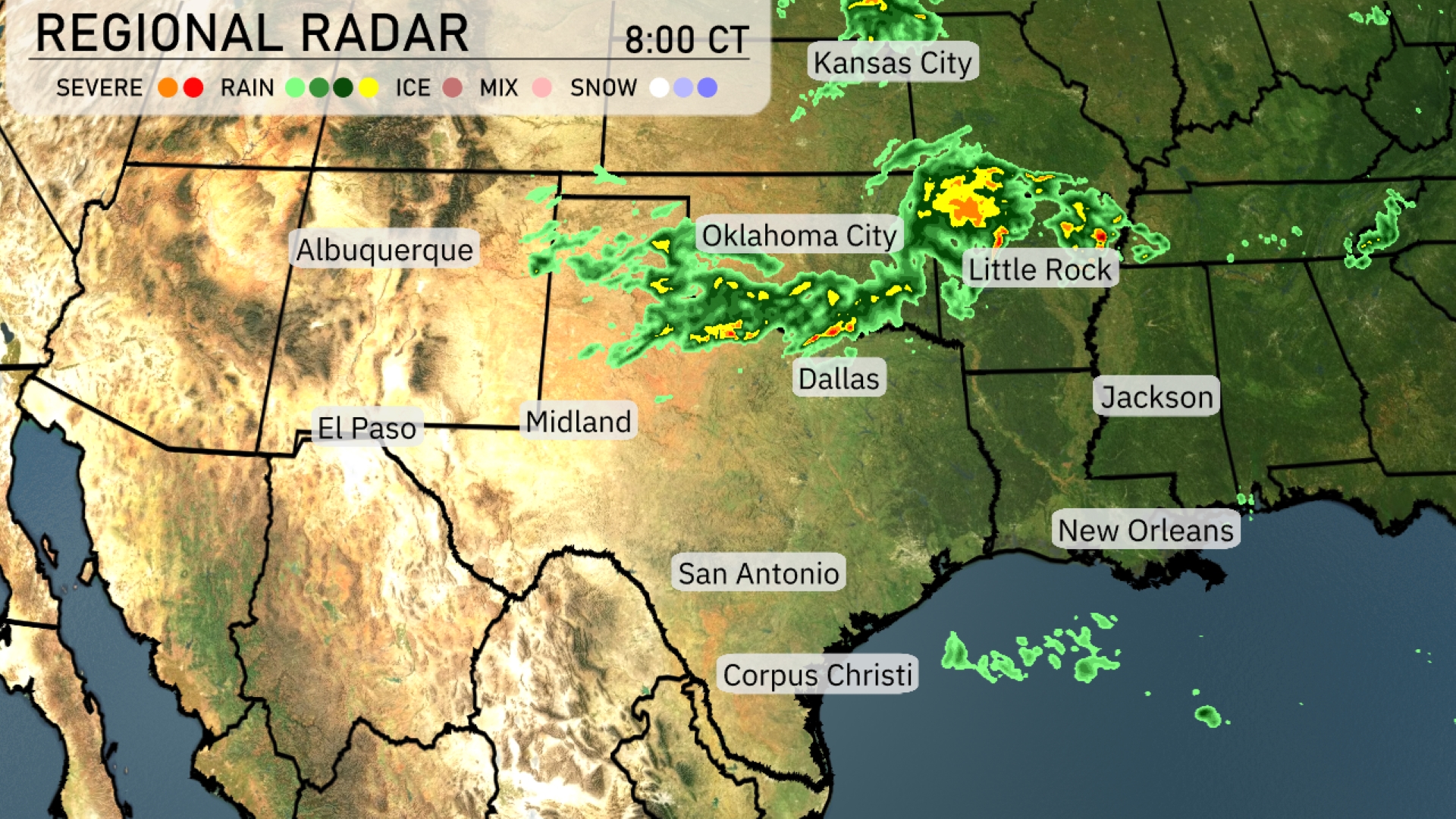
On the Regional Radar, a line of storms is moving eastward across the Southern Plains, stretching from Oklahoma City towards Little Rock. Heavy rain showers are concentrated around Oklahoma City, continuing to track towards the east and impacting areas near Little Rock. Dallas is seeing pockets of rain, while areas to the south, including San Antonio and Corpus Christi, remain clear. In Kansas City, clouds are thickening, suggesting that rain might move in later. New Orleans and Jackson are experiencing mostly clear skies with patchy clouds on the horizon.
Afternoon temperatures in Austin are starting at 80 degrees with an east-southeast breeze at 6 miles per hour. Expect strong storms around 4 PM, transitioning to 76 degrees with north-northeast winds at 7 miles per hour by 6 PM. Thunderstorms look to continue into the evening as temperatures dip to 70 degrees with north-northeast winds increasing to 8 miles per hour.
Today is shaping up to be warm across the Southern Plains. Dallas will see a high of 72 degrees, while farther south in San Antonio, temperatures will reach 84. Over in El Paso, expect a milder day with a high of 82 degrees. The high in Jackson is notably warm for the region at 85, contrasting with Midland, where it’s cooler at 69 degrees. Corpus Christi is matching that warmth with a high of 85 as well.
Tonight in the Southern Plains, temperatures are dipping significantly as a cold air mass settles in. Oklahoma City will reach a low of just 44 degrees, while Little Rock cools down to 49. Dallas is expecting a low of 52 degrees, and further south, San Antonio will see a milder night at 58. Expect cooler conditions across the region, with Midland at 56 degrees and El Paso at 58.
High temperatures in the Southern Plains for tomorrow are looking pleasantly warm and slightly above average. El Paso will see a high of 80 degrees, while Midland is expected to reach 79 degrees. San Antonio and Corpus Christi are both forecasted to hit 82 degrees. Dallas will be cooler at 76, and Little Rock is expected to reach 74 degrees.
The Southern Plains will experience an active weather scenario tomorrow. Expect scattered storms from Dallas to San Antonio, with the potential for severe thunderstorms as a front moves through. Oklahoma City and Little Rock could see stronger storm systems, particularly in the late afternoon and evening. Rain bands stretching from Corpus Christi to Jackson will bring heavy rainfall and a risk of localized flooding.
The UV index in Austin on Friday will be 6 with a burn time of about 23 minutes in direct sunlight, so ensure you protect yourself. By Saturday, the UV index climbs to a very high level of 10, significantly reducing burn time to just 12 minutes.