Navigating Through Nature’s Mood Swings in the Southern Plains
By
Amy Freeze
Detailed weather forecasts for Austin and its surrounding regions, complete with expert insights from meteorologist Amy Freeze.
Master the art of weather preparedness with Amy Freeze’s latest forecast for Austin and the Southern Plains. From thunderstorms to sunny days, get all the updates you need!
Welcome to your comprehensive guide to the Southern Plains weather, presented by meteorologist Amy Freeze. This week, Austin enjoys mostly clear mornings with a high UV index, while areas like New Orleans and Jackson prepare for heavy showers. Detailed forecasts for the week ahead include temperature fluctuations, the potential for localized flooding in North Texas, and safety tips for outdoor activities. Keep tabs on the weather and stay prepared with expert tips from Amy.
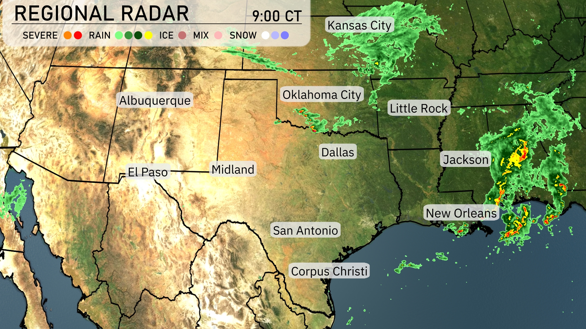
The Southern Plains are experiencing a mix of conditions today. Rain is primarily affecting the southeastern part of the region, with heavy showers moving across New Orleans and into Jackson. These storms are expanding toward the Gulf Coast and are expected to bring significant rainfall and potential thunderstorms. Clear skies dominate the western areas, including El Paso, Midland, and parts of New Mexico, offering a break from active weather. Light precipitation is seen around Oklahoma City with clouds likely expanding further eastward.
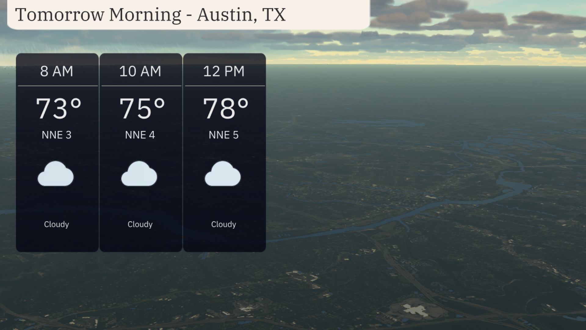
Cloudy skies dominate the morning in Austin, with temperatures beginning at 73 degrees at 8 AM, rising slightly to 75 degrees by 10 AM, and reaching 78 degrees by noon. Gentle north-northeast winds persist, maintaining a light breeze around 3 to 5 miles per hour throughout the morning.
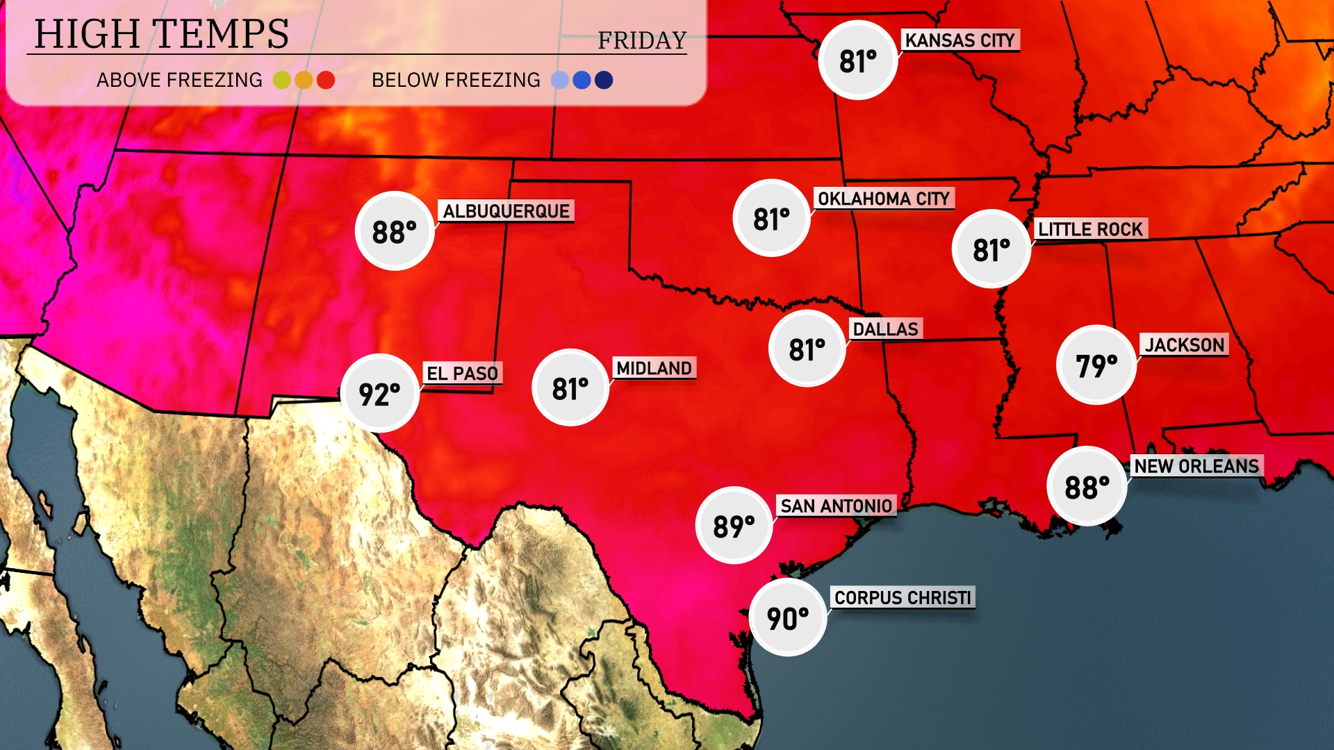
Tomorrow El Paso is expected to soar to 92 degrees, while Midland will reach 81. San Antonio will see a high of 89 degrees, and Corpus Christi is likely to hit 90. Dallas and Oklahoma City will both enjoy highs around 81 degrees. Jackson’s afternoon temperature is anticipated to be a comfortable 79 degrees.
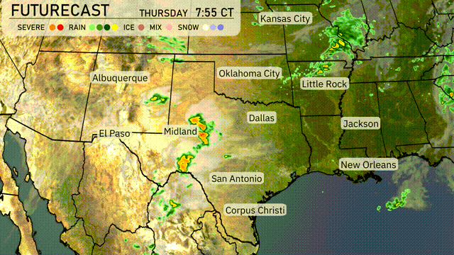
Expect a dynamic day across the Southern Plains with thunderstorms developing from Midland to Oklahoma City. Heavier rain is anticipated, particularly in North Texas, potentially bringing localized flooding concerns. The instability will peak with the approach of a cold front, heightening the risk for severe weather, especially damaging winds and large hail. Dallas and San Antonio will benefit from rain, bringing much-needed relief to recent dry conditions. Monitor for rapid weather changes and follow the latest updates for your travel plans and outdoor activities.
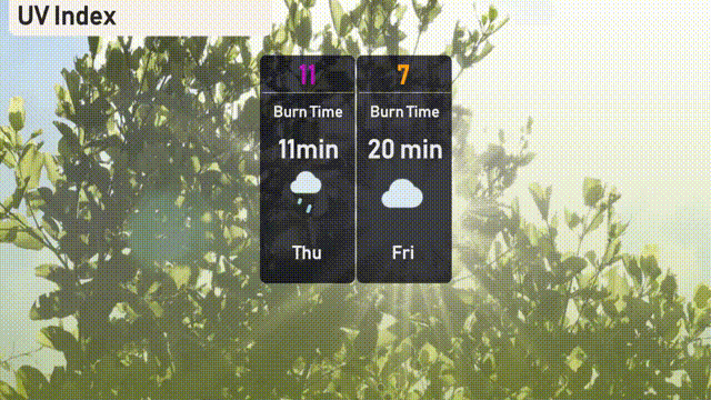
Be ready in Austin for a high UV index of 7 on Friday, with a burn time of about 20 minutes in direct sunlight. It’s important to apply sunscreen and wear protective clothing if you’re out and about. For Thursday, the UV index spikes to an extreme level of 11, bringing a burn time of just 11 minutes.
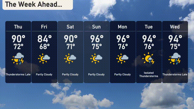
For the 7-day forecast in Austin:
Thursday: Thunderstorms expected later with a high of 90 degrees and a low of 72.
Friday: Partly cloudy with temperatures reaching a high of 84 degrees and a low of 68.
Saturday: A mix of sun and clouds with a high of 90 degrees and 71 for the low.
Sunday: Expect partly cloudy skies with highs around 96 degrees and lows of 75.
Monday: Mostly sunny and warm with a high of 96 degrees and a low of 76.
Tuesday: Isolated thunderstorms are possible, with a daytime high of 94 degrees and a nighttime low of 76.
Wednesday: Thunderstorms later in the day with a high reaching 94 degrees and a low of 75.