Southwest Weather Forecast: A Blend of Sunshine and Chills
By
Amy Freeze
Meteorologist Amy Freeze covers the diverse weather conditions across the Southwest, from sunny highs in Phoenix to snowy scenes in Ely. Discover what's shaping the weather in your area this week.
Experience a detailed roundup of the Southwest’s weather with Meteorologist Amy Freeze. From clear skies in Salt Lake City to a mixed bag near Cedar City and snow in Ely, understand your local forecast.
The Southwest is witnessing a varied climate pattern this week, as outlined by meteorologist Amy Freeze. While Salt Lake City enjoys clear skies and cooler nights, nearby Cedar City deals with mixed precipitation, including snow as it extends into Flagstaff. In California and Nevada, conditions lean drier, setting a calm tone. Meanwhile, temperatures begin to climb significantly in regions like Phoenix and Las Vegas. This comprehensive blog explores weather forecasts, preparing residents for varied climatic conditions.
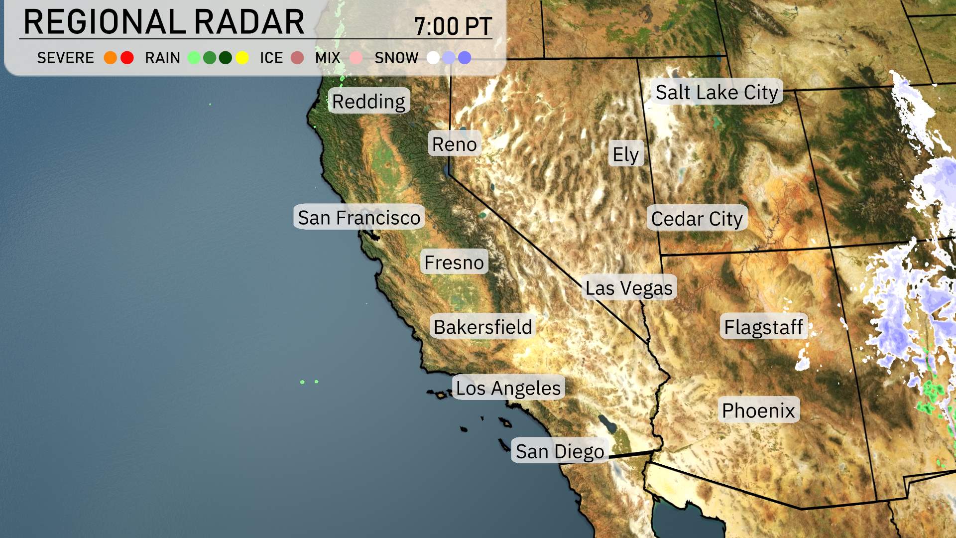
In the Southwest region, the radar indicates a range of weather conditions. A band of mixed precipitation is currently extending across the eastern areas, affecting regions near Cedar City and stretching into Flagstaff. Snow is predominately falling in the higher elevations, particularly near Ely, where winter weather is taking hold.
Further west, the skies are clearing as you move toward the coastal regions. San Francisco, Los Angeles, and San Diego are experiencing dry conditions, offering a reprieve from the rain. The Central Valley, including cities like Fresno and Bakersfield, is cloud-free, indicating a calm night ahead.
Reno and Redding remain relatively dry, consistent with the overall picture for Northern California.
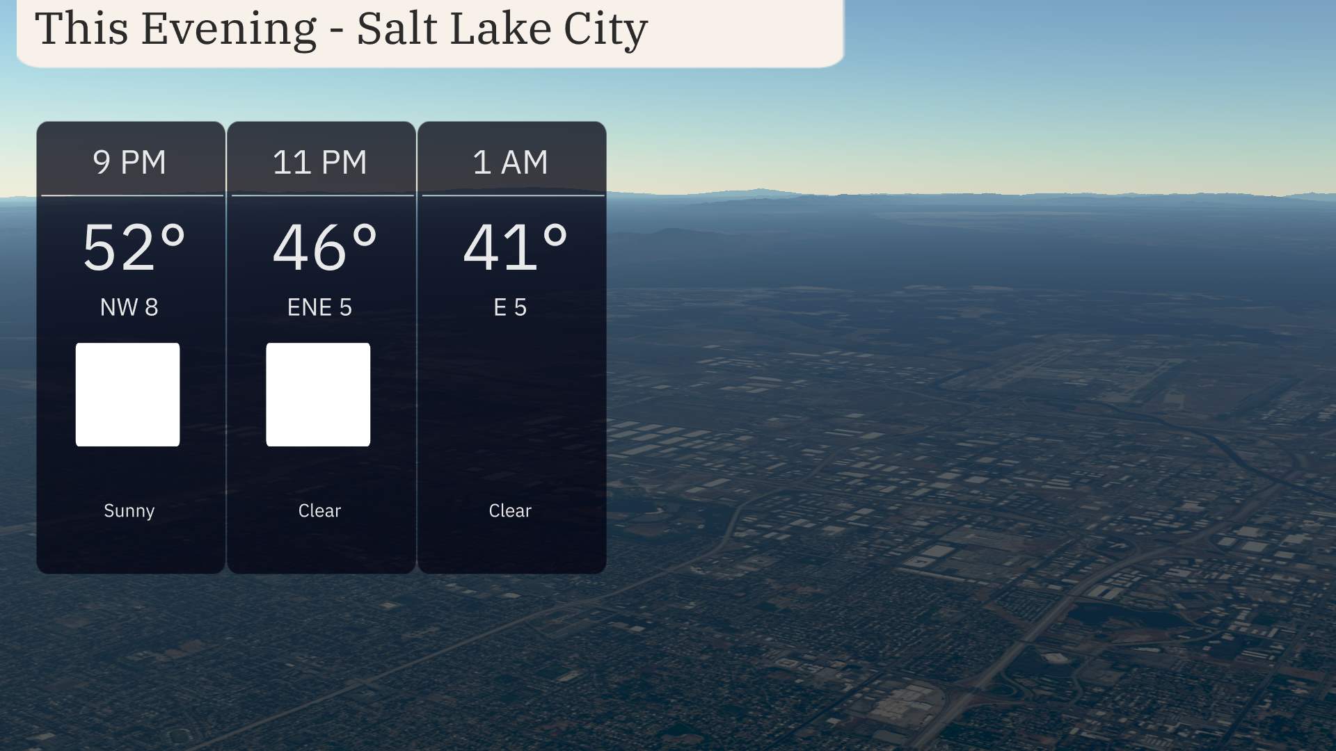
For this evening in Salt Lake City, expect clear and calm conditions. Temperatures will decrease from 52 degrees at 9 PM to 41 degrees by 1 AM. Winds will shift from northwest at 8 miles per hour at 9 PM to east at 5 miles per hour by midnight. Keep in mind the chill in the air if you plan to be outside. High pressure is setting the scene for a stable sky overhead.
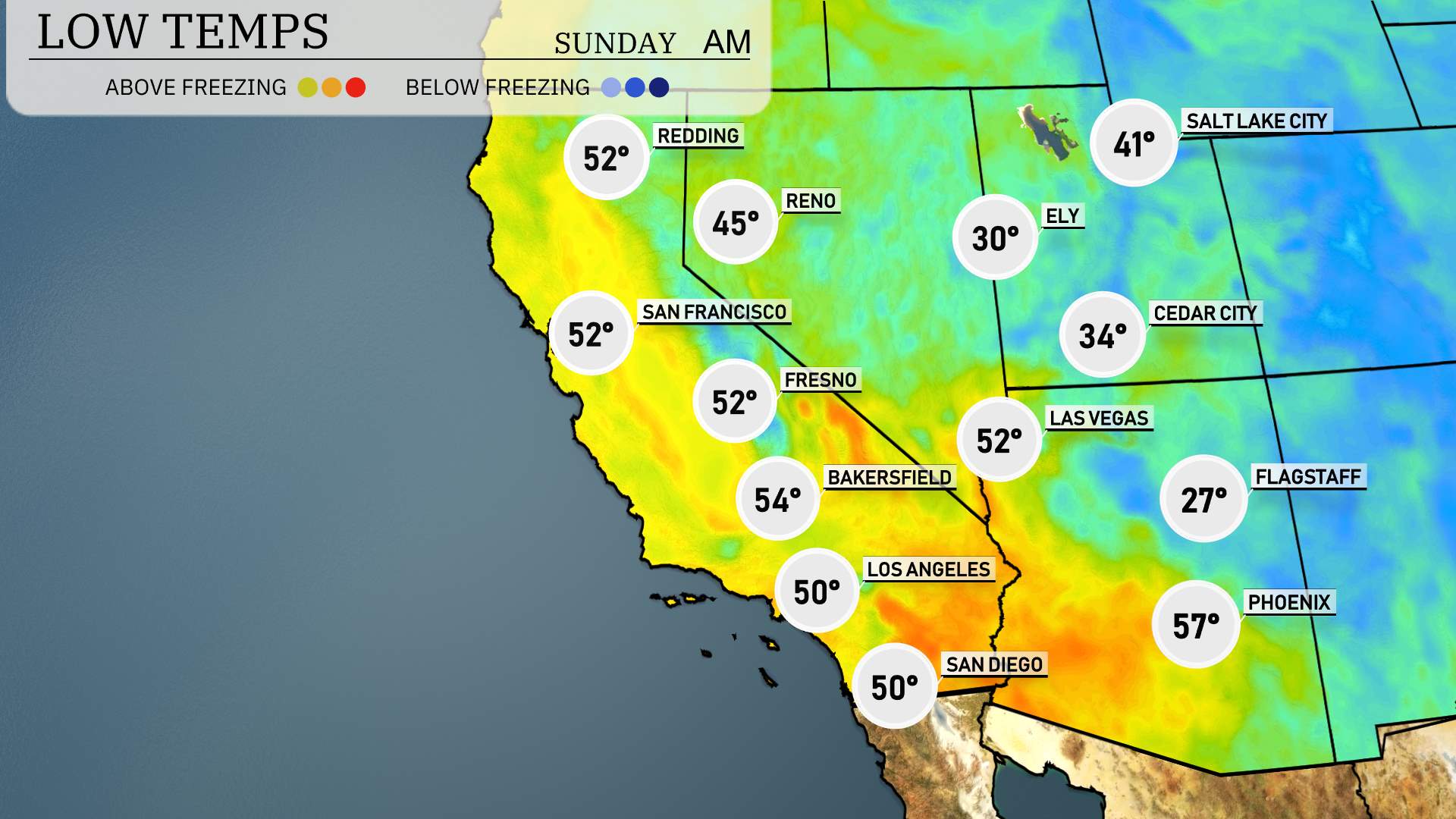
In Ely, expect a chilling low of 30 degrees, while Flagstaff will drop to a brisk 27 degrees. Las Vegas is looking at a low of 52, and Cedar City is projected to cool down to 34. In the California desert, Palm Springs will see 57 degrees, but farther south, San Diego will also rest at 50. It’s a notably chillier night ahead across the region.
High temperatures tomorrow across the Southwest are expected to be above average, thanks to a warm air mass settling in.
In California, Los Angeles will reach a pleasant 77 degrees. Further inland, Bakersfield is anticipating a warm high of 82 degrees, while Fresno isn’t far behind, expected to hit 81 degrees.
Moving to Nevada, Las Vegas will see a high of 79 degrees, while Ely is due for a cooler 63 degrees.
In Arizona, Phoenix will warm up nicely to 82 degrees, whereas Flagstaff is on the cooler side with a high of only 57 degrees.
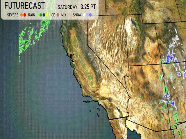
In the regional forecast for the Southwest, expect a mix of sun and clouds as a lingering system brings spotty rain to parts of Northern California tomorrow. Showers will be more concentrated in the San Francisco Bay area and the Sacramento Valley, which could lead to waterlogged streets during heavier downpours. Farther south, it’s a drier and warmer scenario across Southern California and the desert regions, with temperatures climbing into the mid-70s. High pressure dominates, ensuring calmer weather for Las Vegas and Phoenix. Meanwhile, gusty winds could enhance fire danger in parts of northeast Arizona. Keep a watchful eye for any weather advisories, especially closer to the coast, where conditions can change swiftly.
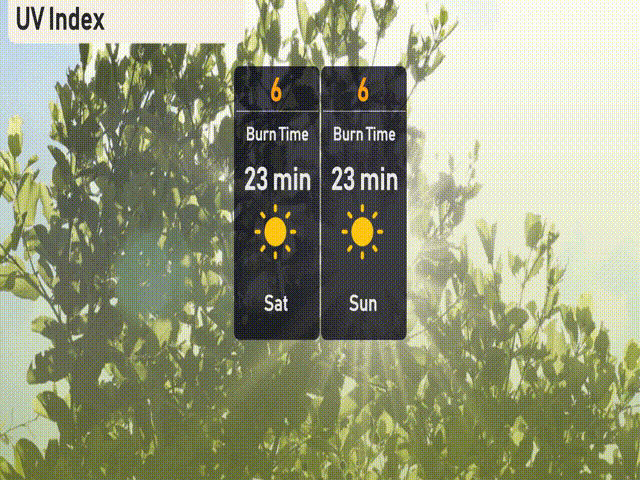
The UV index in Salt Lake City is expected to be moderately high this Saturday and Sunday, with a level of 6. This means you could experience a burn time of around 23 minutes in direct sunlight. B
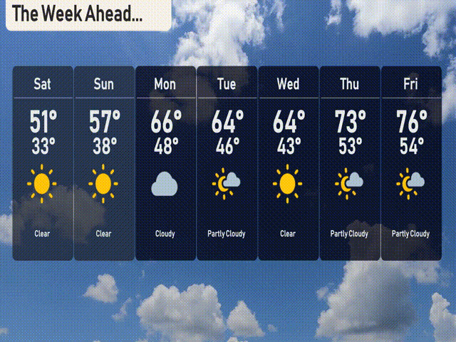
Saturday: Clear skies with a high of 51 degrees and a low of 33 degrees.
Sunday: Enjoy more clear conditions with temperatures reaching 57 degrees during the day and dropping to 38 at night.
Monday: Cloudy weather takes over with a high of 66 degrees and a low of 48.
Tuesday: The sky turns partly cloudy as temperatures hit 64 degrees, cooling to 46 overnight.
Wednesday: Expect clear skies and a high of 64 degrees, with the low falling to 43 degrees.
Thursday: Partly cloudy conditions bring warmth, with temperatures rising to 73 degrees and a low of 53.
Friday: More partly cloudy skies to end the week, with the high reaching 76 degrees and the low at 54.