Decoding Southwest Weather: An Expert Guide with Amy Freeze
By
Amy Freeze
Dive deep into the diverse and dynamic climate of the Southwest with Amy Freeze as your guide. Explore our comprehensive weather breakdown, covering everything from desert heat to serene cloud-covered peaks.
Explore our detailed blog post on the intricate weather patterns across the Southwest, spearheaded by renowned meteorologist Amy Freeze! From city-specific temperature guides to direction-specific weather alerts, get prepped for any climatic surprise!
In this comprehensive guide by Amy Freeze, learn about the changing weather dynamics across the Southwest. This insightful resource covers specific forecasts for cities like Phoenix, Los Angeles, and Las Vegas and discusses broader regional changes. Expect tips on enjoying the public landscapes safely and predicting weather events that could influence your week ahead. Packed with visual aids and proactive suggestions to adapt to the climatic diversity, this guide ensures you’re never caught off guard.
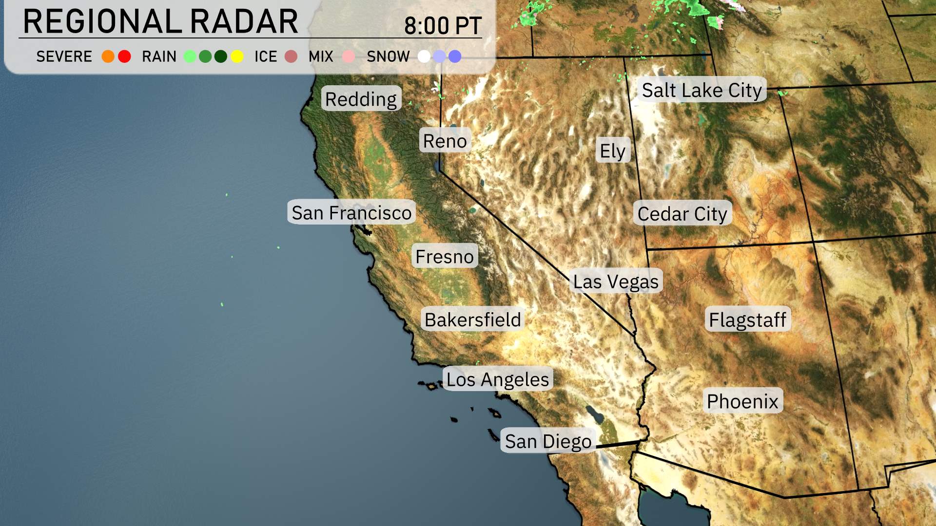
Across the Southwest region, the radar reveals quite a mix of weather conditions. Northern California, especially around Redding, is experiencing some rain, bringing a refreshing change to the normally dry climate. Farther south, from San Francisco moving towards Fresno, expect predominantly cloudy skies with sporadic showers.
In Nevada, Reno remains mostly dry, but watch for some cloud cover rolling in throughout the day. Heading into southern Utah, Cedar City could see some unsettled skies with clouds, although no rain or snow is presently in the forecast there.
Arizona’s higher elevations, particularly around Flagstaff, are facing some potential light snow showers as cooler air dominates the region. Phoenix remains dry and warm, providing a nice break for outdoor activities.
The southern expanse from Los Angeles down to San Diego is experiencing mild conditions with only a few passing clouds. Along the coast, the weather remains calm.
This evening in Phoenix, expect mostly cloudy skies transitioning to partly cloudy conditions. Temperatures will start at 97 degrees around 9 PM, cooling to 91 degrees by 11 PM, and further to 86 degrees by 1 AM. Winds will be coming from the west-southwest at 12 miles per hour initially, calming to 9 miles per hour and shifting to the southwest at 6 miles per hour later tonight.
Ely will be quite cold with a low of just 23 degrees. Cedar City, Utah, isn’t far behind at 34 degrees. Flagstaff is expected to cool down to 35 degrees. In Las Vegas, you’ll see a minima of 61 degrees, which is milder compared to some other locations. Meanwhile, Los Angeles will experience a low of 49 degrees, while further north, San Francisco hits 49 degrees as well. Others, like Bakersfield, will see a low of 56 degrees.
Tomorrow in the Southwest, we’re looking at a warm day ahead with high temperatures significantly above average in many areas.
In California, Bakersfield is set to lead the pack with a high of 89 degrees, while Fresno and Los Angeles will both enjoy highs of 83 and 70 degrees respectively. Over in San Diego, expect a comfortable 68 degrees.
Moving eastward, Las Vegas is heating up to 89 degrees, marking a notable surge in temperatures. In the higher elevations, Flagstaff will see a mild 70 degrees.
In Nevada, Ely is forecasted to reach 62 degrees, which is cooler compared to its neighbors. Cedar City in Utah will see a high of 67 degrees.
Expect a dynamic weather day across the Southwest with a changing pattern through the weekend. A high-pressure system will maintain clear skies and dry conditions for much of Arizona and New Mexico. Meanwhile, an incoming low-pressure system from the Pacific will bring rain to Southern California, especially impacting coastal areas and the San Bernardino Valley with potential heavy downpours. Look for thunderstorms to develop in parts of Nevada and into western Arizona by Saturday evening. The storm potential comes with the chance for gusty winds and localized flooding. Be prepared for cooler temperatures as the frontal system moves in, dropping highs by about ten degrees into the low 70s. Stay alert for any weather advisories over the next 48 hours.
The UV index in Phoenix will be very high at 8 on Saturday, indicating a burn time of just 17 minutes in direct sunlight. By Sunday, although the UV index decreases to 6, it’s still important to be cautious with a burn time of 23 minutes.
For the Phoenix 7 Day Outlook,
Saturday: Expect partly cloudy skies with highs reaching 101 degrees and lows at 68 degrees.
Sunday: A bit cooler and cloudy, with a high of 93 degrees and a low of 68 degrees.
Monday: Partly cloudy with a high of 94 degrees and a low of 72 degrees.
Tuesday: Enjoy clear skies, as temperatures reach 92 degrees during the day, cooling to 66 degrees at night.
Wednesday: Clear conditions continue, with a daytime high of 95 degrees and a nighttime low of 65 degrees.
Thursday: Another clear day, with temperatures peaking at 84 degrees and dropping to 61 degrees overnight.
Friday: Showers are expected late with a high of 78 degrees and a low of 58 degrees.
Enjoy the week ahead, and stay cool!