Sunny Starts and Sizzling Afternoons: Your Comprehensive Southwest Weather Guide
By
Amy Freeze
Unpack everything from Salt Lake City’s pleasant mornings to the heatwaves hitting Las Vegas and Phoenix. Perfect for planning your week!
Explore a detailed forecast for Salt Lake City and the Southwest – From cool mornings to the afternoon highs, be ready for what the weather has in store!
This week in Salt Lake City starts with clear skies and perfect temperatures. As the day progresses, get ready for rising temperatures across the Southwest, with Las Vegas and Phoenix experiencing peak heats. Stay updated with the special focus on UV safety due to high UV index levels and precautions against potential quick sunburns. Don’t miss out on our extended regional forecast, including details on storm potentials and practical safety tips. All the insights you need are right here!
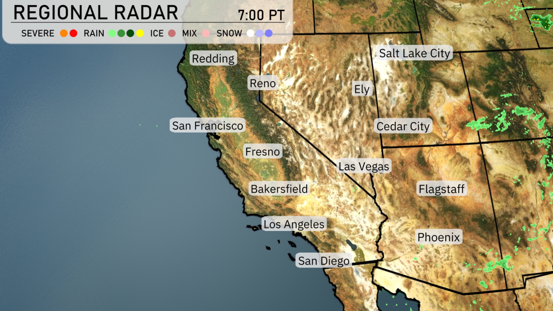
On the Regional Radar for the Southwest, the weather conditions are varied. Light showers are approaching Flagstaff and Cedar City, indicating a chance of rain for these areas. Ely experiences cloud cover, while Las Vegas remains clear. Reno through Redding shows sunny skies, offering pleasant weather without any significant disruptions.
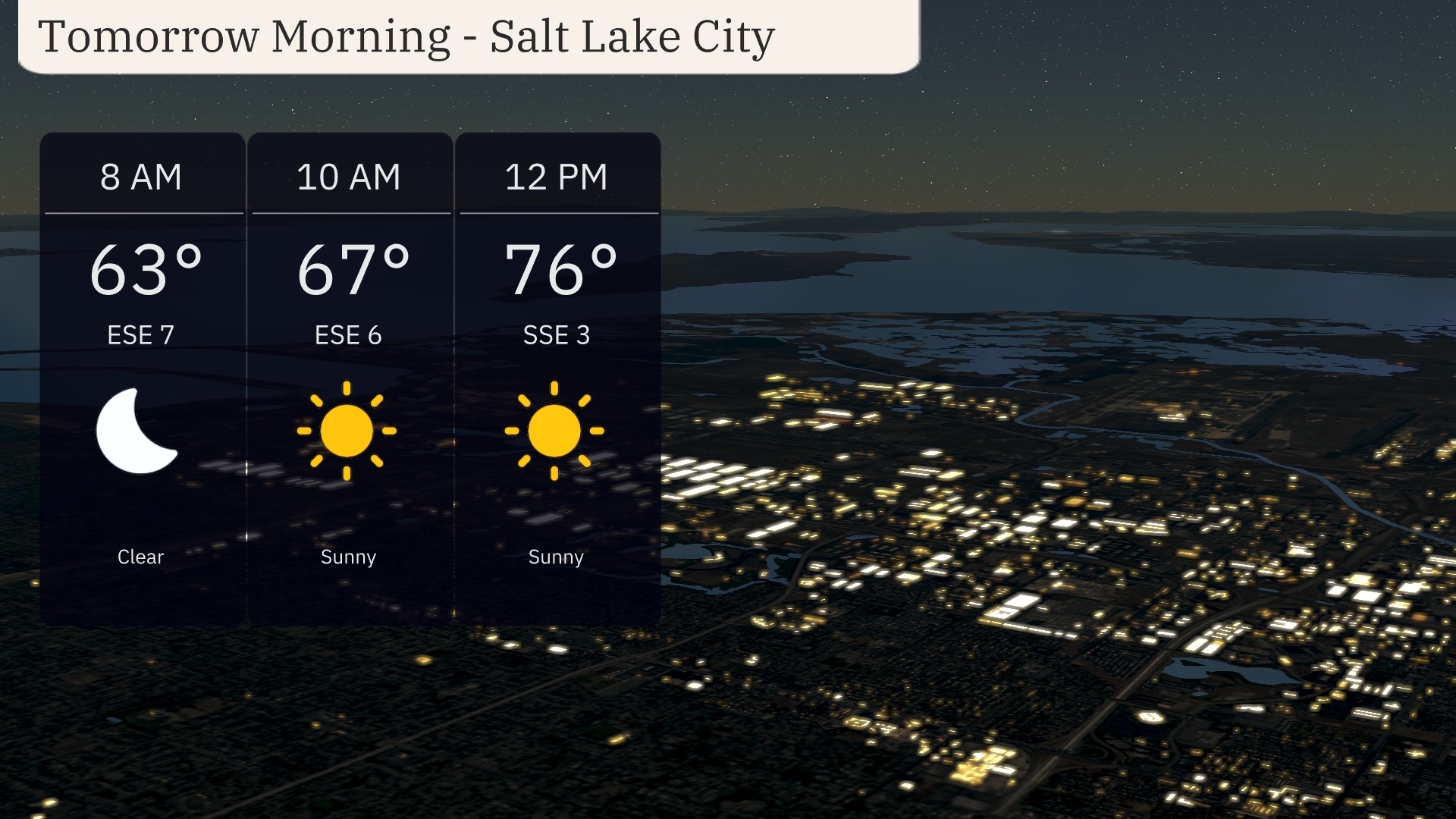
Tomorrow morning in Salt Lake City begins with clear skies and a temperature of 63 degrees at 8 AM. As the morning progresses, expect the sunshine to stay with us, bringing temperatures up to 67 degrees by 10 AM and reaching 76 degrees by noon. Winds are light throughout the morning, starting from the east-southeast at 7 miles per hour at 8 AM, easing up slightly to 6 miles per hour by 10 AM, and shifting south-southeast at 3 miles per hour by noon.
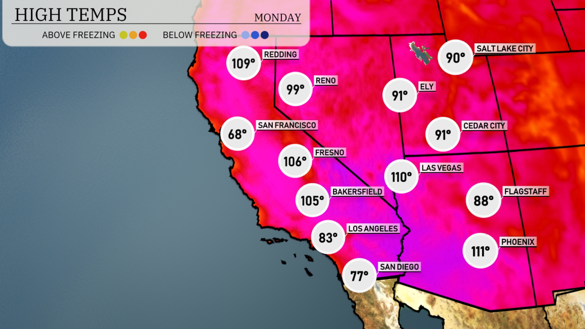
Tomorrow in the Southwest, temperatures soar as Phoenix reaches a scorching 111 degrees. Las Vegas isn’t far behind with a high of 110 degrees, marking a notably warmer trend for this time of year. Bakersfield will see temperatures peaking at 105, while Fresno ticks up to 106 degrees. San Diego enjoys a milder day at 77 degrees.
A strong low-pressure system will sweep through the Southwest tomorrow, bringing a mix of sunshine and intermittent cloud cover. Expect scattered showers and thunderstorms, particularly in eastern Arizona and New Mexico, with a high chance of localized flooding in areas with heaviest rainfall. Temperatures will hover in the mid-80s, slightly cooler than usual, providing a brief respite from the summer heat. Gusty winds may accompany these storms, so exercise caution if traveling or carrying out outdoor activities. F
The UV index in Salt Lake City reaches a very high level of 9 today, with potential sunburn occurring in as little as 15 minutes if you’re out enjoying the sunshine. Tomorrow, the index remains at 9, continuing the risk for quick burns, so taking similar precautions is crucial!
For the 7-day outlook in Salt Lake City:
Sunday: Clear skies with a high of 86 degrees and a low of 62 degrees.
Monday: Partly cloudy with a warm-up to 90 degrees and a nighttime low of 65 degrees.
Tuesday: Sunny and hot, reaching a high of 95 degrees with a low near 70 degrees overnight.
Wednesday: Partly cloudy with temperatures peaking at 98 degrees and dipping to 72 degrees.
Thursday: Slightly cooler with partly cloudy skies, a high of 94 degrees and a low of 69 degrees.
Friday: Partly cloudy, expect a high of 91 degrees and a low around 68 degrees.
Saturday: Mostly clear conditions with a high of 90 degrees and a low of 67 degrees.