Southwest Weather Wonders: Tracking Sun, Snow, and Showers
By
Amy Freeze
Explore the fascinating weather transitions across the Southwest, from chilly snow showers to clear, sunny skies, with Meteorologist Amy Freeze.
Dive into our latest update as Amy Freeze brings you the latest weather trends and changes across the Southwest. Enjoy insights on rainfall, sunny skies, and more!
Welcome to this week’s weather forecast with Amy Freeze. In this update, we cover an array of conditions across the Southwest, from rain along the California coast to unexpected snowfalls in Sierra and the sunny, clear skies over Phoenix. Stick around for details on temperatures, weather patterns, and safety tips during changing conditions.
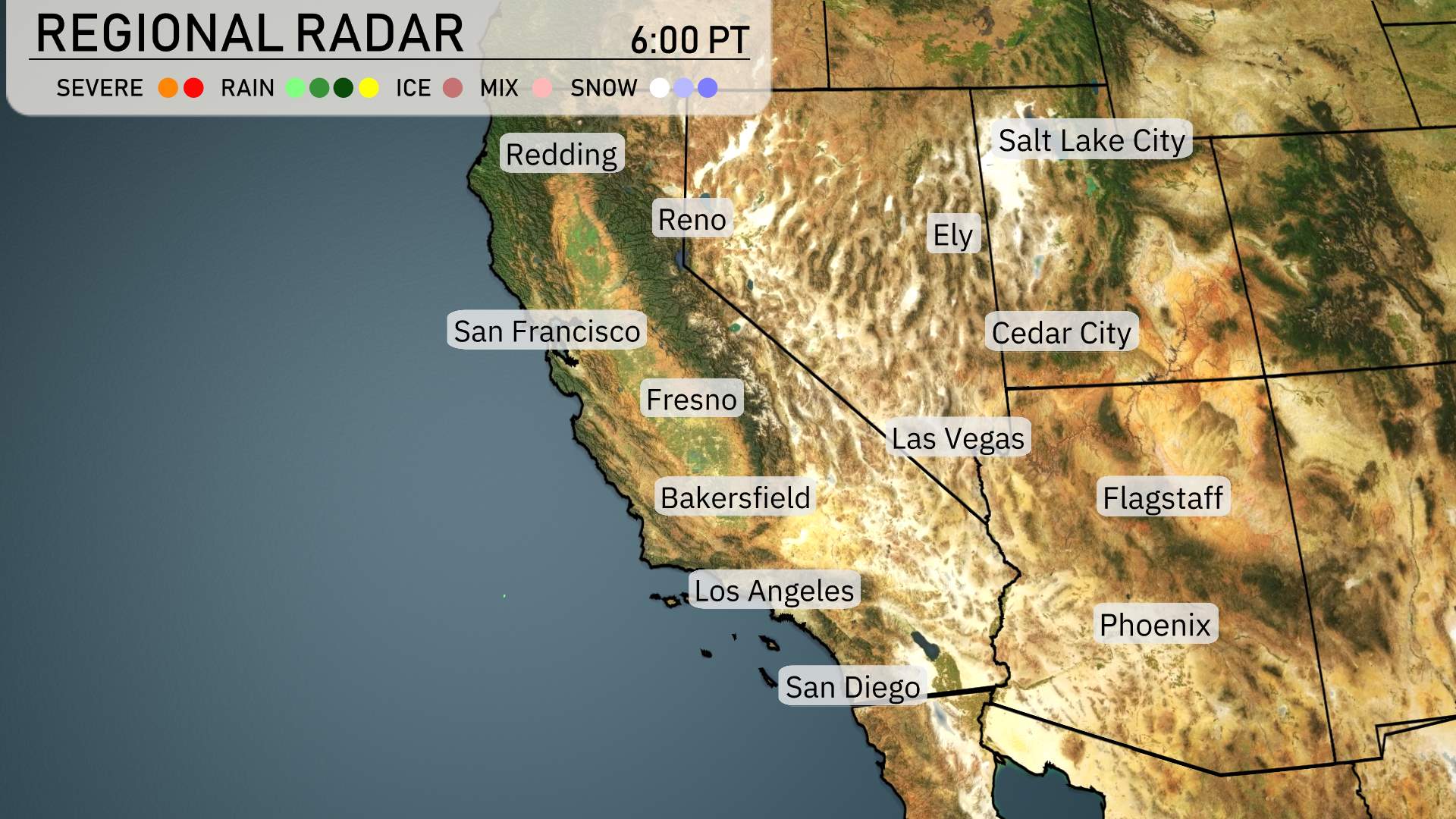
In the Southwest region, a complex weather pattern is unfolding. Rain is moving across the California coastline, providing much-needed moisture to areas like Redding and San Francisco. Up in the Sierra Nevada, Fresno and Reno are encountering a mix of rain and snow, with higher elevations receiving a significant blanket of snow.
Las Vegas is staying dry amid these conditions, while Flagstaff braces for snow showers as colder air moves through. Phoenix is experiencing clear skies, with no precipitation expected in the valley. Ely is keeping it calm with clear conditions, but eyes are on Cedar City, where increasing clouds signal potential for some light snow showers. The system is making its way toward the Great Basin, lending to varying conditions across the Southwest.
Salt Lake City’s afternoon brings temperatures rising to 77 degrees by 6 PM with partly cloudy skies. Expect winds from the southwest at 7 miles per hour tapering slightly to 6 miles per hour later in the evening.
In the northern part, Ely is experiencing mild conditions with a high of 75 degrees. Heading south, Las Vegas is heating things up significantly with a high of 94 degrees today.
Meanwhile, further to the southeast, Phoenix is sizzling with an impressive high of 100 degrees—a stark contrast to the milder temperatures in the north. San Diego enjoys a pleasant day with a high of 78, while Los Angeles is a touch warmer at 80 degrees.
Expect lows of 41 degrees in Ely and Flagstaff. Las Vegas will stay warmer at 70 degrees, while Phoenix cools down to a comfortable 68. In Los Angeles, the low will be 55, with San Diego slightly cooler at 54. Bakersfield will see a low of 57, and Fresno will drop to 54. Farther north, Redding will experience a low of 50, while San Francisco holds steady at 46. A noticeable temperature drop will be felt, making for a brisk start to the weekend in many areas.
High temperatures for the Southwest region tomorrow are set to be notably warm with some cities experiencing above-average readings.
In Las Vegas, look for a staggering high of 97 degrees, well above the typical for this time of year. Phoenix is also heating up, with temperatures soaring to 101 degrees, contributing to a trend of warmer weather across the area.
Heading into California, Bakersfield will reach a high of 86 degrees, while Los Angeles enjoys a comfortable 80 degrees. San Diego will be slightly cooler at 78 degrees, maintaining its mild coastal climate. Up north in San Francisco, temperatures will be cooler at 64 degrees, contrasting with the more intense heat inland.
Ely will see a high of 76 degrees, which is above its usual highs for this time of year. Flagstaff stays relatively mild at 76 degrees. Cedar City rounds out the forecast with a high of 79 degrees. A strong ridge of high pressure is influencing these warm temperatures across the Southwest.
A cold front is moving into the Southwest, bringing about a shift in the weather pattern. For the desert regions, it’s predominantly clear and sunny, maintaining dry conditions. However, along the coast, especially in Northern California, expect multiple rounds of valley rain starting Thursday. Meanwhile, Southern California, particularly the San Bernardino Valley, will encounter additional showers, leading to potentially heavy rain at times. Be cautious of tricky driving conditions and slick roads, particularly over mountain passes. With the cold front approaching, these changes will bring cooler temperatures and a mix of sun and scattered showers in the days ahead.
The UV index in Salt Lake City will be moderate on Thursday with a level of 6, carrying a burn time of approximately 23 minutes in direct sunlight. By Friday, the UV index remains at 6, indicating a similar burn time of 23 minutes.