Spring Swirls in the Southeast: A Complete Weather Guide
By
Amy Freeze
Explore the shifting weather patterns across the Southeast with our comprehensive guide. From cool nights in Atlanta to sunny days in Florida, understand what to expect and how to prepare.
Dive into the dynamic weather of the Southeast with Meteorologist Amy Freeze. From stormy skies to sunny days, your comprehensive spring weather guide is here!
As spring unfolds, the Southeast is a tapestry of contrasting weather. With Meteorologist Amy Freeze, navigate from thunderstorms in Tennessee to the sunny tranquility of Florida. Expect insights on temperature swings, storm preparations, and daily forecasts tailored for cities from Atlanta to Miami. Detailed forecasts and safety tips included.
A dynamic weather picture is emerging over the Southeast. Thunderstorms are casting a spotlight over western Tennessee and northern Mississippi as they trek eastward. Memphis is currently experiencing heavy rain with potential for severe weather as the storms move toward Nashville.
A line of rain stretches across northern Louisiana, making its way into Shreveport and heading for Jackson. Below this, Houston enjoys a break from precipitation, and New Orleans is on the cusp of some showers that are yet to reach the city.
Further east, the skies over Georgia are painting a mostly clear picture, although Atlanta and Montgomery should prepare for potential cloud covers as the day progresses. Moving farther south, Savannah and Jacksonville are basking in sunshine with mild, tranquil weather. Coastal cities like Tampa and Miami enjoy a stretch of fair weather, ideal for outdoor activities.
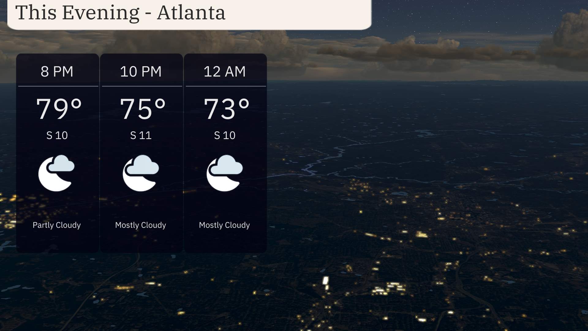
For this evening in Atlanta, anticipate partly cloudy skies transitioning to mostly cloudy as the night progresses. Temperatures will decrease from 79 degrees at 8 PM to a more comfortable 73 degrees by midnight. Winds are steady from the south around 10-11 miles per hour throughout the evening, maintaining a mild atmosphere.
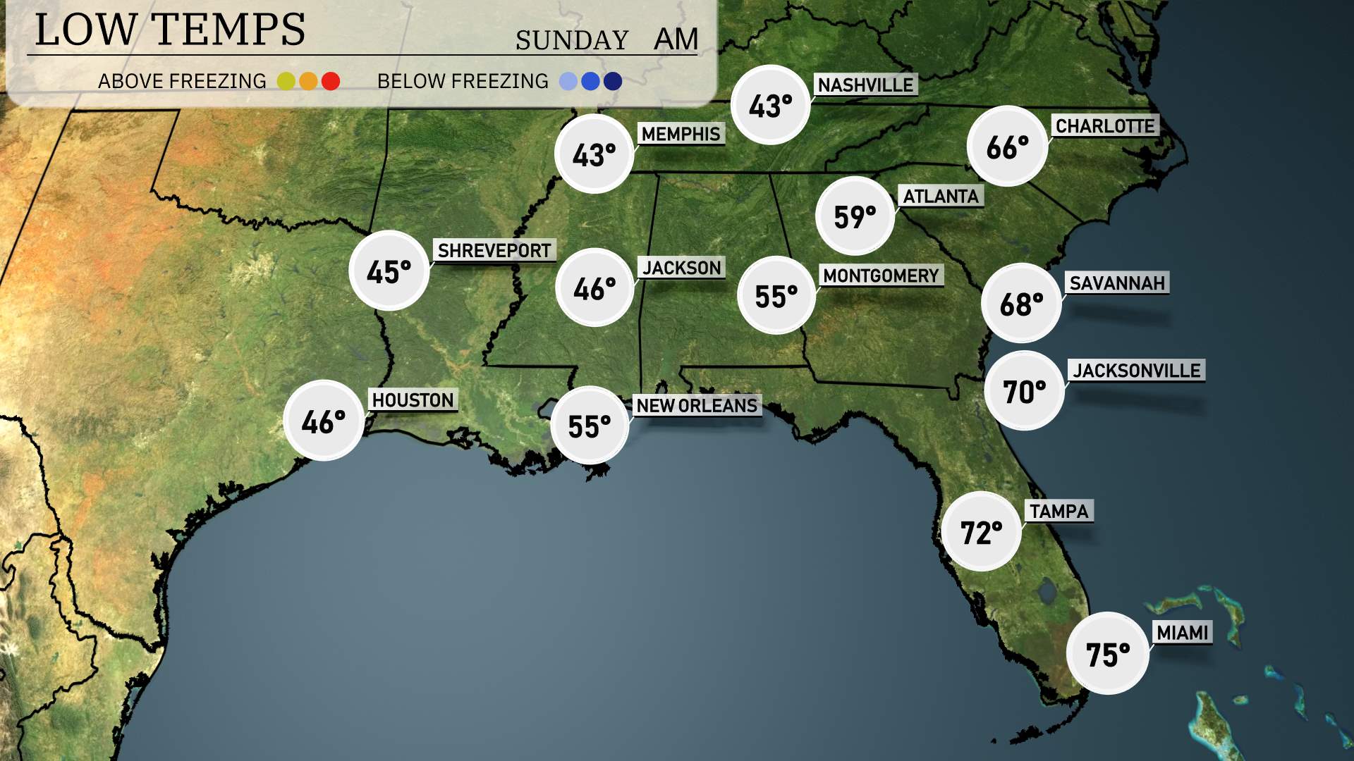
Now for the low temperatures, the Southeast is experiencing a drop in temperatures tonight. Memphis will see a chilly low of 43 degrees, while Nashville is expected to dip down to 43 as well. Shreveport will cool off to 45 degrees. In Jackson, the temperature will fall to 46. Atlanta will have a low of 39 degrees, making it notably colder. Expect a mild 55 degrees in New Orleans, while Montgomery reaches 55 as well. Further south, Jacksonville is set for a low of 70 degrees. Tampa will have a comfortable low of 72, and Miami stays warm at 75 degrees.
Tomorrow, the Southeast region will experience a surge in temperatures, with many areas showing above-average readings.
In Florida, Jacksonville is set to reach a hot 91 degrees, while Tampa follows closely with a high of 90 degrees. Miami is also warm at 82 degrees. Heading north, Savannah is expected to hit 84 degrees, providing a sunny day for outdoor activities.
Further inland, Montgomery anticipates a high of 75 degrees. In Atlanta, temperatures will climb to 73 degrees. Over in Louisiana, New Orleans will register 77 degrees, while Jackson, Mississippi, will see a high of 63 degrees.
On the Gulf Coast, Houston’s temperatures are expected to reach 59 degrees, and Shreveport, Louisiana, will be slightly cooler at 55 degrees.
A cold front pushes into the Southeast tomorrow, creating an active weather scene. Look out for strong thunderstorms impacting areas from Shreveport to Atlanta as the front moves eastward. Severe storm risks are noted, with strong winds and potential flooding from heavy rainfall. The line of storms will affect Jackson, New Orleans, and Montgomery throughout the day. Temperatures may cool slightly after the thunderstorm passage, with drier conditions expected late Wednesday. Stay weather alert and monitor for any emergency weather notifications, especially in Louisiana and Mississippi.
The UV index in Atlanta will be very high on Saturday with a value of 8, resulting in a burn time of about 17 minutes in direct sunlight. Expect cloud cover and possible thunderstorms on Sunday which brings the UV index down to 5, with a burn time stretching to 27 minutes. Remember to apply sunscreen and seek shade as needed!
Saturday: Mostly cloudy with a warm high of 88 degrees, cooling down to 68 degrees overnight.
Sunday: Afternoon thunderstorms expected, with temperatures dropping to a high of 73 degrees and a low of 59.
Monday: Partly cloudy skies as temperatures fall further to 62 degrees during the day and 42 at night.
Tuesday: Clear skies throughout the day with a high of 63 degrees and a crisp low of 37.
Wednesday: Mostly clear with plenty of sunshine, reaching a comfortable high of 68 degrees and a night low of 43.
Thursday: Showers arriving late in the day, but overall mild with a high of 74 degrees and a low of 52.
Friday: The week wraps up with mostly clear skies and slightly cooler temperatures peaking at 72 degrees, dipping to 45 overnight.
Hope that helps! Stay safe!