Forecast First: Tomorrow’s Weather Doorstep in Atlanta
By
Amy Freeze
Discover what Atlanta’s weather has in store for tomorrow morning - from calm, partly cloudy skies to a detailed look at this week's Southeastern temperatures and storm alerts.
A tranquil start in Atlanta tomorrow with partly cloudy skies and gentle breezes sets the scene for a week of dynamic Southeastern weather. Key points include temperature variations, and storm forecasts — essential details for all Atlantans!
Expect a calm morning in Atlanta this Wednesday with temperatures steadily climbing under partly cloudy skies—perfect for an early jog. However, don’t let the serene start fool you; the Southeast braces for a wave of challenging weather. From evening lows to stormy alerts, get the comprehensive outlook to stay informed and prepared.
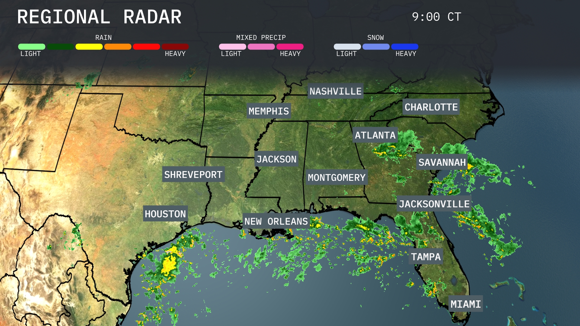
A line of storms stretches across the Gulf Coast, with New Orleans and points eastward like Pensacola experiencing rainfall. Moderate to heavy rain is pushing over areas in and around Montgomery, as well as moving towards Georgia’s state line. Miami is under a blanket of persistent showers extending northward up to Jacksonville. Clear skies prevail over Memphis, Nashville, and much of the Carolinas, though cloud cover is increasing in Charlotte as showers approach.
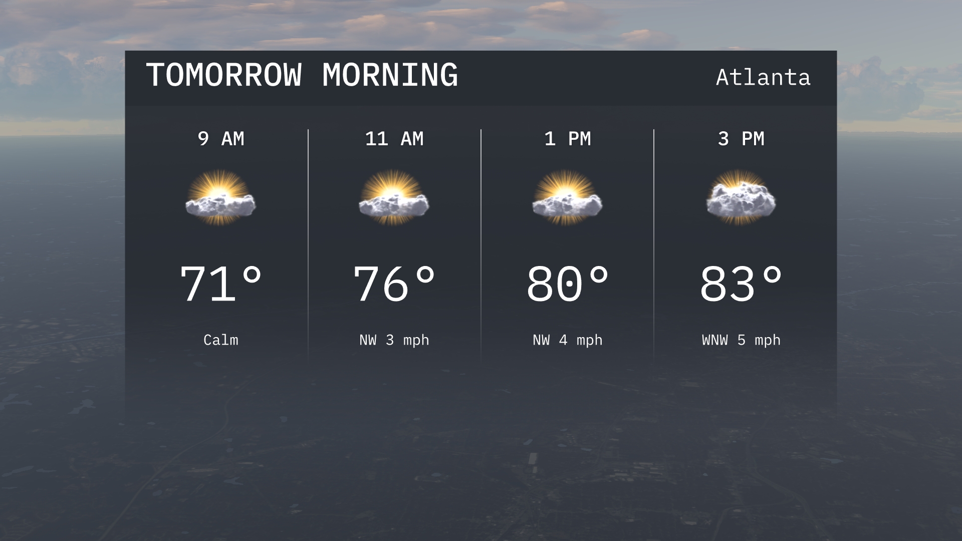
Tomorrow morning in Atlanta, expect calm conditions to start with temperatures around 71 degrees at 9 a.m. By 11 a.m., temperatures will rise to 76 degrees with a light northwest wind. Skies will be partly cloudy, with gentle winds maintaining a northwest direction.
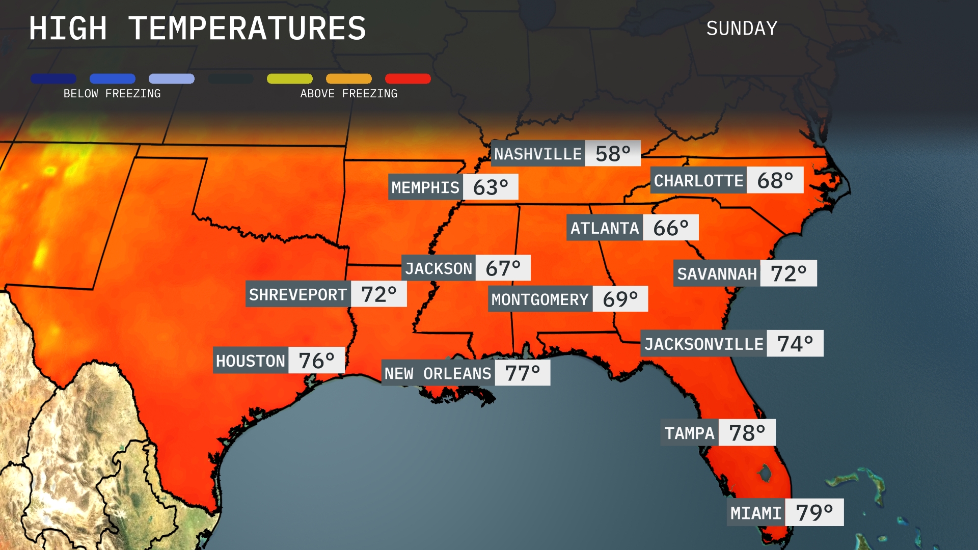
Tomorrow, high temperatures will vary across the Southeast with Gainesville reaching 79 degrees. Atlanta can expect a high of 66 degrees, which is slightly below average for this time of year. Nashville will see a cool high of 58, while Memphis warms up to 63. New Orleans will be warmer at 77 degrees, bringing mild conditions to the region.
A cold front is set to move across the Southeast, bringing a wave of thunderstorms from Houston to Shreveport, reaching Jackson by the afternoon. Expect severe storm potential with high winds and heavy rain, particularly affecting Jackson, Montgomery, and Atlanta through Wednesday. Rainfall could exceed an inch, targeting areas already prone to flash flooding, especially in Nashville and Charlotte. After the frontal passage, cooler and drier air will follow into the weekend. Thunderstorms will persist along the coastal areas from Savannah to Tampa, creating challenging conditions for travelers, particularly from Jacksonville to Miami.
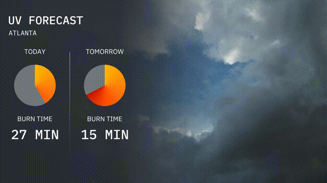
The UV index in Atlanta today is higher, resulting in a burn time of 27 minutes under direct sunlight. Prepare for a slightly more intense UV index tomorrow with a sharper burn time of 15 minutes.
For the 7 day forecast in Atlanta:
Sunday: Warm and partly cloudy with a high of 85 degrees and a low of 65 degrees.
Monday: Slightly cooler and mostly sunny, reaching high temperatures of 84 degrees with a low of 60 degrees.
Tuesday: Mild weather with partly sunny skies and a high of 82 degrees and a low of 59 degrees.
Wednesday: More clouds roll in, maintaining highs around 82 degrees and lows around 59 degrees.
Thursday: A mostly sunny day, peaking at 83 degrees during the day, cooling down to 64 degrees at night.
Friday: Cloudy with scattered showers developing. Expect a high of 75 degrees and a low of 64 degrees.
Saturday: Rainy conditions continue with a high of 75 degrees and a low of 65 degrees.