LA’s Mild Morning vs. Southwest’s Sizzling Surge: Tomorrow’s Weather Face-Off
By
Amy Freeze
As Los Angeles welcomes a mild morning, the broader Southwest braces for a heat onslaught. Explore our detailed forecast and safety tips tailored for your area!
While Los Angeles enjoys mild warmth tomorrow morning, the Southwest faces extreme heat. Check the full forecast on our blog!
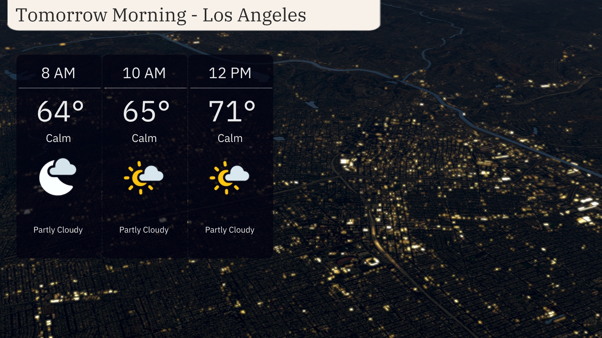
This August 4, Los Angeles starts its day with calm, partly cloudy skies, while cities like Phoenix prepare for breath-taking heat. Los Angeles will peak at a pleasant 84°F, while Phoenix soars to 114°F. Learn more on safe practices and the week’s fire risks in Southern California in our full-length article. Dive into various city forecasts and safety measures on our blog!
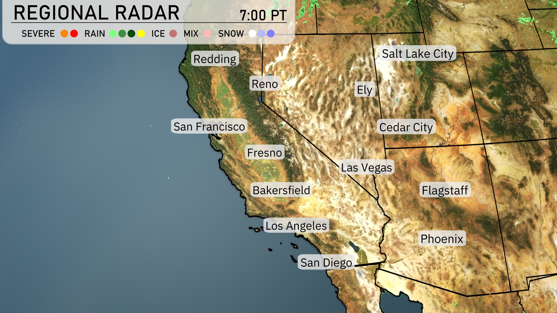
Across the Southwest, coastal areas like Los Angeles enjoy relatively mild warmth, while inland desert cities like Las Vegas and Phoenix face intense heat. Phoenix is battling extreme temperatures and official warnings. If you’re outdoors, staying hydrated, avoiding peak mid-afternoon exposure, and seeking shade or air conditioning is strongly advised. Also there will be elevated fire risk as the week goes on in Southern California.
In Los Angeles, tomorrow morning begins with partly cloudy skies and a temperature of 64 degrees at 8 AM, creating a calm atmosphere. By 10 AM, expect temperatures to rise slightly to 65 degrees.
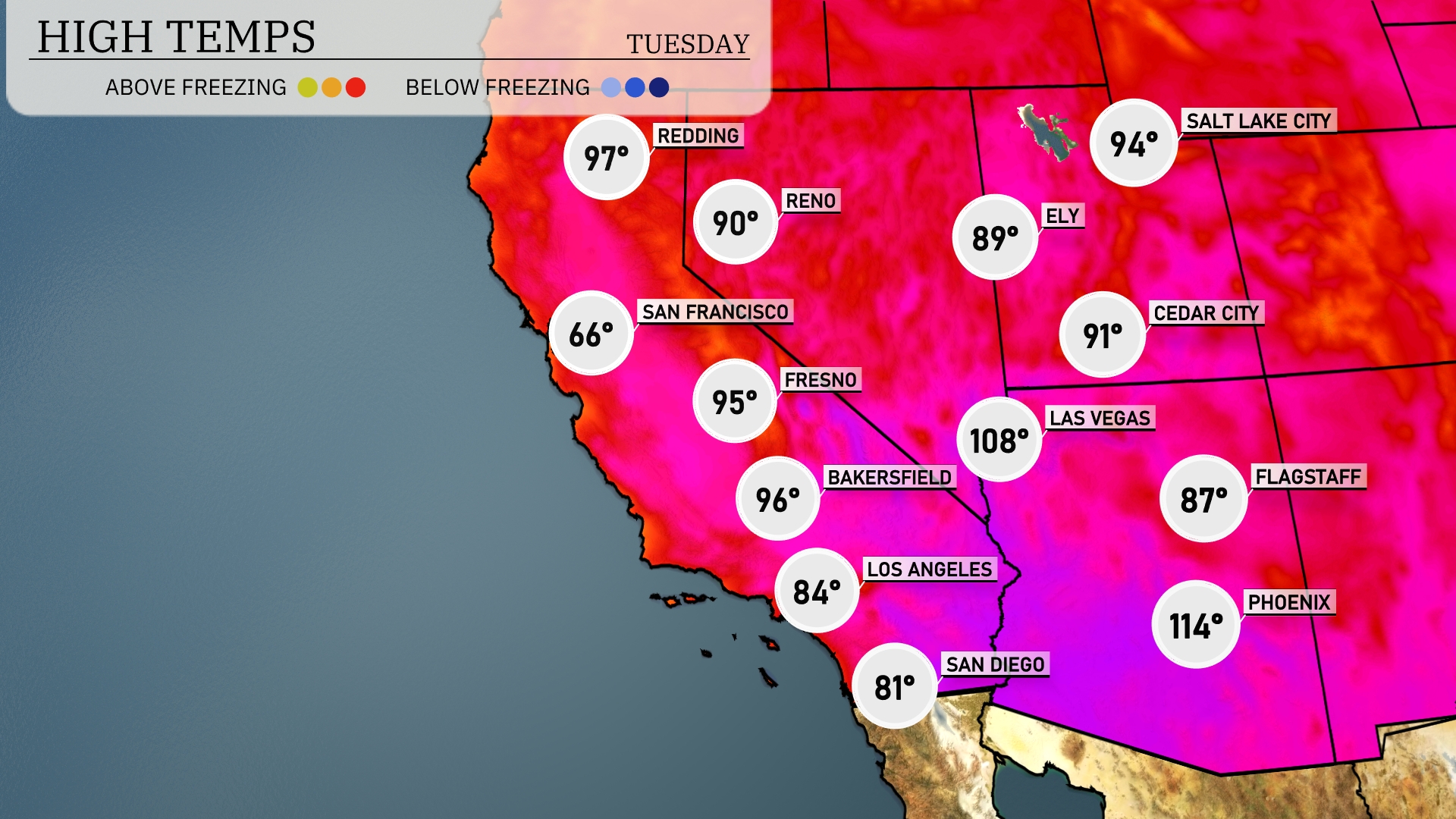
Tomorrow in Phoenix, expect a sweltering high of 114 degrees, well above the average for this time of year. Las Vegas will also feel the heat, reaching 108 degrees, making it a dangerously hot day overall. In Los Angeles, temperatures will be more moderate at 84 degrees, providing a brief respite from the heat. Farther north in Fresno, highs will climb to 95 degrees, showing similar above-average trends across the region. San Diego can look forward to a high of 81 degrees, remaining on the cool end of the spectrum compared to neighboring cities.
In the Southwest, expect a significant warm-up with temperatures climbing into the mid-80s by late afternoon. However, a strong cold front will push through Arizona and New Mexico by early evening, bringing scattered thunderstorms and gusty winds. Some of these storms may become severe, particularly in eastern Arizona, where there’s potential for damaging winds and hail. Overnight, the rain will persist into New Mexico, providing much-needed relief from recent dry conditions. By late Wednesday, the weather clears up, with mild air settling in across the region as temperatures dip into the low 70s.
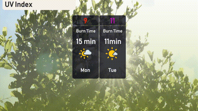
The UV index in Los Angeles for today (Monday) is very high at 9, indicating potential burn in just 15 minutes of sun exposure. Tomorrow (Tuesday), the index rises to an extreme 11, with an even quicker burn time of 11 minutes.
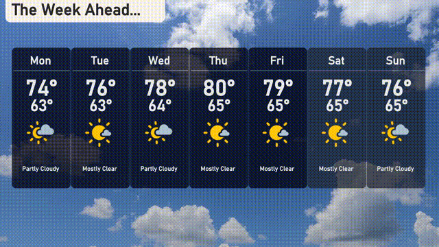
Monday: Partly cloudy skies with a high of 74 degrees and a low of 63 degrees.
Tuesday: Mostly clear, warming up to a high of 76 degrees, and a low of 63 degrees.
Wednesday: Partly cloudy with temperatures hitting 78 degrees during the day and dropping to 64 degrees at night.
Thursday: Mostly clear skies, peaking at 80 degrees, and a nighttime low of 65 degrees.
Friday: Temperatures reach a high of 79 degrees with mostly clear conditions and a low of 65 degrees.
Saturday: Slightly cooler with a high of 77 degrees, under mostly clear skies, and a low of 65 degrees.
Sunday: Wrap up the week with partly cloudy conditions, a high of 76 degrees, and a low of 65 degrees.