Hurricane Erin Hits Category 4: East Coast on High Alert
By
Amy Freeze
Discover the latest developments as Hurricane Erin intensifies to a Category 4, prompting emergency preparations along the East Coast. Plus, detailed weather insights from across the United States.
As Hurricane Erin morphs into a formidable Category 4 storm, the East Coast is gearing up for significant impacts. Stay tuned as we track Erin’s path and the accompanying weather changes across the Midwest and beyond.
With Hurricane Erin now a dangerous Category 4 storm, this detailed article provides an in-depth look at the potential impacts on the East Coast, anticipating significant rip-currents and urgent safety preparations. Meanwhile, the Midwest battles severe weather, while the West enjoys clearer skies.
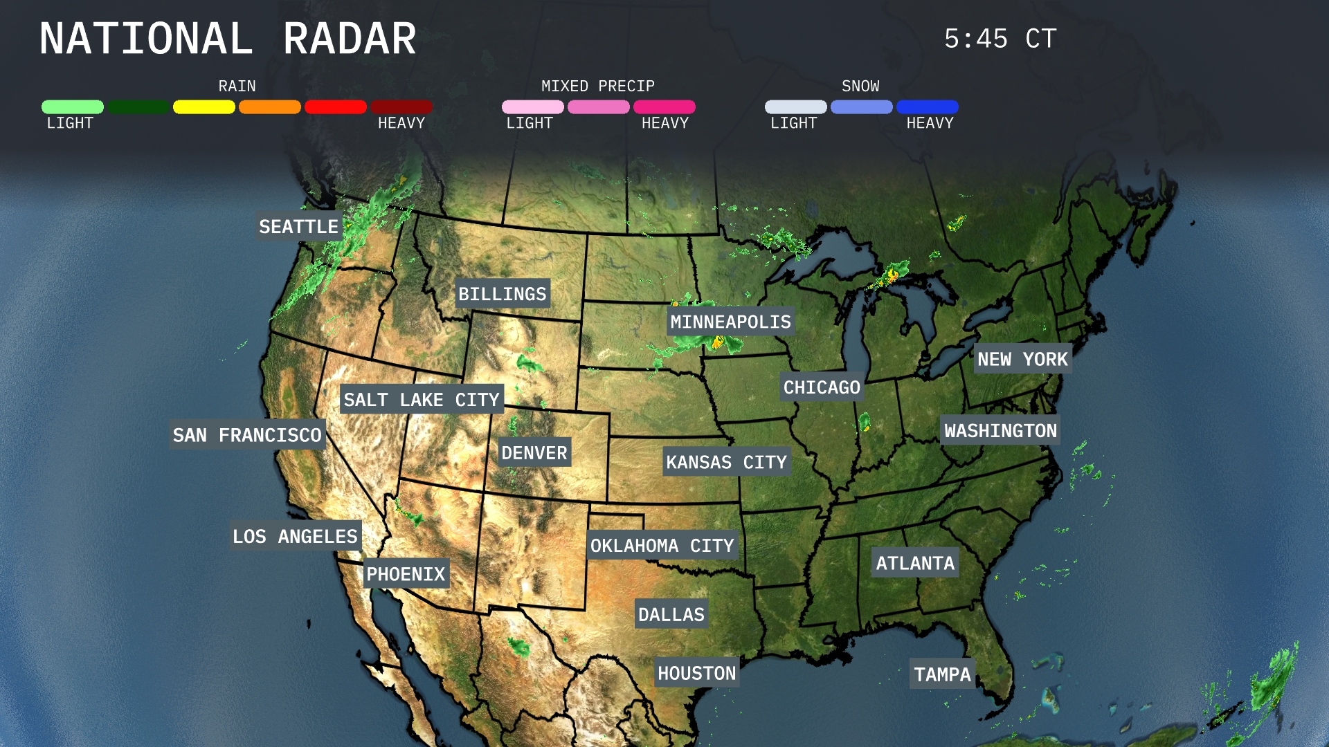
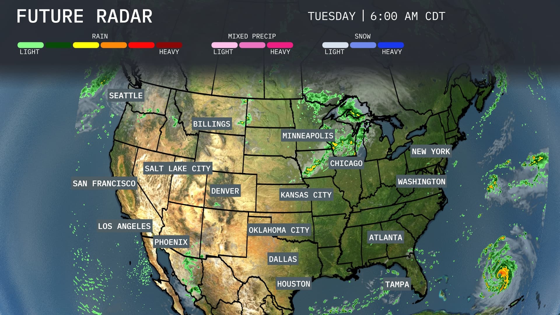
The radar shows the biggest weather impact in the Midwest with heavy rain and a mix of severe weather targeting Kansas City and stretching northeast toward Minneapolis. This weather system is causing substantial rainfall and potential storm activity in both regions, making for a challenging day. Farther west, cities like Seattle and Los Angeles are enjoying dry and clear conditions, offering a pleasant break from any inclement weather. The East Coast, including New York and Washington, D.C., remains mostly calm, with light showers near the Great Lakes affecting cities like Chicago.
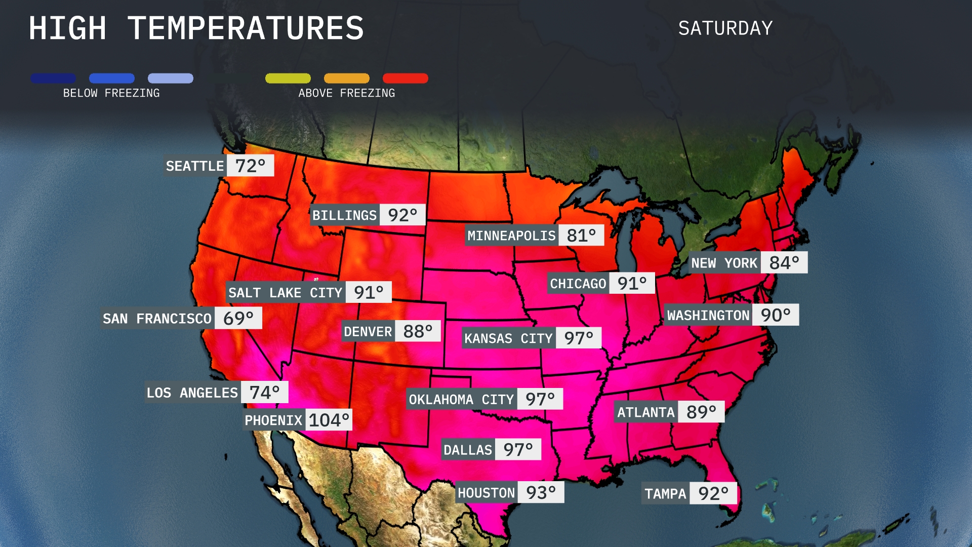
Today, high temperatures soar across the southern tier of the U.S. In Phoenix, the mercury climbs to a blistering 104 degrees, while Dallas and Oklahoma City both reach 97 degrees, creating a widespread heat sensation. Moving to the Southeast, Atlanta warms up to 89 degrees, slightly cooler than Tampa’s steamy 92. The Midwest sees more moderate temperatures, with Chicago and Minneapolis both nearing 81 degrees, providing a welcome break from the heat.
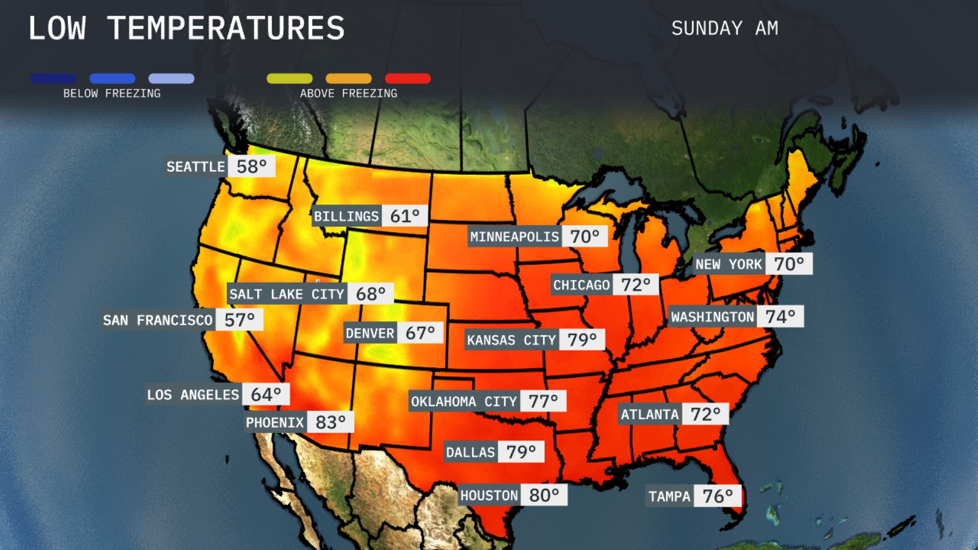
Now for the low temperatures tomorrow morning across the U.S. In the Midwest, Minneapolis will dip to 70 degrees, while Chicago cools down to 72. Moving to the South, Atlanta is set for a low of 72 degrees, and Dallas will wake up at 79. The Northeast remains mild, with New York at 70 degrees and Washington, D.C. hitting 74.
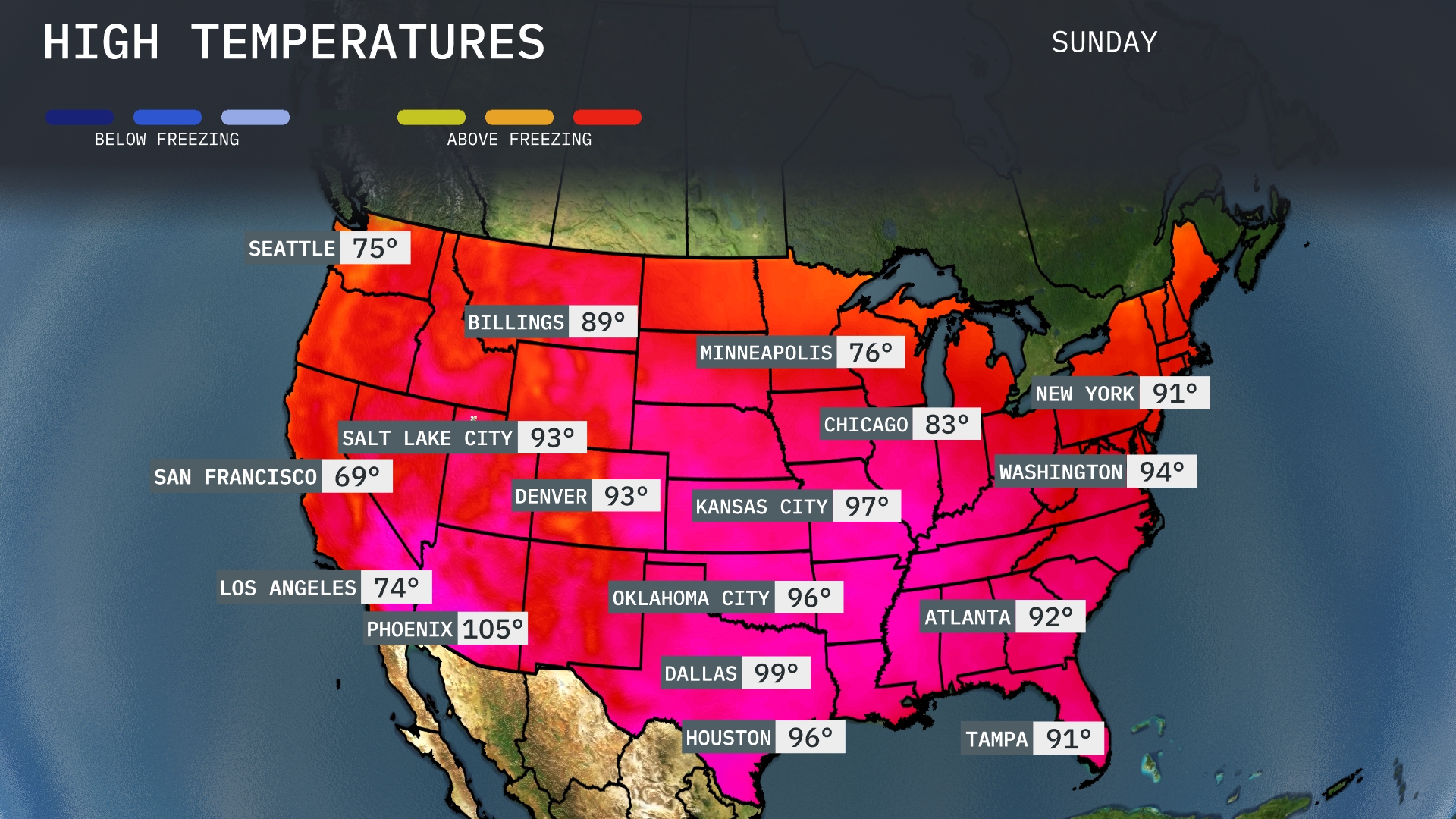
Tomorrow, the region will experience some sweltering highs, with Dallas reaching 99 degrees, well above average for this time of year. Houston isn’t far behind, expected to hit 96 degrees, contributing to the overall warmth in the Gulf Coast. Atlanta will see a high of 92 degrees, indicative of a warm trend across the Southeast. New Orleans will also experience elevated temperatures, peaking at 91 degrees.
A swift-moving cold front is set to sweep through the Midwest, delivering heavy rain and isolated thunderstorms from Kansas City to Chicago. Expect a noticeable drop in temperatures following the front, making for cooler conditions in its wake. The Southeast, including regions from Dallas to Atlanta, should be prepared for severe thunderstorms, with the risk of high winds and possible hail. The Pacific Northwest will see continued rain showers around Seattle, while Southern California stays dry and sunny.