Storm Alert: How Hurricane Erin and a Sweltering Heatwave are Reshaping Weather Across America
By
Amy Freeze
Explore the latest weather dynamics as Hurricane Erin approaches North Carolina and a brutal heatwave grips the Southwest. Learn how these conditions could affect your area with detailed forecasts and safety tips.
Today’s weather is a tapestry of extremes. From scorching heat across the Southwest to impending storms brought by Hurricane Erin along the NC Outer Banks. Dive deeper into what these shifts mean for regions across the U.S.
In the wake of Hurricane Erin steering north, the Outer Banks is under a tropical storm watch, signaling potential strong winds and heavy rains. Meanwhile, the West faces blistering temperatures, breaking records and escalating fire risks. This comprehensive post explores these critical weather patterns, their implications for U.S. regions, and essential precautions to consider. From disrupted travel plans in Chicago due to rain to serene skies in Denver, we map out the likely scenarios to prepare you for any weather.
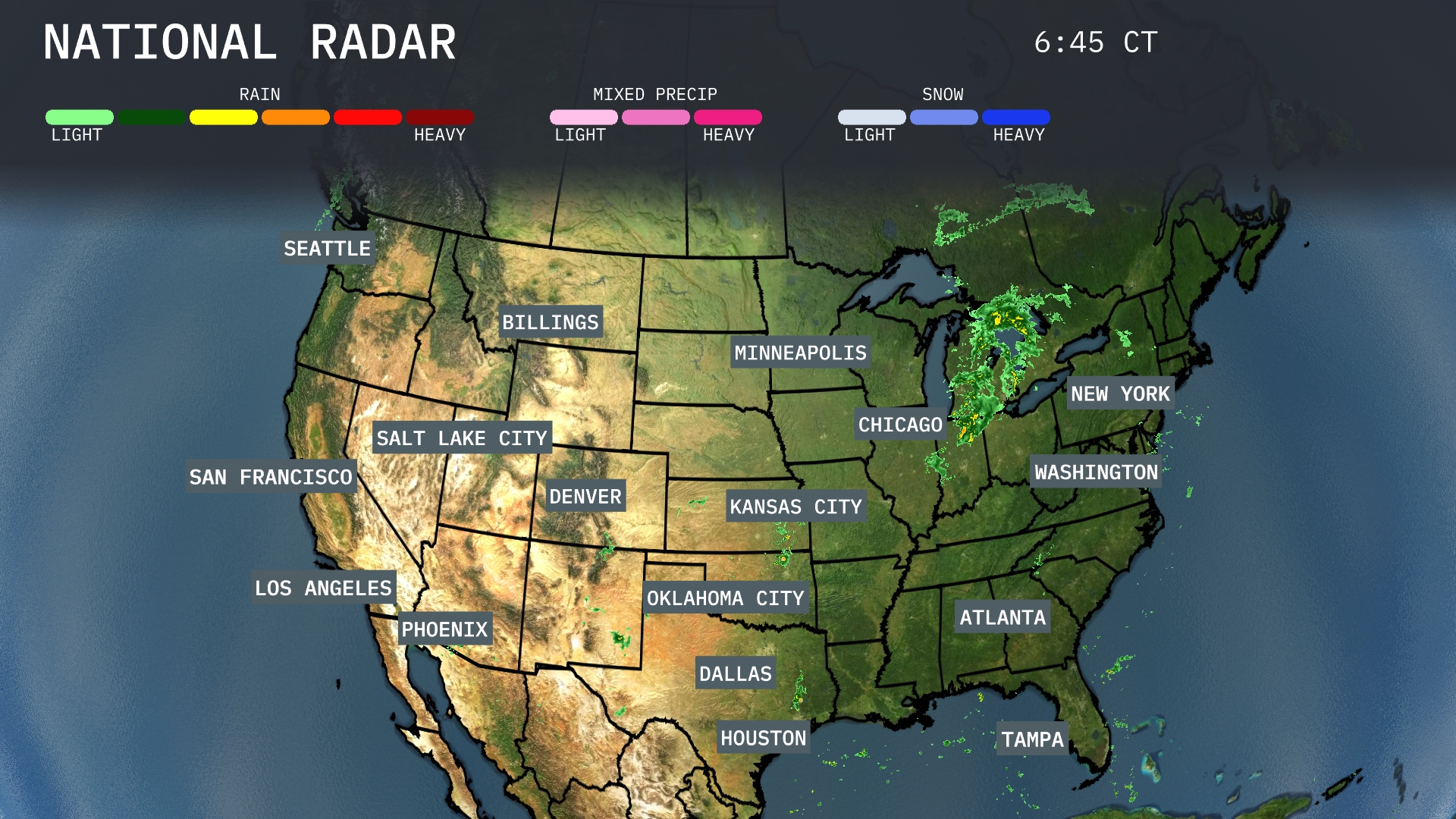
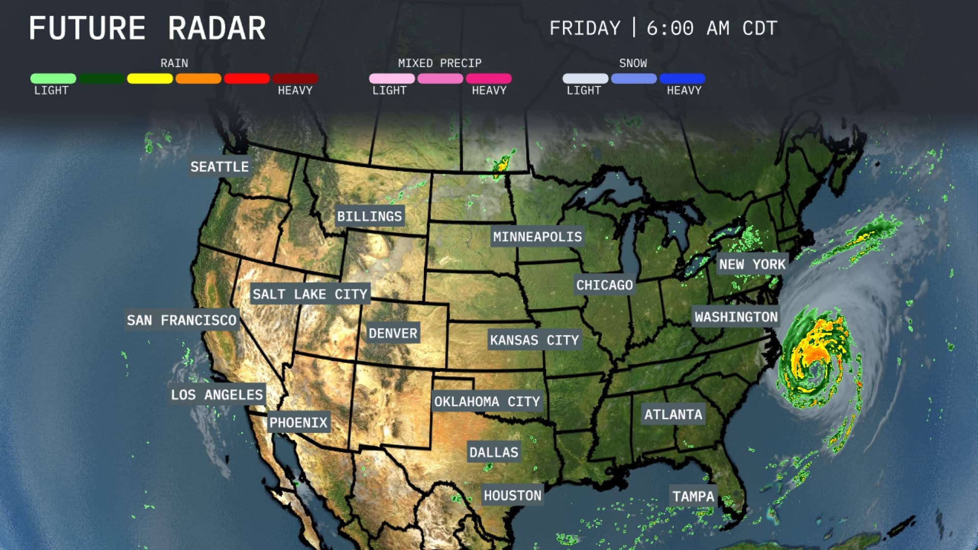
An active weather pattern is impacting the upper Midwest, with Chicago encountering heavy rain that could affect evening travel plans. Farther east, New York is also grappling with rain showers, making for a damp day across the region. In contrast, cities like Denver are experiencing calm, clear conditions, providing a pleasant break from active weather.
Down south, Oklahoma City is seeing scattered thunderstorms, while both Dallas and Houston enjoy dry conditions for now but should watch for potential weather changes. The Pacific Northwest, including Seattle, remains dry and clear.
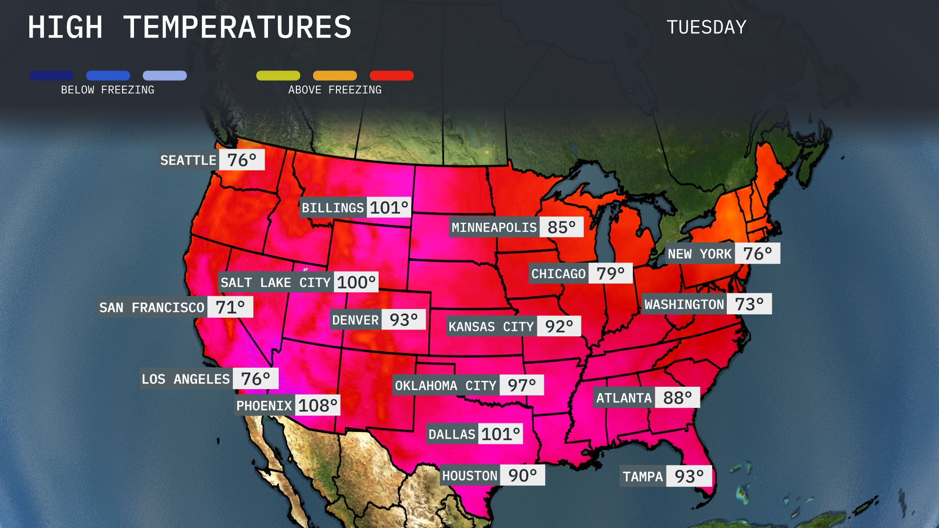
Today, we’re seeing significant warmth across the southwestern U.S., with Phoenix blazing at a remarkable 108 degrees, making it the hottest city of the day. Heading east, Dallas is not far behind with a high of 101 degrees, while Oklahoma City offers slightly cooler conditions at 97. In the Southeast, temperatures remain steamy; Tampa reaches 93 degrees, while Atlanta enjoys a warm 88. The Midwest remains mild, with Chicago only reaching 79 degrees, contrasting with the heat farther south.
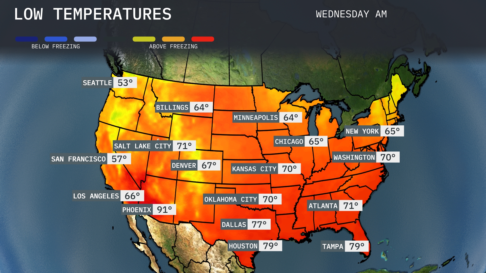
Now for the low temperatures tomorrow morning across the U.S. Chicago will see a low of 65 degrees, while Minneapolis drops to a cooler 64. The Southeast remains mild, with Atlanta at 71 and New Orleans slightly warmer at 79 degrees. Out West, Los Angeles will start at 66 degrees, with Seattle slightly cooler at 53.
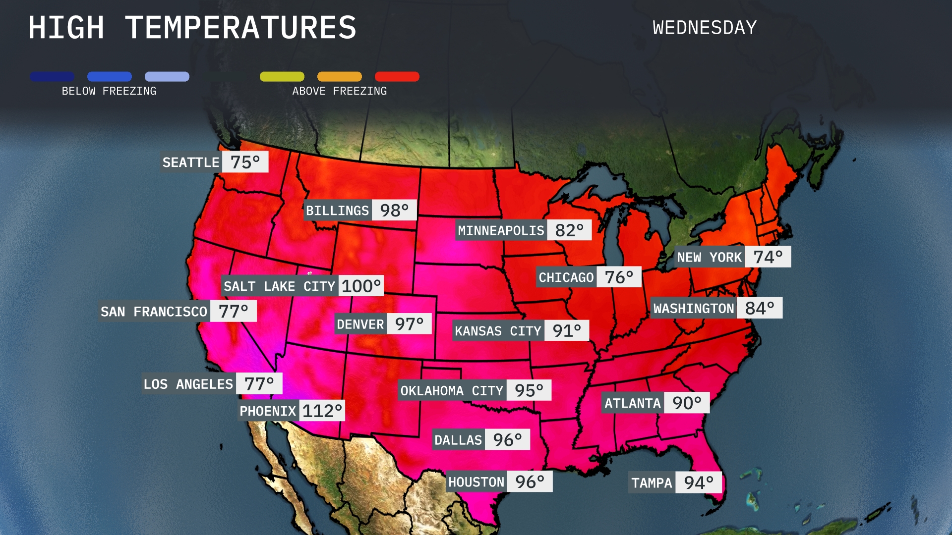
Tomorrow, we can expect a significant heat wave to impact the region, with temperatures well above average. Dallas will experience a high of 96 degrees, while Houston is forecasted to reach 96 degrees as well, reflecting the sweltering conditions. In the Southeast, Atlanta will see a warm day at 90 degrees, and Tampa is set to hit 94 degrees, indicating a continued trend of high humidity and heat.
A complex frontal system in the Northeast is causing heavy rain from New York to Washington, with potential for localized flooding. The Southeast sees scattered storms, particularly around Atlanta and Tampa, with a risk of severe weather as isolated systems develop. Meanwhile, the Pacific Northwest remains mostly dry, while the central states, including Kansas City and Oklahoma City, deal with mixed precipitation under cooler temperatures. Clear skies and warm conditions prevail across Southern California, offering respite from any active weather.