March’s Meteorological Madness: Amy Freeze’s Comprehensive U.S. Weather Wrap-Up
By
Amy Freeze
From turbulent storms in the Southeast to serene skies in the West, explore a detailed breakdown of the U.S. weather as March ends with meteorologist Amy Freeze.
This March has seen a mix of intense weather patterns across the U.S. Dive into our blog as Amy Freeze discusses the severe storms in the Southeast, the clear skies in the West, and a surprising cold snap in the Rockies.
As March bids farewell, it leaves behind a trail of distinct weather patterns across the United States. Meteorologist Amy Freeze takes you on a detailed tour from the stormy climes of the Southeast to the tranquil weather in the West, and onto the unexpected chilly conditions in the Rockies. Accompanied by high-resolution maps and engaging visuals, this blog post covers everything from city-specific forecasts to overarching climatic trends that shaped the U.S. weather in March 2025.
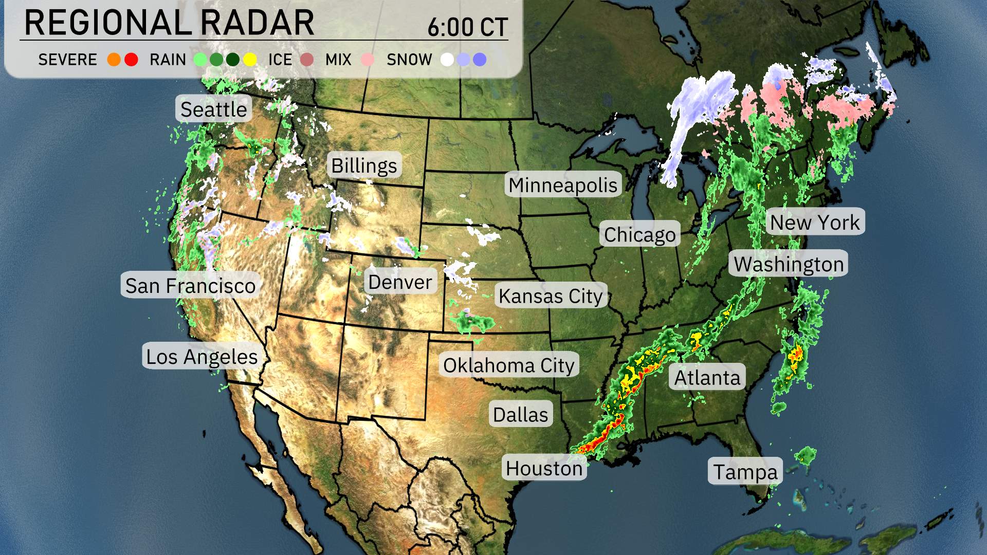
On the National Radar, severe storms stretch across the southeastern United States, from eastern Texas, impacting Houston with heavy precipitation, and extending toward Atlanta. Ensure you’re prepared for the potential of thunderstorms along this line, especially in the vicinity of Birmingham, where storm intensity is high.
A significant weather system is causing rain showers in the central U.S., with a standout area from Oklahoma City to Kansas City facing rain activity today. Showers are also spotted moving in the Midwest towards Chicago. The rainfall is lighter there but worth noting as it could impact travel and outdoor activities.
Out west, California and the Pacific Northwest are largely clear, with a quiet radar for most areas. However, a few scattered showers are visible north of San Francisco, offering a brief respite from dry conditions. Meanwhile, the Rockies, particularly in areas around Denver, are experiencing clear conditions as well.
In the Northeast, the radar shows a wintry mix, with more snow in the northern reaches, particularly around upstate New York and Vermont.
The battle of the airmasses is where we will find a storm boundary today. Keep an eye to the sky in the Carolinas, Alabama and Georgia.
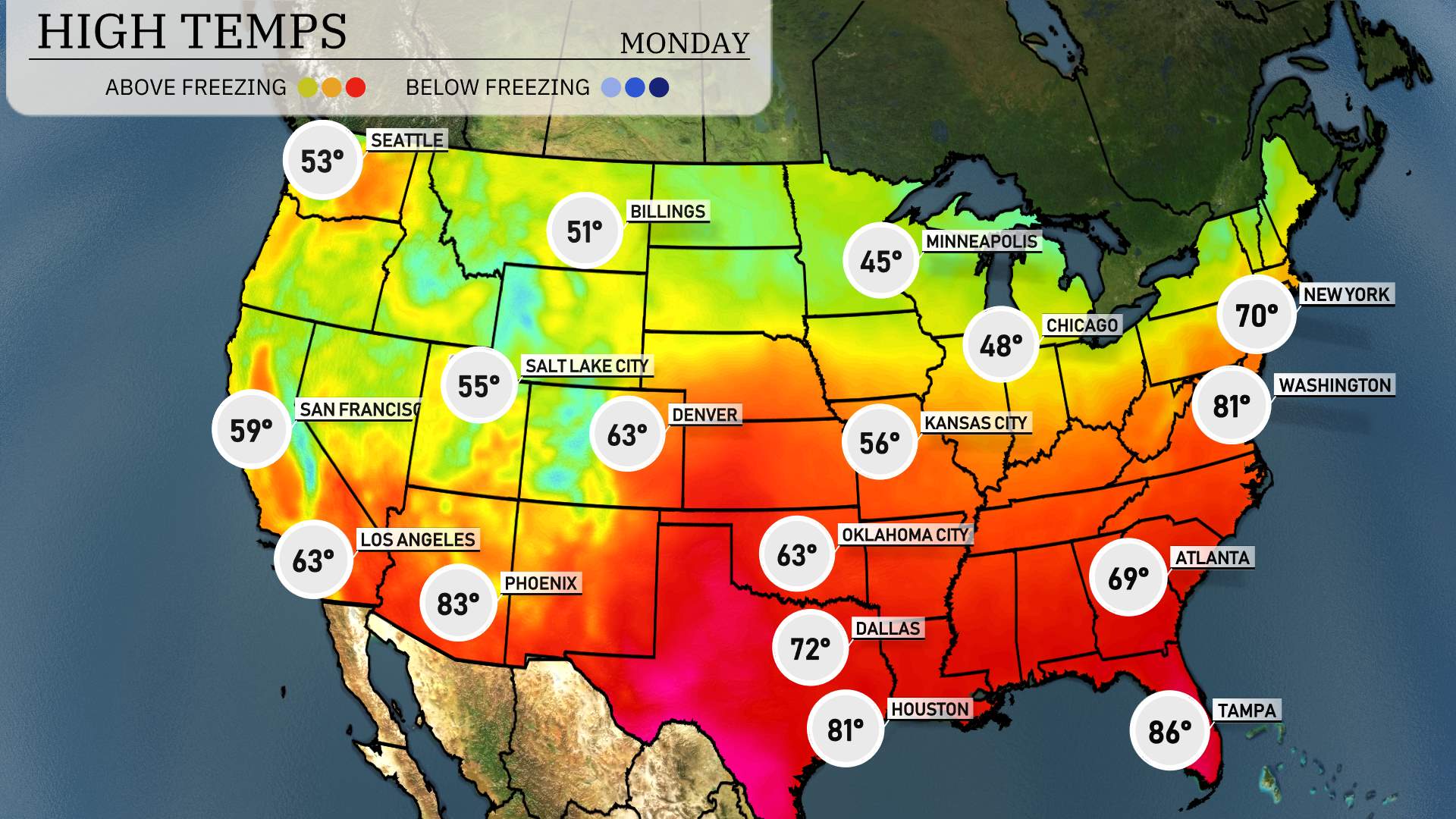
In the Southeast, temperatures trend higher with Tampa basking in sunshine and hitting 86 degrees, notably the warmest in the region. Meanwhile, Atlanta sees a high of 69.
In the Northeast, New York reaches 70 degrees, and Washington, D.C. surprisingly warms up to 81.
To the south, Houston warms up nicely to 81 degrees, while Dallas is slightly cooler at 72.
Behind the front, Denver hits a pleasant 63 degrees, while Kansas City is a bit cooler at 56. In Oklahoma City, temperatures rise to just 63.
In the West, it’s a mild day in San Francisco, reaching 59 degrees. Los Angeles is warmer, making it to 63. In Phoenix, we’re seeing a significant increase with a high of 83 degrees.
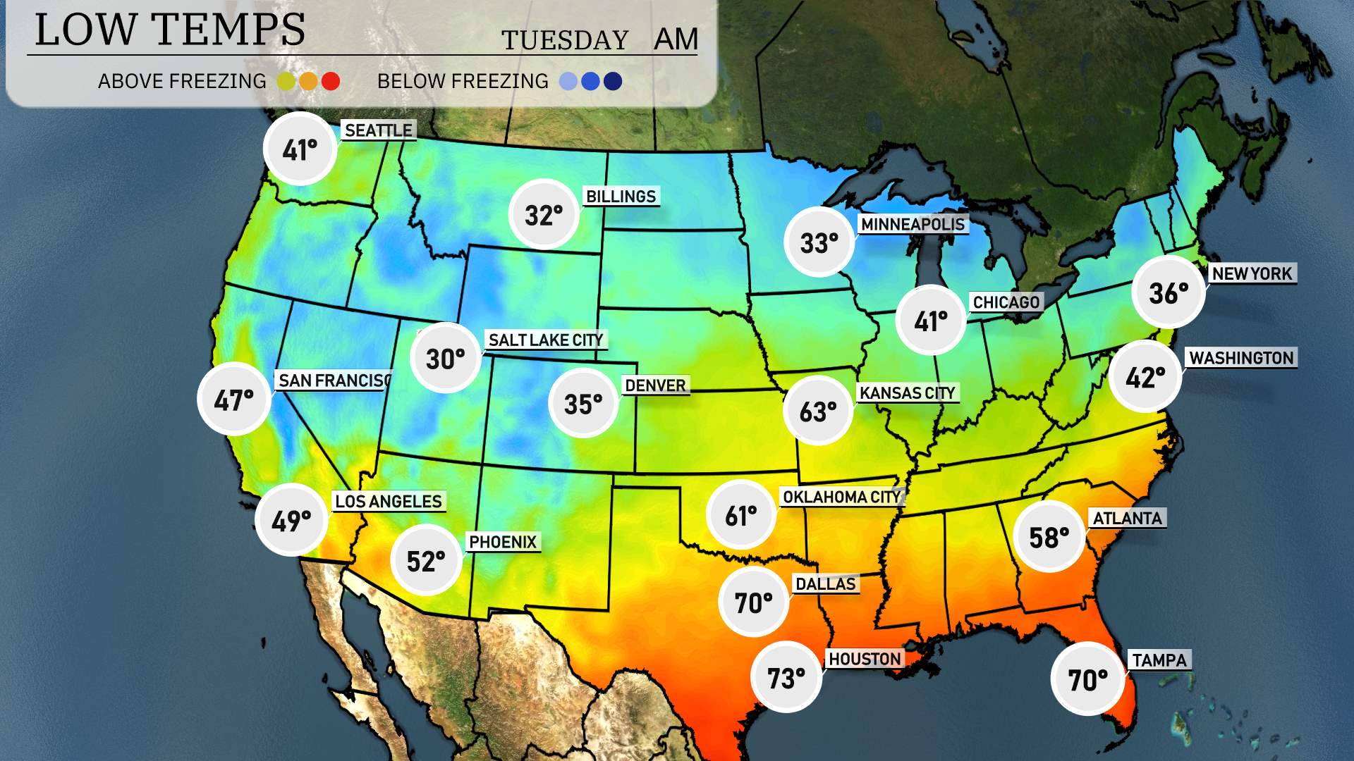
Moving to the low temperatures for tomorrow morning across the U.S., a chilly start is on tap for many. In the Northeast, we’ll see lows drop to 36 degrees in New York and 42 in Washington, D.C. The Midwest is waking up to even cooler air, with Minneapolis at 33 degrees and Chicago at 41 degrees.
Now, heading west, we have a significant cold snap in the Rockies: Billings bottoms out at 32 degrees, and further south, Denver will see a low of 35 degrees. Salt Lake City will be even colder, with a morning low of 30 degrees.
In the West, Ely, Nevada will chill down to 30 degrees as well. Los Angeles will remain milder at 49, while San Francisco has a low of 47 degrees.
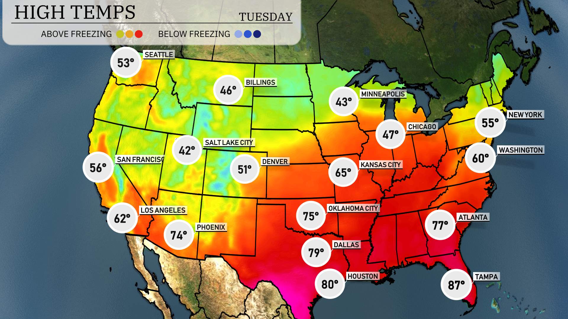
High temperatures for tomorrow, April 1, 2025, are showing a mix of seasonal readings across the Southwest. Las Vegas is preparing for a warm day with a high of 77 degrees, which is slightly above average for the season. Moving to Ely, temperatures will reach around 66 degrees, making for a comfortable day in eastern Nevada.
Temperatures are expected to spike into the 80s in southern regions, with Phoenix hitting 84 degrees under mostly sunny skies, while Los Angeles will see a pleasant high of 71 degrees. In San Diego, expect a comfortable 69 degrees as the coastal influence continues to keep things mild.
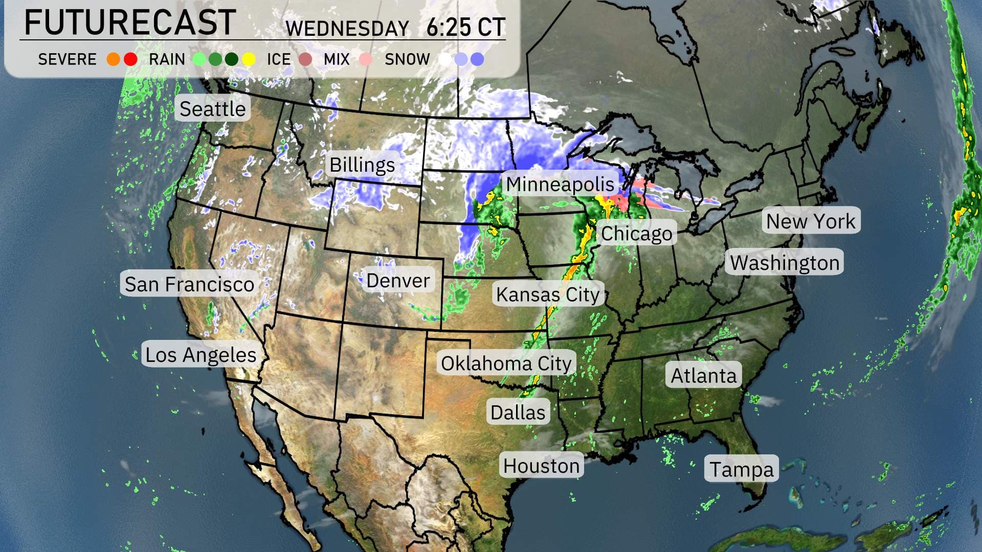
Expect an active weather pattern across the Central U.S. over the next 48 hours. A strong cold front will push through, sparking a line of thunderstorms across areas from Oklahoma City northeastward towards Chicago. Thunderstorms may bring damaging winds and isolated tornado threats. Be prepared for weather alerts as these storms progress, especially Tuesday evening into Wednesday morning.
In the Upper Midwest, including Minneapolis and Chicago, expect snow showers as colder air moves in behind the front. This will make for tricky travel conditions, especially during the Wednesday morning commute.
On the West Coast, areas from Seattle to Denver will remain relatively calm and dry. Down in Southern California, including Los Angeles, anticipate mild and sunny conditions.