From Scorching Heat to Hurricane Alerts: America’s Weather Rollercoaster
By
Amy Freeze
A comprehensive look at the dramatic weather patterns impacting the U.S. this week, including the looming threat of Hurricane Erin along the East Coast.
Today’s weather across the US holds severe weather threats from coast to coast. From Hurricane Erin’s looming dangers to record temperatures in the West and sudden storms in the Midwest, get the latest insights on what to expect and how to prepare.
As we dive deeper into today’s national weather phenomena, concerns mount with Hurricane Erin potentially reaching major status, threatening not only massive waves but serious coastal impacts along the East Coast. Meanwhile, the northern plains face severe storms likely to disrupt mundane day-to-day activities. Adding to the atmospheric chaos, an intense heatwave holds the West captive with temperatures soaring past 100 degrees. This comprehensive blogpost dissects the whirling weather patterns and provides crucial forecasts, helping you stay one step ahead in your daily and emergency planning. For more detailed insights, visit our dedicated update at https://amyfreeze.ai/
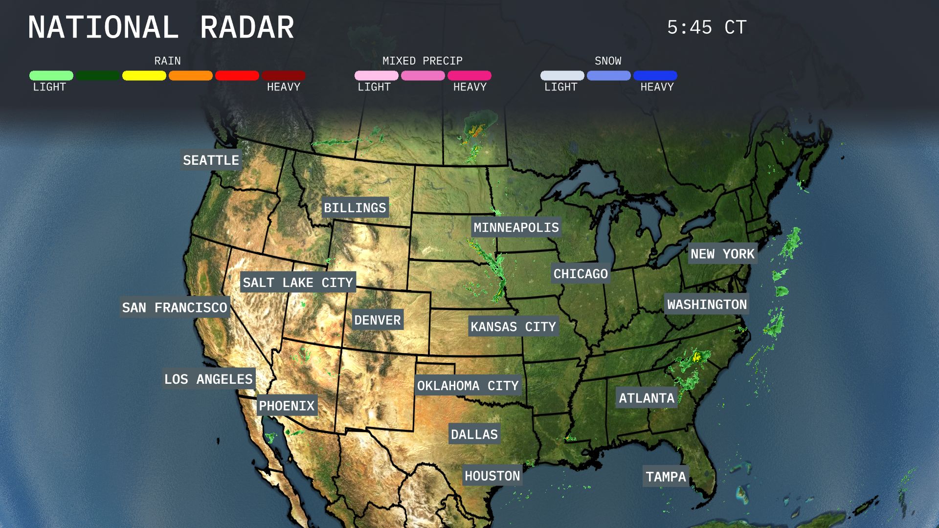
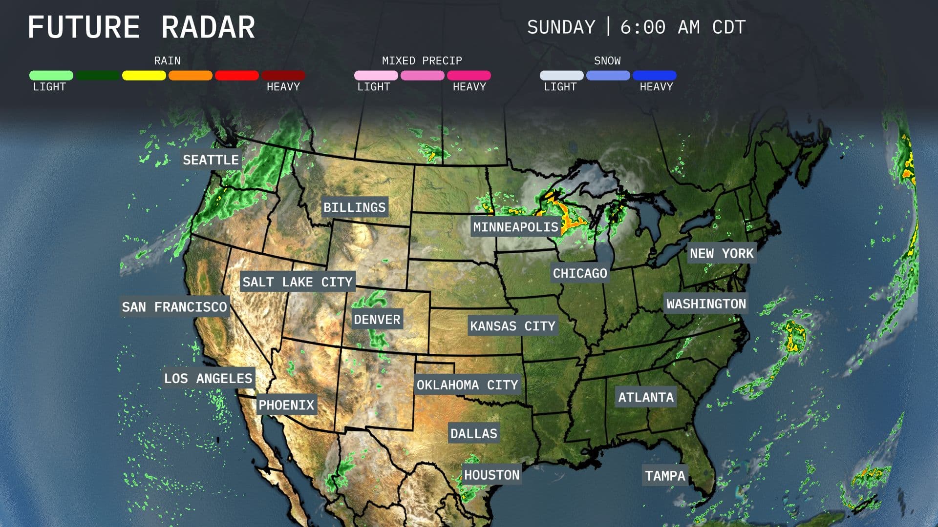
Heavy rain is teasing the Northeast with Washington, D.C., and New York City under the effects of steady precipitation, which could lead to delays and wet commutes today. Minneapolis stands out with light rain showers gradually moving through the region. Farther west, the radar displays clear skies from Denver to Salt Lake City, offering a beautiful stretch of weather across the Rockies. The Pacific Northwest, including Seattle, is dry with overcast skies, while calm conditions prevail in the Southeast, spanning from Atlanta to Tampa.
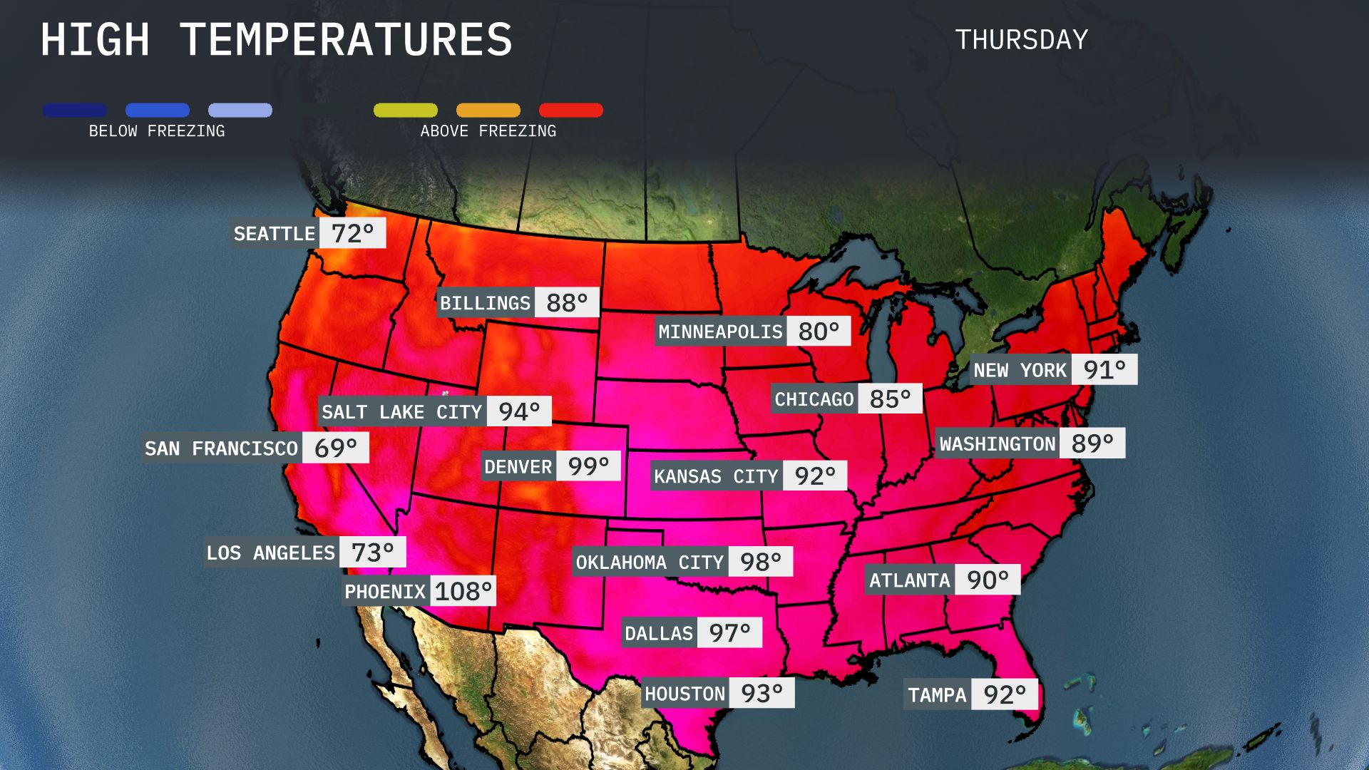
Today, the Southwest is feeling the heat, with Phoenix blazing at a staggering 108 degrees—making it the hottest spot in the nation. In stark contrast, San Francisco remains significantly cooler at just 69 degrees. Moving to the Southeast, temperatures are rising as Atlanta reaches 90 degrees while Tampa isn’t far behind at 92. Up north in the Midwest, Chicago stays mild at 85 degrees, with Minneapolis a bit more mild at 80 degrees.
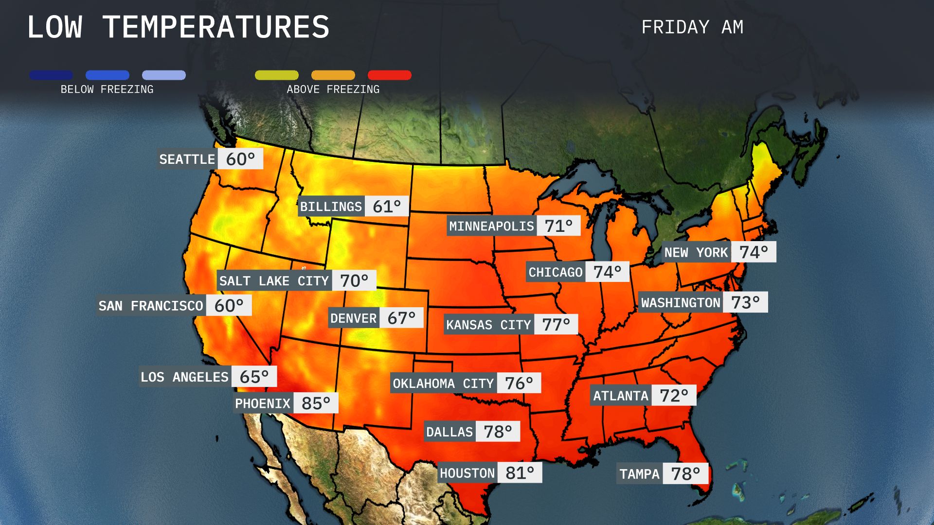
Now for the low temperatures tomorrow morning across the U.S. In the Midwest, Chicago cools down to 74 degrees, while Minneapolis is slightly warmer at 71. Moving to the South, Dallas will see a mild low of 78 degrees, and Atlanta expects 72. In the Northeast, New York retains a comfortable 74 degrees, while Washington, D.C. comes in at 73.
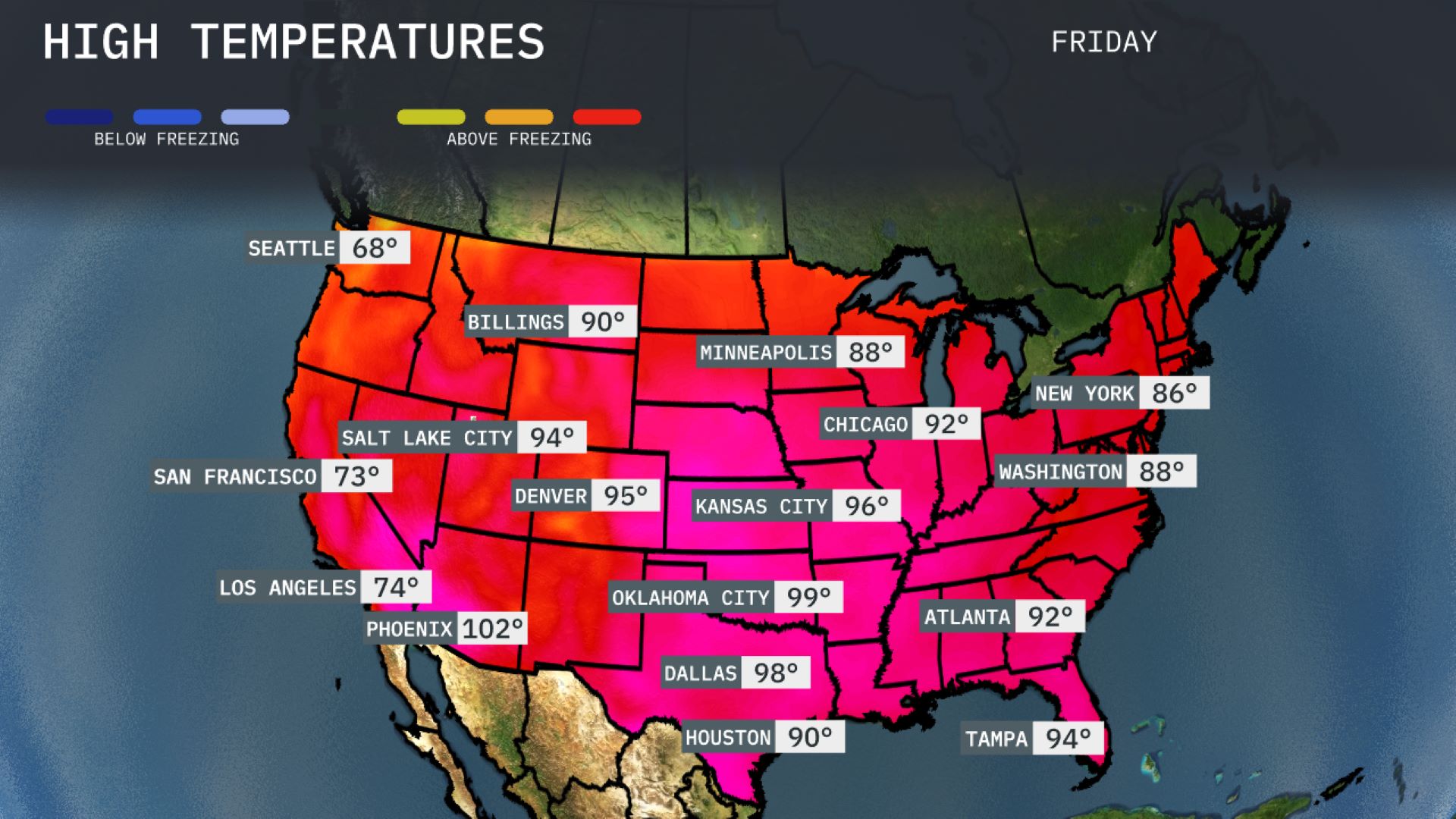
Tomorrow’s temperatures are set to spike significantly across much of the country, with many areas experiencing highs well above seasonal averages. Dallas is forecasted to reach 98 degrees, while Houston is expected to see a high of 90 degrees. In the Midwest, Kansas City will hit a sizzling 96 degrees and Chicago is not far behind at 92 degrees. Over on the East Coast, Washington, D.C. will see a high of 88 degrees, marking a warm day for August.
A storm system impacts the Upper Midwest, bringing heavy rain and thunderstorms from Minneapolis to Chicago, with heightened severe weather risks including strong winds and hail. A cold front moves through the Central Plains, affecting areas like Kansas City and Oklahoma City, with cooler temperatures trailing behind. Out West, Seattle experiences consistent rain, transitioning to snow in higher elevations of the Northern Rockies around Billings and Denver. The Southeast remains quiet with warm, dry conditions persisting in major cities such as Atlanta and Tampa.