Weather Alert: Thunder, Heat, and Frost – A Coast-to-Coast Weather Snapshot
By
Amy Freeze
From severe storms in the Central Plains to sun-soaked days on the West Coast, explore the diverse weather patterns currently sweeping across the U.S.
Severe thunderstorms hit the Central Plains as the West enjoys sun and the Southwest faces intense heat. Keep abreast of dramatic U.S. weather changes.
As severe weather targets the Central Plains with potential flooding, the northern states tackle a mixture of rain and chilly forecasts. The Southwest scorches under extreme heat, while the East Coast enjoys calm, clear skies. Dive deeper into each region’s weather specifics and prepare adequately for the upcoming temperature shifts and potential severe weather impacts across the nation.
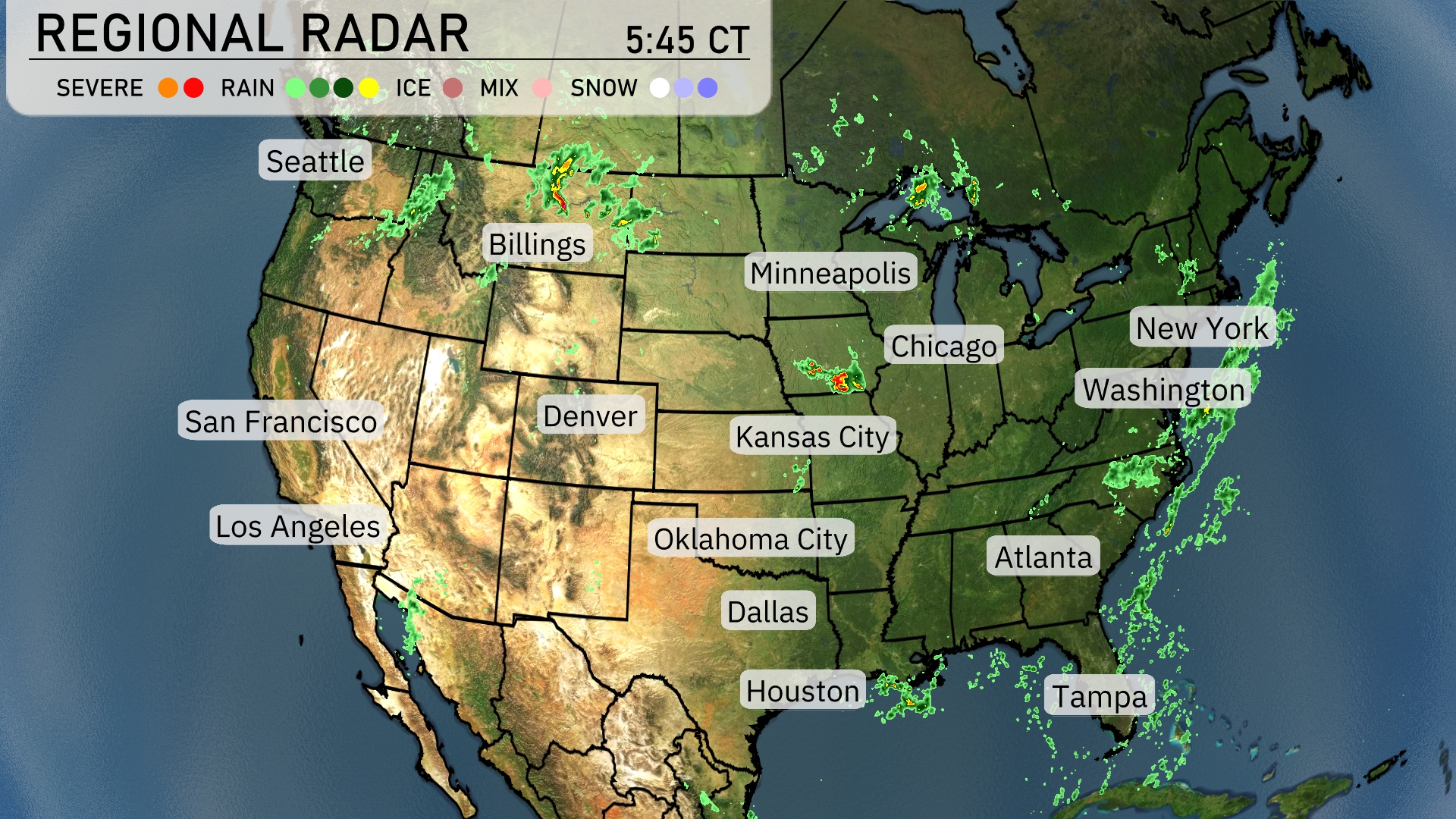
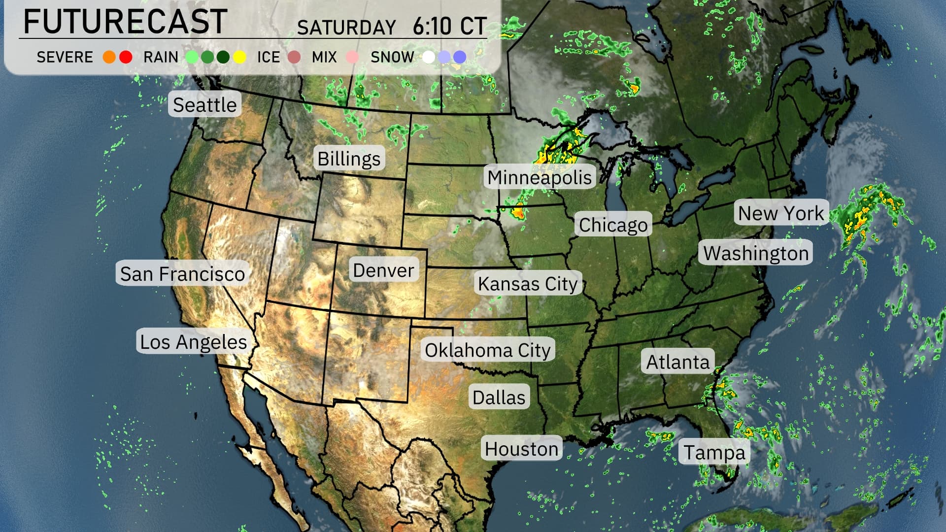
From the Northern Plains through the Great Lakes, radar reveals rain and severe weather activity. In Chicago, heavy rain is moving through, while Kansas City sees scattered storms with the potential for intense downpours. Minneapolis is also experiencing rain, though lighter in nature compared to areas farther south.
Looking at the Southeast, areas like Atlanta are preparing for approaching showers, but conditions remain mostly dry for now. In contrast, the Eastern Seaboard, including New York and Washington, D.C., appears calm with clear skies, providing a break from recent rain events. The West Coast, from Seattle to Los Angeles, enjoys a sunny reprieve, with Denver seeing similarly dry conditions.
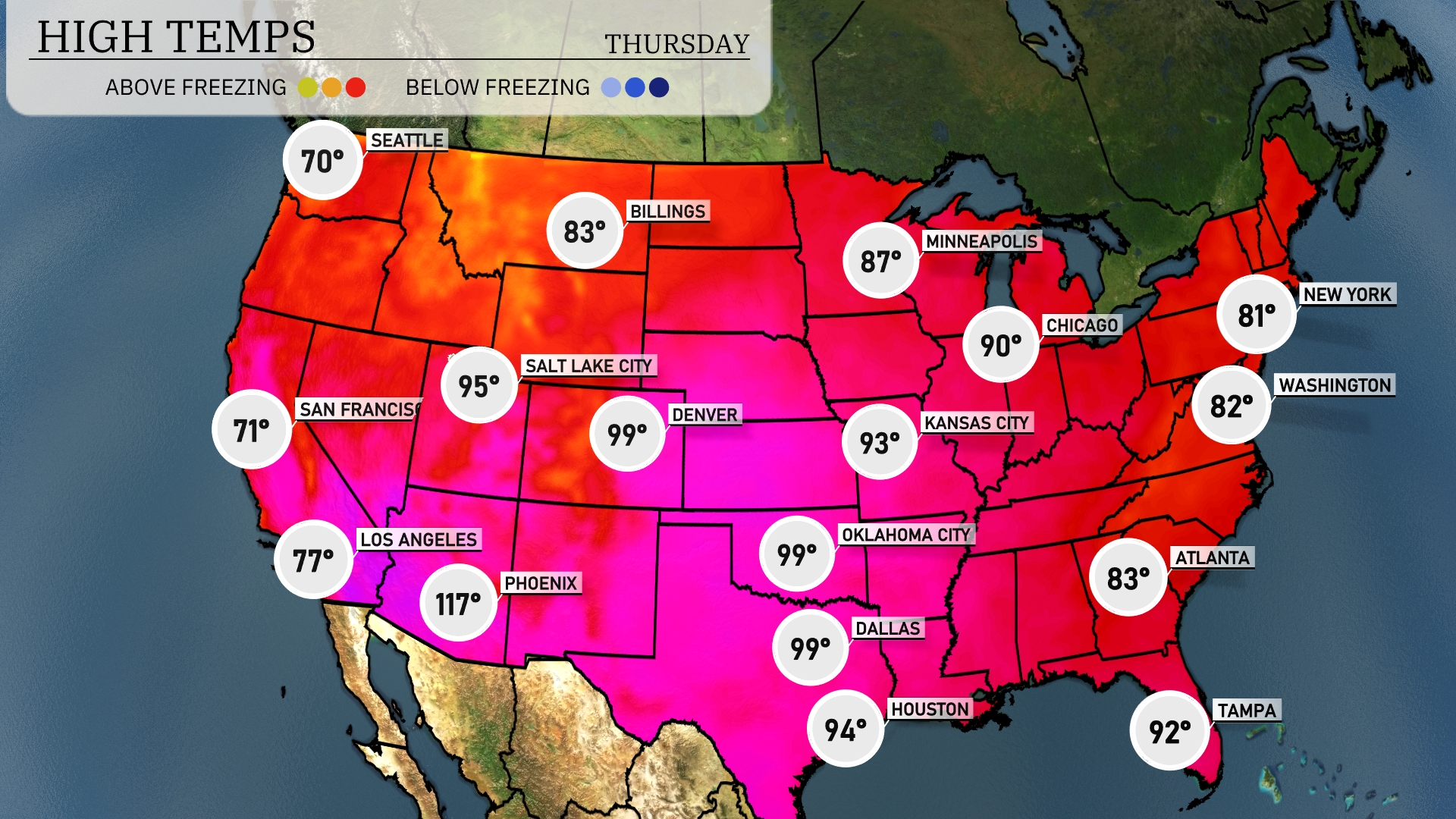
Today’s high temperatures reveal intense heat, especially in the Southwest, where Phoenix sizzles at a remarkable 117 degrees, standing out as the hottest city in the nation. Nearby, Dallas and Oklahoma City both reach a steamy 99 degrees, while Houston cools slightly at 94 degrees. In contrast, the Southeast sees milder conditions with Atlanta at 83 degrees and Tampa a touch warmer at 92. Up northeast, temperatures remain moderate with New York at 81 degrees and Washington, D.C. slightly warmer at 82.
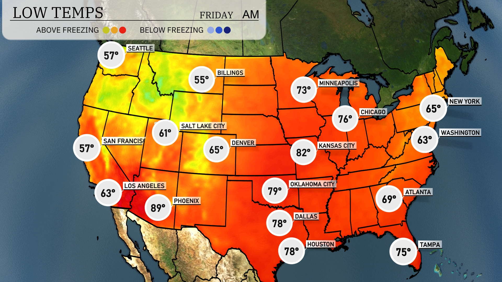
Now for the low temperatures tomorrow morning across the U.S. Expect a chilly 34 degrees in Minneapolis and a crisp 31 in Chicago, signaling the first frost for many. Heading south, Kansas City will see a low of 57 degrees, while Dallas remains milder at 66. In the Southeast, Atlanta will start the day at 64 degrees, while warmer spots like Miami hold steady at 75 degrees.
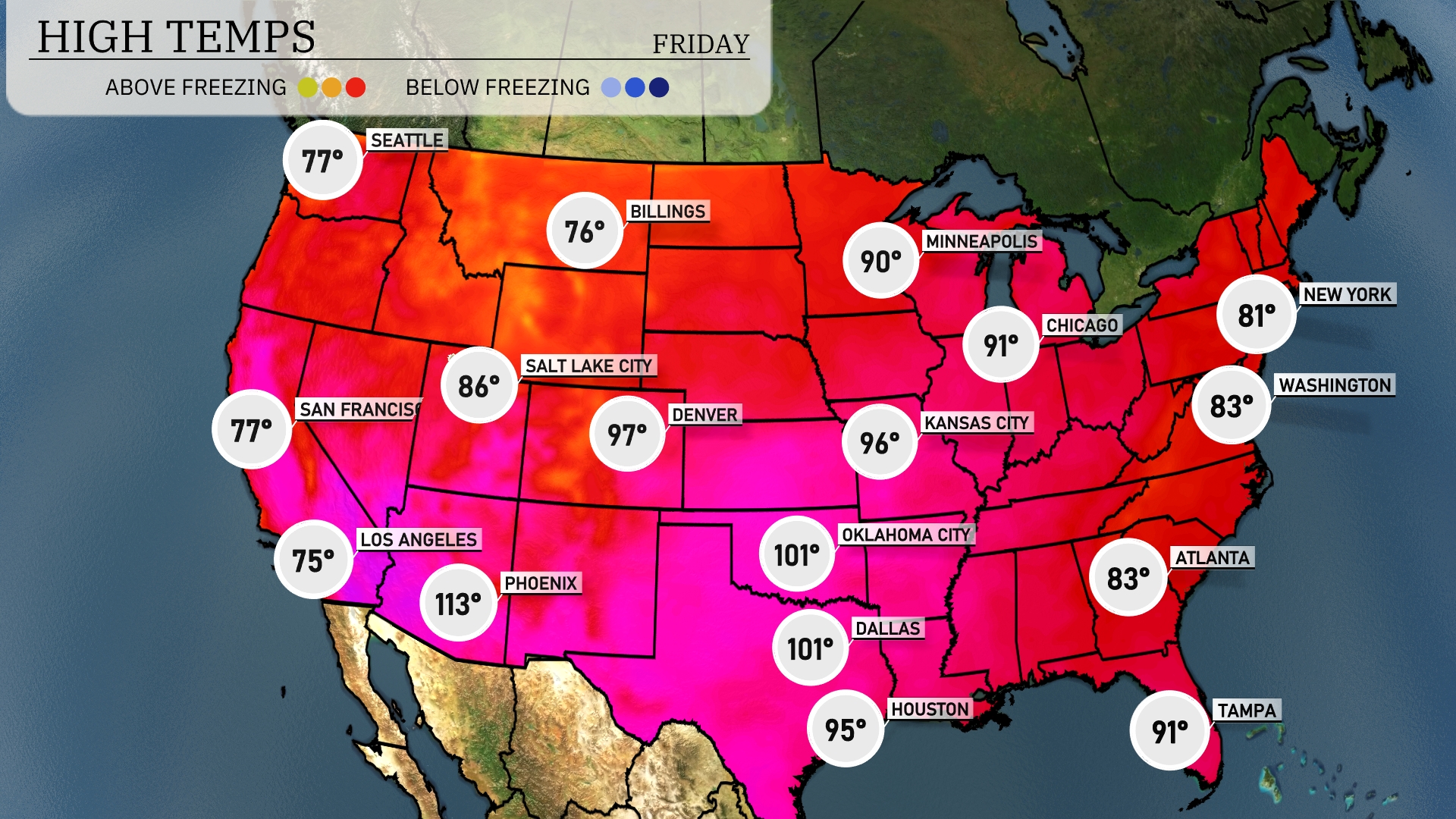
Tomorrow, expect some sizzling high temperatures across the region, with significant heat particularly in Texas. Dallas and Houston are both set to hit 101 degrees. Farther east, Atlanta reaches a warm 83 degrees, while Tampa will see highs around 91 degrees, indicating a mix of summer warmth in the Southeast. Meanwhile, out west in Phoenix, temperatures will soar to a sweltering 113 degrees, definitely pushing the limits for this time of year.
The central U.S. anticipates active weather as a cold front sweeps through, bringing strong storms from Kansas City to Oklahoma City with potential for gusty winds and localized flooding. In the Midwest, expect a mix of rain and possible snow showers around Minneapolis, as cooler air moves in. The Southeast, including Atlanta, should prepare for scattered thunderstorms, while the Northeast, from New York to Washington, deals with steady rain and possible travel impacts. Out West, dry conditions prevail along the California coast, though Seattle and the Northern Rockies can expect rain and some high-elevation snow.