From Thunderstorms to Sun: Navigating This Week’s Extreme Weather Across the U.S.
By
Amy Freeze
A dramatic contrast in weather engulfs the U.S. this week, impacting everything from travel plans to daily commutes. Explore how a cold front and an intense heat wave are shaping the nation.
This week, the U.S. sees a mix of extreme weather, from heavy thunderstorms to record high temperatures. Discover how these conditions affect various regions and what to expect in your area.
The U.S. is currently a theater of extreme weather patterns, featuring everything from severe thunderstorms in the Midwest to a crippling heat wave in the Southwest. As a cold front plunges through the central U.S., major cities face disruptions from rapid temperature drops and increased rainfall. Meanwhile, clear skies in the Southwest push temperatures to record highs. This detailed analysis explains the meteorological dynamics at play and offers forecasts to help residents prepare for the coming days.
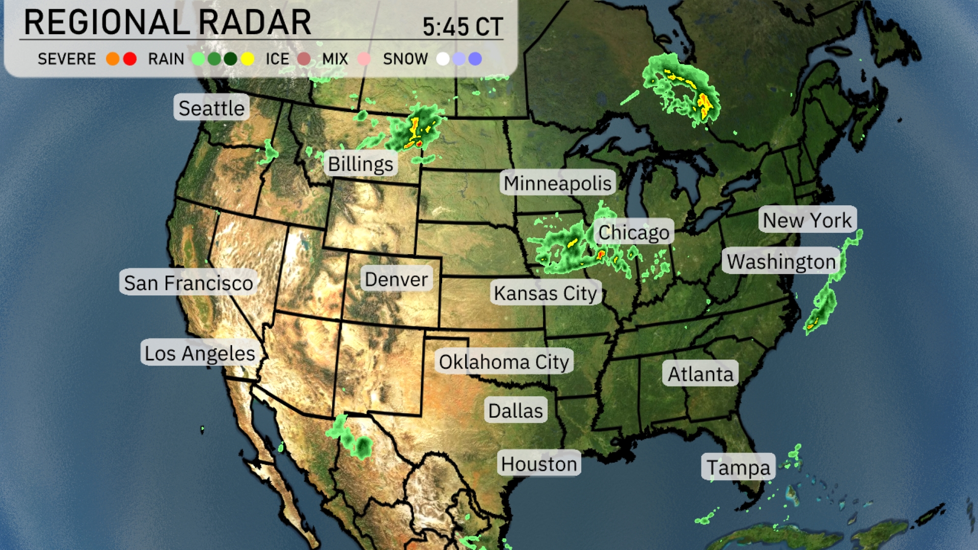
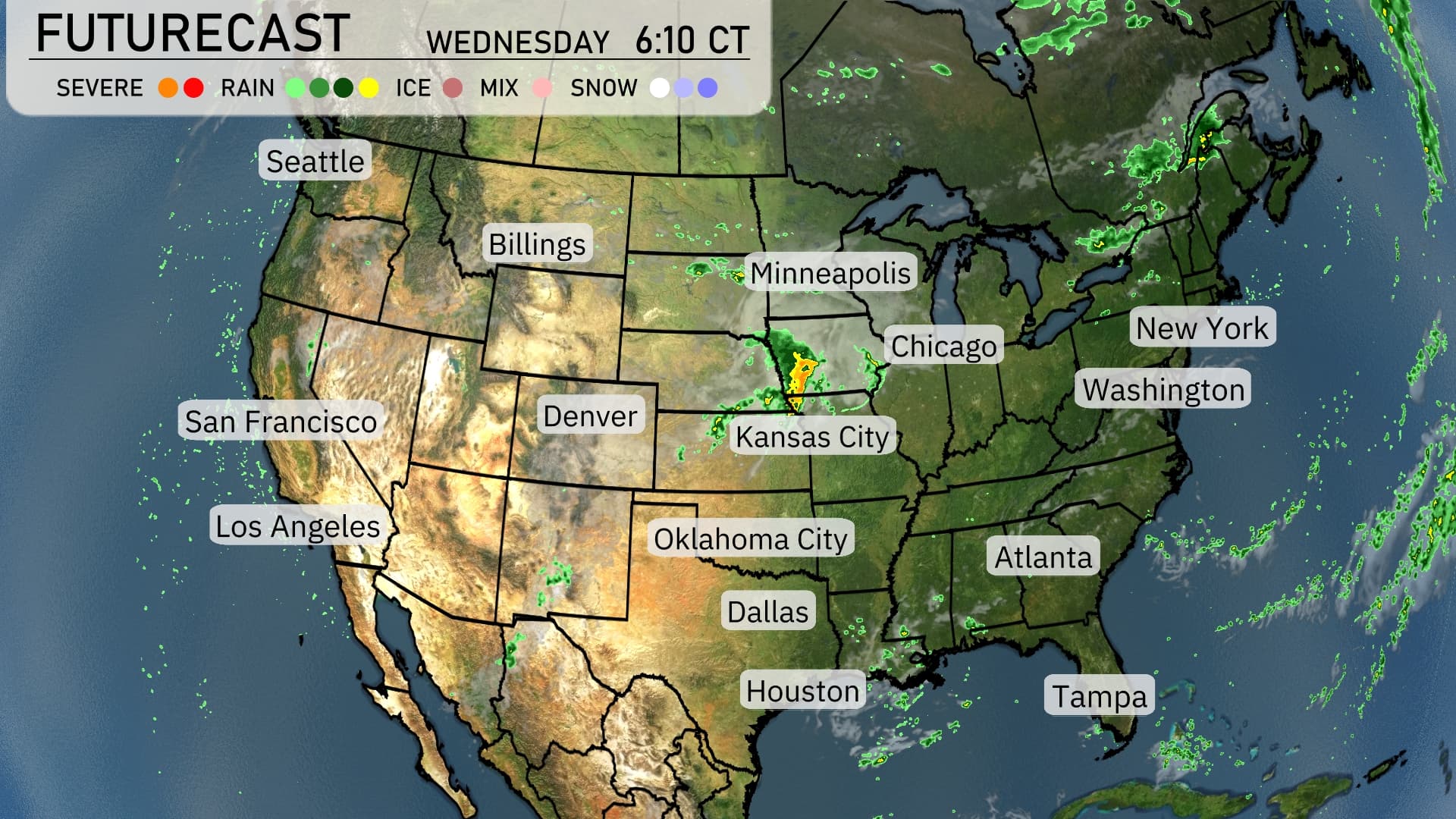
The radar shows a significant band of thunderstorms in the Upper Midwest, impacting Minneapolis with heavy rain and a potential for strong thunderstorms. Chicago is experiencing scattered showers that could intensify, affecting daily activities. On the East Coast, New York and Washington, D.C. are dealing with rain as a system moves through, potentially leading to travel disruptions. Seattle and San Francisco enjoy clear skies, while Denver remains dry, and the Southeast, including Atlanta, stays mostly calm with no severe weather expected.
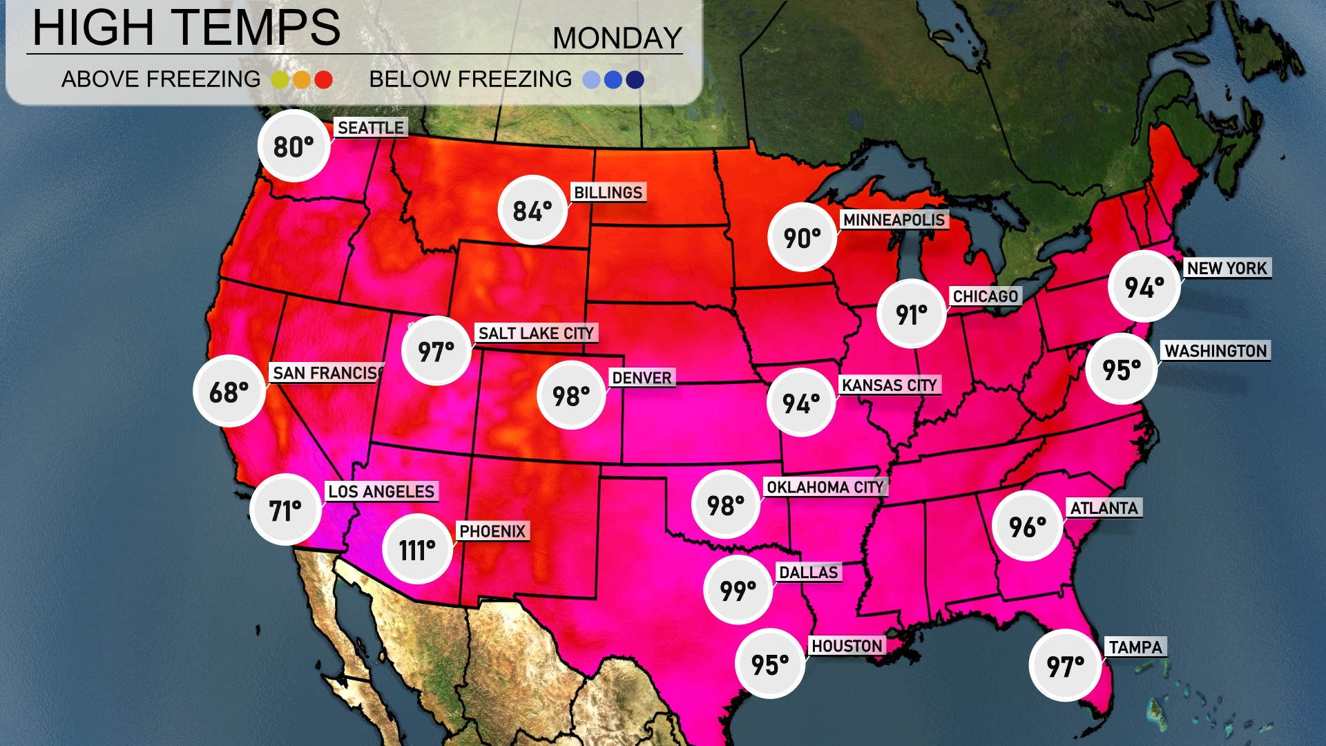
Today, the Southwest is experiencing an intense heat wave, with Phoenix scorching at a staggering 111 degrees, representing the hottest spot in the nation. Los Angeles remains comfortably cooler at 71 degrees, creating a striking temperature contrast. In the Southeast, Atlanta warms up to 96 degrees, while farther south in Tampa, temperatures are also high at 97 degrees. Heading north, Chicago reaches a warmer-than-usual 91 degrees, showcasing a broad range of temperatures across the country.
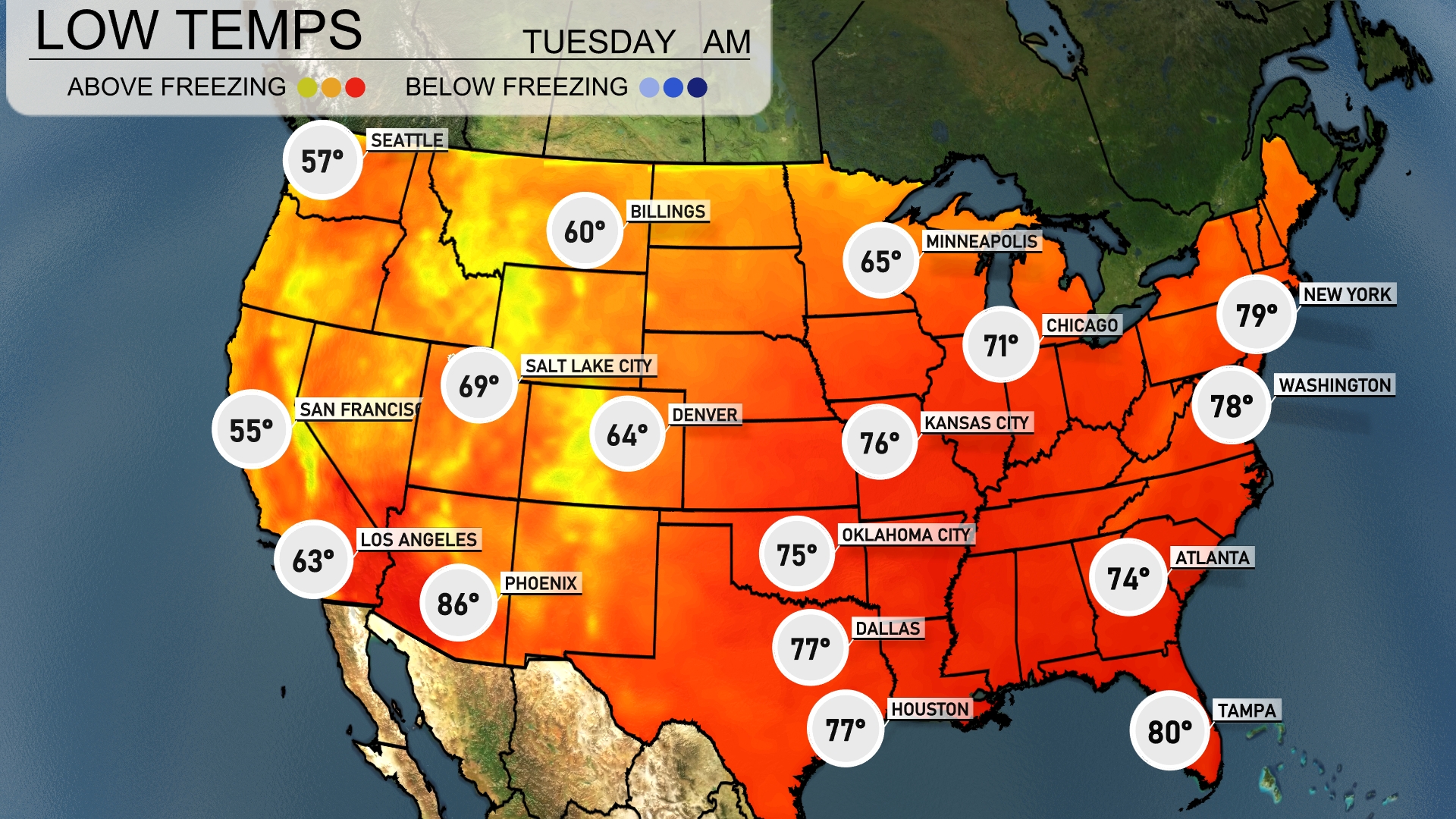
Now for the low temperatures tomorrow morning across the U.S. The Midwest will feel a chill, with Minneapolis dipping to 65 degrees and Chicago at 71. Moving south, Kansas City will wake up to 76 degrees, while Dallas and Houston remain warm at 77 degrees. In the Southeast, Atlanta will start the day at 74 degrees, and the coastal warmth continues, with Miami holding steady at 80 degrees.
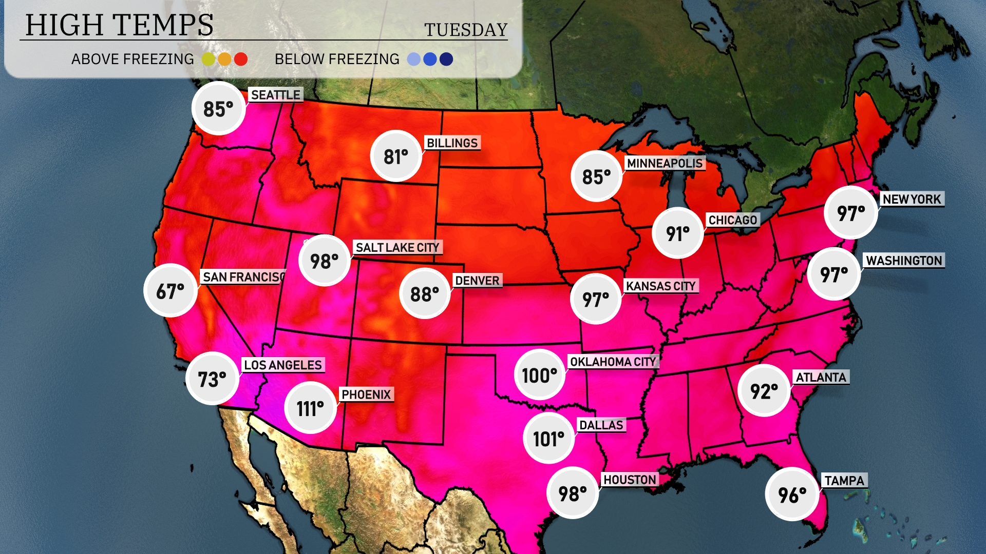
Tomorrow’s temperatures will climb significantly across the region, with notable highs. Dallas is poised for a scorching 101 degrees, while Houston closely follows at 98 degrees, both well above seasonal averages. In the Southeast, Atlanta is expected to reach a warm 92 degrees, with Tampa nearing a steamy 96 degrees. These increases are driven by a strong high-pressure system settling over the area, bringing clear skies and plenty of sunshine.
A cold front is advancing through the central United States, bringing a likelihood of severe thunderstorms from Minneapolis to Dallas over the next 48 hours. Expect potential high winds and heavy rainfall, with conditions favorable for localized flooding in these areas. The Northeast, from New York to Washington, will experience steady rain, impacting commute times with slick road conditions. In the Pacific Northwest, Seattle prepares for continued rain showers, while the Southwest, including Los Angeles and San Francisco, enjoys dry and sunny weather.