Navigating Weather Wonders: Your Comprehensive Guide to Southwest Skies
By
Amy Freeze
Explore the dynamic weather conditions of the Southwest with Meteorologist Amy Freeze. From serene clear skies to unexpected snow showers, understand what these changes mean for your daily plans.
Get the latest insights on the changing weather patterns in the Southwest. Amy Freeze provides a detailed look at conditions from clear skies in city hubs to intriguing snow showers in mountainous regions.
Hello, weather enthusiasts! Amy Freeze here with a detailed report on the diverse weather conditions sweeping through the Southwest. Our journey takes us from the calm, clear skies of cities like Las Vegas to the snowy surprises in Flagstaff and beyond. Each city offers a unique glimpse into the broader weather patterns affecting our region, and with a cold front on the horizon, there are swift changes to anticipate. Whether you’re planning your week or just curious about the weather, this guide has got you covered. Tune in and stay weather-wise!
Over the Southwest region, the radar indicates a mix of weather conditions ranging from clear skies to active weather systems. In northern California, cities like Redding and San Francisco are beginning their evening under calm skies with largely clear conditions. Meanwhile, further inland, Reno is experiencing similar calm with a quiet radar.
As we move eastward into the Great Basin, has some high country light snow showers, adding a wintry touch to the evening. Cedar City in southwestern Utah is mostly clear, contributing to a pleasant evening.
Flagstaff, Arizona, is the center of action with a significant cluster of mixed precipitation, indicating some snow and rain activity. Phoenix stays dry with clouds diffusing overhead.
Farther west, the coastal cities such as San Francisco and Los Angeles remain relatively calm, offering mild weather. The Southland, including Los Angeles, holds onto mild conditions as well, with only a hint of moisture in the air contributing to light fog or drizzle.
In summary, while the majority of the region relaxes under clear skies, Flagstaff stands as a focal point for mixed precipitation, indicating a more active weather system over those higher terrains.
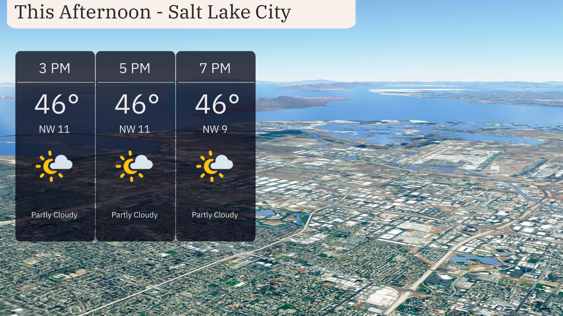
For this afternoon in Salt Lake City, temperatures hold steady at 46 degrees with partly cloudy skies. Expect a northwest wind blowing at 11 miles per hour, decreasing to 9 miles per hour by 7 PM.
Let’s take a look at those high temperatures across the Southwest today.
In Las Vegas, we’re seeing a high of 63 degrees, while Phoenix is enjoying considerably warmer weather with a high soaring up to 70 degrees. Further north, Cedar City is on the cooler side, only reaching 41 degrees. Ely is a bit chillier as well, with a high of just 43.
In Flagstaff, we’re experiencing some brisk air with a high of 37 degrees. Down in Southern California, San Diego will feel quite pleasant at 61 degrees, and Los Angeles is topping out at 66 degrees.
Tonight Ely drops to a frigid 21 degrees, making it one of the coldest spots in the region. Salt Lake City will also experience a significant chill at 32 degrees. Over in Flagstaff, expect a low of 25. Meanwhile, Las Vegas may be warmer relative to its surroundings with a low of 50. In California, San Francisco and Los Angeles are both forecasted to settle around 50 degrees. Bakersfield will see a low of 48, while Fresno is slightly cooler at 46.
In the desert regions, Las Vegas is set to reach a high of 70 degrees, contributing to the ongoing warm trend. Phoenix will also see conditions heating up with a high of 73 degrees, which is slightly above average for early April.
Farther west, in California, Bakersfield and Fresno will both hit a warm 72 degrees. Los Angeles will experience more mild weather with a high of 68 degrees, while coastal San Diego is expected to reach 66 degrees.
Overall, the general warm air mass is dominating the Southwest, while areas further north, like Cedar City, will stay quite chilly at just 46 degrees.
A cold front sweeps through the Southwest tomorrow, bringing a mix of weather changes. Most areas will experience clear and sunny skies, ideal for outdoor activities. However, be aware of isolated rain showers moving over areas from Southern Nevada into Central Arizona early in the day. Snow is anticipated over higher elevations in Northern Arizona, causing possible travel delays.
Prepare for potential thunderstorms from the Texas Panhandle into New Mexico by late afternoon. While severe storms aren’t highly probable, gusty winds and brief downpours are likely. Temperatures will generally remain consistent, with slightly cooler evenings expected due to the advancing front.
For Salt Lake City, the UV index on Thursday is moderate at 5, suggesting a burn time of approximately 27 minutes in direct sunlight. Come Friday, sun protection becomes more crucial with the UV index rising to 6.